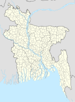
Dhunat Upazila (Bengali: ধুনট উপজেলা) is an upazila of Bogra District in the Division of Rajshahi, Bangladesh. Dhunat Thana was established in 1962 and...
8 KB (520 words) - 12:51, 23 October 2024
An upazila (Bengali: উপজেলা, romanized: upajēlā, lit. 'sub-district' pronounced: ['upɘdʒeːlaː]), formerly called thana, is an administrative division...
31 KB (757 words) - 19:47, 15 November 2024
Sonatala Upazila to the north and east, Sariakandi Upazila to the east, Dhunat Upazila to the south, and Shajahanpur and Bogra Sadar upazilas to the west...
13 KB (1,131 words) - 12:52, 23 October 2024
Dhunat Govt. N.U. Pilot Model High School is a secondary school in Dhunat Upazila, Bogra, Bangladesh established in 1941. It is a central high school...
1 KB (112 words) - 07:04, 24 July 2024
north, Gabtali and Dhunat upazilas to the east, Sherpur Upazila to the south, Nandigram Upazila to the southwest, and Kahaloo Upazila to the west. The Karatoya...
7 KB (458 words) - 12:53, 23 October 2024
Shahjadpur (Bengali: শাহজাদপুর) is an upazila, or sub-district of Sirajganj District, located in Rajshahi Division, Bangladesh. In c. 1250, a Yemenite...
20 KB (1,624 words) - 13:21, 23 October 2024
Bogra District (section Upazilas)
Bogura. The area consisting of Sariakandi Upazila, Gabtali Upazila, Sonatala Upazila, and the majority of Dhunat is called the eastern alluvial tract. It...
23 KB (1,868 words) - 11:49, 12 November 2024
upazilas of Jamalpur District to the east, Kazipur upazila of Sirajganj District to the southeast, Dhunat Upazila to the south, and Gabtali Upazila to...
7 KB (490 words) - 12:53, 23 October 2024
Chatmohar (Bengali: চাটমোহর) is an upazila of Pabna District in the Division of Rajshahi, Bangladesh. Chatmohar is located at 24°13′30″N 89°17′30″E /...
9 KB (624 words) - 13:16, 23 October 2024
Shibganj (Bengali: শিবগঞ্জ) is an upazila of Nawabganj District in the Division of Rajshahi, Bangladesh. Shibganj is located at 24°41′00″N 88°10′00″E...
11 KB (823 words) - 19:07, 16 November 2024
sub-district or upazila in 1983. Tanore is 30 kilometers from Rajshahi city. It is surrounded by Niamatpur Upazila and Manda Upazila of Naogaon District...
11 KB (884 words) - 13:03, 23 October 2024
Akkelpur (Bengali: আক্কেলপুর) is an upazila of Joypurhat District in the division of Rajshahi, Bangladesh. Akkelpur is located at 24°58′30″N 89°01′15″E...
7 KB (480 words) - 12:54, 23 October 2024
the upazila. It is bounded by Dhunat, Sariakandi and Sarishabari upazilas on the north, Sirajganj sadar upazila on the south, Sarishabari upazila and...
8 KB (561 words) - 13:20, 23 October 2024
Atghoria(Bengali: আটঘোরিয়া or আটঘরিয়া) is an upazila of Pabna District in Rajshahi Division, Bangladesh. A fierce battle was fought in 1971 between...
8 KB (685 words) - 13:15, 23 October 2024
by Natore Sadar Upazila on the north, Lalpur Upazila on the south, Baraigram Upazila on the east and Charghat, Bagha and Puthia Upazilas on the west. The...
6 KB (361 words) - 13:08, 23 October 2024
Ish-shordi) is an upazila of Pabna District in Rajshahi Division. It is the westernmost upazila of Pabna district. This upazila is a dynamic administrative...
30 KB (2,328 words) - 13:16, 23 October 2024
is an upazila of Joypurhat District in the Division of Rajshahi, Bangladesh. Khetlal Thana was formed in 1847 and it was turned into an upazila on 3 July...
7 KB (498 words) - 12:55, 23 October 2024
(Bengali: ধামইরহাট) is an upazila of Naogaon District in the Division of Rajshahi, Bangladesh. The main river of the Dhamoirhat Upazila is the Atrai. During...
11 KB (1,044 words) - 13:12, 23 October 2024
Bera (Bengali: বেড়া) is an upazila of Pabna District in the Division of Rajshahi, Bangladesh. Bera is located at 24°04′00″N 89°37′30″E / 24.0667°N...
7 KB (530 words) - 13:15, 23 October 2024
Colony). Sherpur Upazila has a total area of 295.93 square kilometres (114.26 sq mi). It borders Shajahanpur Upazila to the north, Dhunat Upazila to the east...
17 KB (1,554 words) - 12:51, 23 October 2024
Niamatpur (Bengali: নিয়ামতপুর) is an upazila of Naogaon District in the Division of Rajshahi, Bangladesh. Niamatpur is located at 24°51′30″N 88°34′00″E...
6 KB (412 words) - 13:13, 23 October 2024
Sherpur and Dhunat upazilas of Bogra district on the north, Ullahpara and Belkuchi upazilas on the south, Sirajganj Sadar and Belkuchi upazilas on the east...
6 KB (492 words) - 13:22, 23 October 2024
location of Raiganj upazila is between 24'09 and 24'23 north latitude, 89'23 and 89'38 longitude. It is bounded by Sherpur and Dhunat upazilas (Bogura) on the...
12 KB (1,058 words) - 13:21, 23 October 2024
Lalpur (Bengali: লালপুর) is an upazila of Natore District, located the Rajshahi Division of Bangladesh. According to the Imperial Gazetteer of India,...
12 KB (1,087 words) - 13:09, 23 October 2024
Shibganj Upazila (Bengali: শিবগঞ্জ উপজেলা) is an upazila of Bogra District in the Division of Rajshahi, Bangladesh. The upazila was created in 1983. It...
10 KB (672 words) - 12:53, 23 October 2024
Kamarkhanda, Raiganj and Dhunat upazilas on the west. According to the 2011 Census of Bangladesh, Sirajganj Sadar Upazila had 125,485 households and...
9 KB (734 words) - 13:20, 23 October 2024
Ullapara (Bengali: উল্লাপাড়া) is an upazila, or sub-district of Sirajganj District, located in Rajshahi Division, Bangladesh. Around 4500 BC, the region...
13 KB (1,198 words) - 19:03, 6 November 2024
Godagari (Bengali: গোদাগাড়ী) is an Upazila of Rajshahi District in the Division of Rajshahi, Bangladesh. This is the place where Mahananda river fall...
8 KB (564 words) - 13:02, 23 October 2024
Bogra Sadar Upazila (Bengali: বগুড়া সদর উপজেলা) is an upazila of Bogra District in the Division of Rajshahi, Bangladesh. Bogra Thana was established in...
8 KB (490 words) - 23:00, 8 November 2024
Bagmara (Bengali: বাগমারা) is an upazila of Rajshahi District in the Division of Rajshahi, Bangladesh. Bagmara is located to the north of Rajshahi city...
9 KB (649 words) - 13:01, 23 October 2024


