
East Carbon is a city in Carbon County, Utah, United States. The population was 1,567 as of 2022 East Carbon was incorporated on July 23, 1973, from the...
10 KB (977 words) - 03:25, 13 September 2024
East Carbon City is a city in Carbon County, Utah, United States, that was incorporated on January 1, 2014 as East Carbon-Sunnyside, from the merger of...
6 KB (245 words) - 03:10, 18 November 2023

Carbon County is a county in the U.S. state of Utah. As of the 2020 United States Census, the population was 20,412. Its county seat and largest city...
19 KB (1,353 words) - 23:57, 7 July 2024
Carbon County, Utah, United States. The population was 377 at the 2010 census. On January 1, 2014, the city merged with the neighboring city of East Carbon...
9 KB (802 words) - 13:57, 29 October 2021
– North Logan [18] Carbon School District [19] Carbon High School – Price [20] East Carbon High School (closed) – East Carbon, Utah [21] Lighthouse Alternative...
27 KB (1,522 words) - 00:07, 13 July 2024

canyon, approximately 40 miles (60 km) long, located in Carbon and Duchesne counties in eastern Utah, United States. Promoted as "the world's longest art...
21 KB (2,194 words) - 12:22, 3 August 2024
Junction, East Carbon, Carbon, Utah" (Map). Google Maps. Retrieved June 3, 2013. Note: A search for "Columbia Junction, East Carbon, Utah" results in...
74 KB (3,477 words) - 23:09, 19 January 2024

to east), Wasatch-Utah-Duschesne-Carbon-Emery-Uintah-(Rio Blanco Co., CO)-(Garfield Co., CO)-(Mesa Co., CO) Wasatch Plateau, Utah-Sanpete-Carbon-Emery-Sevier...
14 KB (1,330 words) - 23:49, 27 August 2024

Bo Huff (category People from Carbon County, Utah)
town of Dragerton, Utah—a town that was later merged with the neighboring town of Columbia, Utah and incorporated as East Carbon. Junior Gervis Huff...
11 KB (1,130 words) - 06:53, 16 June 2024

to the east right-of-way line at the railroad crossing. The entire route is in Carbon County. KML file (edit • help) Template:Attached KML/Utah State Route...
5 KB (499 words) - 15:39, 16 February 2024

U.S. Route 6 (US-6) is an east–west United States Numbered Highway through the central part of the U.S. state of Utah. Although it is only about 40 miles...
42 KB (4,371 words) - 01:44, 5 August 2024

Scofield is a town in Carbon County, Utah, United States. The population was 26 at the 2020 census. Scofield's name is frequently applied to the 1900...
22 KB (2,078 words) - 04:48, 6 July 2024

Helper is a city in Carbon County, Utah, United States, approximately 110 miles (180 km) southeast of Salt Lake City and 7 miles (11 km) northwest of...
20 KB (1,882 words) - 12:30, 13 August 2024
Carbon High School is a high school in Price, Utah, that is part of Carbon School District. Carbon High School athletics participate in the UHSAA in Class...
3 KB (113 words) - 06:41, 8 July 2024

Utah State Route 123 (SR-123) is a state highway in the U.S. state of Utah. Spanning 11.4 miles (18.3 km), it connects the city of East Carbon with US-6...
4 KB (316 words) - 15:42, 16 February 2024

Desolation Canyon (redirect from Desolation Canyon (Utah))
of Historic Places listings in Carbon County, Utah National Register of Historic Places listings in Emery County, Utah National Register of Historic Places...
9 KB (684 words) - 16:10, 9 August 2023
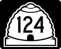
East Carbon. KML file (edit • help) Template:Attached KML/Utah State Route 124 KML is not from Wikidata "Utah State Route 124 Reference" (pdf). Utah Department...
4 KB (371 words) - 15:43, 16 February 2024
airport 3 miles east of downtown Price, in Carbon County, Utah. List of airports in Utah "Carbon County RGNL/Buck Davis FLD". Resources for this airport:...
2 KB (66 words) - 14:47, 11 April 2023

Carbon Power Plant, also known as Castle Gate Power Plant, was a relatively small, 190-MWe coal-fired power station in Utah, US, operated by PacifiCorp...
3 KB (196 words) - 20:37, 19 September 2024

continue to play a large role in Utah's economy, especially in the eastern part of the state in counties such as Carbon, Emery, Grand, and Uintah. In 2007...
206 KB (18,056 words) - 15:13, 12 October 2024

The entire route is in Price, Carbon County. "State Route 55 Highway reference". Utah Department of Transportation. "Utah National Highway System". UDOT...
4 KB (303 words) - 15:40, 16 February 2024

Price River (category Rivers of Carbon County, Utah)
137-mile-long (220 km) southeastward flowing river in Carbon, Utah and Emery counties in eastern Utah. It is a tributary to the Green River, itself a tributary...
14 KB (1,363 words) - 13:41, 28 September 2023

Utah State Route 157 (SR-157) is a state highway in Carbon County in the U.S. state of Utah. Spanning just over 5 miles (8.0 km), it connects Helper and...
4 KB (407 words) - 13:04, 13 April 2024

Crystal Geyser (category Bodies of water of Grand County, Utah)
water, carbon dioxide driven geyser located on the east bank of the Green River approximately 9 miles (14 km) downstream from Green River, Utah, United...
8 KB (877 words) - 23:14, 27 September 2023

sickened from carbon monoxide poisoning at the LDS Monroe East chapel of the Church of Jesus Christ of Latter Day Saints in Sevier County, Utah, on December...
17 KB (1,851 words) - 20:54, 3 October 2024

Helper station (redirect from Helper station (Utah))
Helper station is a railroad station in Helper, Utah. It is served by Amtrak's California Zephyr, which runs once daily between Chicago, Illinois, and...
5 KB (309 words) - 21:46, 7 August 2024

State Route 264 is a state highway in central Utah that connects Sanpete County to Carbon County through Flat Canyon, Boulger Canyon, Upper Huntington...
4 KB (247 words) - 15:42, 16 February 2024

Cisco to the Utah-Colorado State line near Utaline, Colorado; also from Soldier Creek Junction, Carbon County to Myton, Duchesne county. Utah State Legislature...
27 KB (2,396 words) - 07:45, 6 October 2024

Spring Glen is a census-designated place in Carbon County, in eastern Utah, United States. The population was 1,054 at the 2020 census. Founded in 1878...
9 KB (740 words) - 05:05, 6 July 2024

Highway UT-137 Utah State Highway UT-264 Utah County - north Carbon County - northeast Emery County - east Sevier County - south Millard County - southwest...
26 KB (2,225 words) - 03:21, 29 September 2024