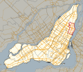
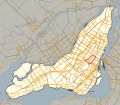
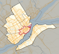
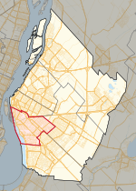
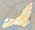
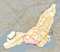
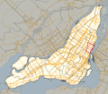
map (PDF) 2001 map (Flash) 2001–2011 changes (Flash) 1992–2001 changes (Flash) Electoral map of Montréal region Quebec electoral map, 2011 45°35′20″N...
8 KB (223 words) - 15:38, 10 January 2024
map (PDF) 2001 map (Flash) 2001–2011 changes (Flash) 1992–2001 changes (Flash) Electoral map of Nord-du-Québec region Quebec electoral map, 2011 57°30′N...
13 KB (236 words) - 09:26, 31 March 2024
Gouin is a provincial electoral district in the Montreal region of the province of Quebec, Canada that elects members to the National Assembly of Quebec...
19 KB (240 words) - 09:27, 31 March 2024
(Flash) 2001–2011 changes Archived 2016-03-04 at the Wayback Machine (Flash) 1992–2001 changes (Flash) Electoral map of Estrie region Quebec electoral...
27 KB (236 words) - 19:42, 8 September 2024
(QuébecPolitique) Maps 2011 map (PDF) 2001 map (Flash) 2001–2011 changes (Flash) 1992–2001 changes (Flash) Electoral map of Montreal region Quebec electoral map, 2011...
14 KB (225 words) - 09:24, 31 March 2024
2011 map (PDF) 2001 map (Flash) 2001–2011 changes (Flash) 1992–2001 changes (Flash) Electoral map of Montréal region Quebec electoral map, 2011 v t e...
10 KB (193 words) - 18:45, 10 January 2024
(PDF) 2001 map (Flash) 2001–2011 changes (Flash) 1992–2001 changes (Flash) Electoral map of Capitale-Nationale region Quebec electoral map, 2011 47°09′54″N...
18 KB (253 words) - 09:27, 31 March 2024
map (PDF) 2001 map (Flash) 2001–2011 changes (Flash) 1992–2001 changes (Flash) Electoral map of Montreal region Quebec electoral map, 2011 45°31′40″N...
8 KB (212 words) - 09:09, 31 March 2024
map (PDF) 2001 map (Flash) 2001–2011 changes (Flash) 1992–2001 changes (Flash) Electoral map of Montérégie region Quebec electoral map, 2011 45°10′N 72°45′W...
9 KB (196 words) - 09:06, 31 March 2024
2011 map (PDF) 2001 map (Flash) 2001–2011 changes (Flash) 1992–2001 changes (Flash) Electoral map of Montérégie Quebec electoral map, 2011 45°19′N 73°44′W...
14 KB (257 words) - 09:19, 31 March 2024
Popular Force (section Electoral history)
Spanish). Retrieved 23 May 2021. CORREO, NOTICIAS (12 April 2021). "Flash electoral | Ipsos resultados boca de urna | Conteo rápido | Elecciones generales...
52 KB (5,147 words) - 12:18, 4 November 2024
Archived from the original on 12 April 2021. Retrieved 12 April 2021. "Flash electoral a boca de urna región por región, según Ipsos". Diario Correo (in Spanish)...
4 KB (727 words) - 21:53, 10 June 2024
(Flash) 2001–2011 changes Archived 2016-03-03 at the Wayback Machine (Flash) 1992–2001 changes (Flash) Electoral map of Laval region Quebec electoral map...
9 KB (259 words) - 13:57, 29 March 2024
Archived from the original on 12 April 2021. Retrieved 12 April 2021. "Flash electoral a boca de urna región por región, según Ipsos". Diario Correo (in Spanish)...
30 KB (3,699 words) - 07:22, 13 July 2024
(Flash) 2001–2011 changes (Flash) 1992–2001 changes (Flash) Electoral map of Lanaudière region Electoral map of Laurentides region Quebec electoral map...
13 KB (271 words) - 09:24, 31 March 2024
(QuébecPolitique) Maps 2011 map (PDF) 2001 map (Flash) 2001–2011 changes (Flash) 1992–2001 changes (Flash) Electoral map of Montreal region Archived 2013-05-28...
8 KB (191 words) - 02:47, 11 January 2024
(PDF) 2001 map (Flash) 2001–2011 changes (Flash) 1992–2001 changes (Flash) Electoral map of Capitale-Nationale region Quebec electoral map, 2011 46°49′N...
15 KB (225 words) - 09:24, 31 March 2024
map (PDF) 2001 map (Flash) 2001–2011 changes Archived 2016-03-04 at the Wayback Machine (Flash) 1992–2001 changes (Flash) Electoral map of Lanaudière region...
19 KB (308 words) - 16:36, 24 October 2024
Ollanta Humala (section Electoral history)
Spanish). Retrieved 23 May 2021. CORREO, NOTICIAS (12 April 2021). "Flash electoral | Ipsos resultados boca de urna | Conteo rápido | Elecciones generales...
55 KB (5,016 words) - 06:06, 4 November 2024
map (PDF) 2001 map (Flash) 2001–2011 changes Archived 2013-11-03 at the Wayback Machine (Flash) 1992–2001 changes (Flash) Electoral map of Montreal region...
18 KB (262 words) - 20:19, 6 August 2024
Duplessis is a provincial electoral district in the Côte-Nord region of Quebec, Canada, that elects members to the National Assembly of Quebec. It notably...
19 KB (306 words) - 22:21, 26 August 2024
Maps 2011 map (PDF) 2001 map (Flash) 2001–2011 changes (Flash) 1992–2001 changes (Flash) Electoral map of Montérégie region Quebec electoral map, 2011...
10 KB (236 words) - 09:24, 31 March 2024
map (PDF) 2001 map (Flash) 2001–2011 changes (Flash) 1992–2001 changes (Flash) Electoral map of Outaouais region Quebec electoral map, 2011 Archived 2013-02-07...
13 KB (230 words) - 09:09, 31 March 2024
map (PDF) 2001 map (Flash) 2001–2011 changes (Flash) 1992–2001 changes (Flash) Electoral map of Montreal region Quebec electoral map, 2011 Archived 2013-02-07...
12 KB (214 words) - 03:31, 6 October 2024
map (PDF) 2001 map (Flash) 2001–2011 changes (Flash) 1992–2001 changes Archived 2016-03-04 at the Wayback Machine (Flash) Electoral map of Outaouais region...
12 KB (162 words) - 17:12, 24 August 2024
Maps 2011 map (PDF) 2001 map (Flash) 2001–2011 changes (Flash) 1992–2001 changes (Flash) Electoral map of Montérégie region Quebec electoral map, 2011...
11 KB (243 words) - 23:30, 10 January 2024
map (PDF) 2001 map (Flash) 2001–2011 changes (Flash) 1992–2001 changes (Flash) Electoral map of Montérégie region Quebec electoral map, 2011 45°31′12″N...
18 KB (267 words) - 09:24, 31 March 2024
map (PDF) 2001 map (Flash) 2001–2011 changes (Flash) 1992–2001 changes (Flash) Electoral map of Montreal region Quebec electoral map, 2011 45°27′N 73°42′W...
10 KB (186 words) - 09:20, 31 March 2024
map (PDF) 2001 map (Flash) 2001–2011 changes (Flash) 1992–2001 changes (Flash) Electoral map of Montréal region Quebec electoral map, 2011 45°33′07″N...
9 KB (225 words) - 20:42, 8 May 2024
Maps 2011 map (PDF) 2001 map (Flash) 2001–2011 changes (Flash) 1992–2001 changes (Flash) Electoral map of Lanaudière region Quebec electoral map, 2011...
10 KB (219 words) - 09:24, 31 March 2024

