
The Foothill Freeway is a freeway in the Los Angeles metropolitan area, California, United States, running from the Sylmar district of Los Angeles east...
37 KB (3,085 words) - 02:59, 16 September 2024

California State Route 118 (redirect from Ronald Reagan Freeway)
1957, the first segment of the Foothill Freeway was completed between Montana and Cañada Streets in Pasadena and Foothill Blvd and Michigan Avenue in La...
18 KB (1,555 words) - 23:03, 24 September 2024

for Interstate 710, the Long Beach Freeway, to its originally planned terminus at Interstate 210, the Foothill Freeway, in Pasadena, via a tunnel underneath...
42 KB (4,115 words) - 17:30, 21 July 2024

California State Route 2 (redirect from Glendale Freeway)
Foothill Boulevard in La Cañada Flintridge. Just before reaching Foothill Boulevard, SR 2 turns off the Glendale Freeway onto the eastbound Foothill Freeway...
35 KB (3,398 words) - 12:09, 21 September 2024

Pasadena, California (section Freeways and highways)
The Foothill Freeway initially runs due south, passing the Rose Bowl before its junction with the Ventura Freeway. At this interchange, the Foothill Freeway...
114 KB (11,063 words) - 07:09, 19 September 2024

before entering Pasadena near the Arroyo Seco and terminating at the Foothill Freeway (I-210). The road is the main connector from the San Fernando Valley...
21 KB (1,810 words) - 02:11, 18 September 2024

Colorado Boulevard (redirect from Colorado Blvd. (Unsigned Freeway))
now locally maintained in favor of the parallel Ventura Freeway (SR 134) and Foothill Freeway (I-210). The west end of Colorado Boulevard is composed...
16 KB (1,707 words) - 05:48, 7 September 2024

L Line (Los Angeles Metro) (section Foothill Extension)
Avenue, north of Foothill Boulevard, near the downtown shops and government buildings. Continuing west, the line crossed over the I-210 freeway and ran parallel...
44 KB (3,660 words) - 07:26, 19 September 2024
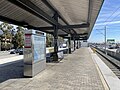
Metro Rail system. It is located in the median of Interstate 210 (Foothill Freeway), at Sierra Madre Villa Avenue, in Pasadena, California. The light...
6 KB (535 words) - 19:27, 17 September 2024
generally along the Interstate 210 freeway, giving it the name "Foothill Freeway". The Interstate 210 and State Route 210 freeway covers 86 miles, between Sylmar...
6 KB (799 words) - 00:42, 15 September 2024
roads and highways, including I-210 (Foothill Freeway), Huntington Drive, and Foothill Boulevard. The Foothill Extension was initially conceived as "Phase...
37 KB (3,514 words) - 08:41, 27 July 2024

California State Route 57 (redirect from Orange Freeway)
Pomona Valleys and ending at the Glendora Curve interchange with the Foothill Freeway (I-210) in Glendora. High-occupancy vehicle lanes (HOV) exist in the...
28 KB (3,114 words) - 00:43, 15 September 2024
210 may refer to: Interstate 210 (California) or the Foothill Freeway, a major east–west freeway running through the valleys north and east of Los Angeles...
558 bytes (93 words) - 07:56, 20 June 2023
of its length. At the I-5/I-210 interchange, Foothill Boulevard heads southeast along the Foothill Freeway, bypassing the city of San Fernando, entering...
13 KB (1,467 words) - 23:52, 11 July 2024

Interstate 10 in California (redirect from San Bernardino Freeway)
The Foothill Freeway between I-5 in the Sylmar district of Los Angeles and SR 57 in Glendora is designated as I-210. The rest of the Foothill Freeway, between...
72 KB (4,492 words) - 05:03, 29 September 2024

Glendale, California (section Freeways and highways)
neighborhood of Los Angeles. The Golden State, Ventura, Glendale, and Foothill freeways run through the city. In 1798, José María Verdugo, a corporal in the...
110 KB (8,988 words) - 05:10, 28 September 2024
Interstate 605 (redirect from San Gabriel River Freeway)
across the San Gabriel Valley. I-605 then ends at its junction with the Foothill Freeway, (I-210) just south of the Irwindale–Duarte border. Ramps from I-605...
16 KB (1,016 words) - 01:01, 24 September 2024

existing freeways in Southern California's Inland Empire were completed in the late 1970s. The only exception is the segment of the Foothill Freeway, State...
8 KB (530 words) - 05:20, 5 July 2024
Interstate 238 and State Route 238 (California) (category San Francisco Bay Area freeways)
Fremont to Hayward was planned to be upgraded to a freeway, called the "Mission" or "Foothill" freeway. The segment was submitted to the Interstate Highway...
21 KB (1,834 words) - 21:38, 2 June 2024

Euclid Avenue to the Foothill Freeway (State Route 210) in Upland. During the planning stages for the construction of the Foothill Freeway through the area...
10 KB (992 words) - 05:09, 29 September 2024
A Line (Los Angeles Metro) (section Foothill Extension)
Downtown station at Azusa Avenue, north of Foothill Boulevard. Continuing west, the line crosses over the I-210 freeway and runs parallel to it, entering Irwindale...
52 KB (4,725 words) - 18:09, 25 September 2024

major freeways: the Foothill Freeway (Interstate 210 (California) and State Route 210) the Ventura Freeway (State Route 134) the San Bernardino Freeway (Interstate...
61 KB (6,701 words) - 21:30, 20 August 2024

California State Route 19 (redirect from Lakewood Blvd. (Unsigned Freeway))
suburban roadway, lying east of the Long Beach Freeway (Interstate 710) and west of the San Gabriel River Freeway (Interstate 605), and connecting the eastern...
21 KB (1,692 words) - 22:06, 1 May 2024
Angeles Crest Highway (redirect from Angeles Crest Freeway)
Antelope Valley Freeway (State Route 14) and the Golden State Freeway (Interstate 5), both located to the west, for reaching the Foothill Freeway (Interstate...
16 KB (1,701 words) - 10:20, 24 August 2024

Southern California (section Freeways and highways)
Association (FAA) as a hub airport: Sections of the Southern California freeway system are often referred to by names rather than by the official numbers...
81 KB (6,612 words) - 04:50, 26 September 2024

unhealthiest commutes. Interstate Highways San Bernardino Freeway (Interstate 10) Interstate 15 Foothill Freeway (Interstate 210) Interstate 215 State Highways State...
24 KB (2,240 words) - 06:37, 13 February 2024

Bernardino Freeway Ontario Freeway () Foothill Boulevard (Historic U.S. Route 66) Valley Boulevard (Historic U.S. Route 99) Foothill Freeway Fontana receives...
61 KB (5,079 words) - 23:51, 26 August 2024

university Azusa lies along the Foothill Freeway (I-210) between the San Gabriel River Freeway (I-605) and the Orange Freeway (SR 57). Azusa Avenue (SR 39)...
38 KB (3,783 words) - 04:23, 19 August 2024
interchange between the Golden State Freeway and San Diego Freeway and the 1981 completion of the Foothill Freeway and 118 Freeway, which made the community easier...
43 KB (4,829 words) - 23:27, 27 August 2024

Interstate 15 in California (redirect from Ontario Freeway)
designated as the Escondido Freeway, Avocado Highway, Temecula Valley Freeway, Corona Freeway, Ontario Freeway, Barstow Freeway, CHP Officer Larry L. Wetterling...
59 KB (4,223 words) - 15:33, 16 September 2024