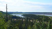
Fort Liard Airport (IATA: YJF, ICAO: CYJF) is located adjacent to Fort Liard, Northwest Territories, Canada. North Cariboo Air offers charter services...
2 KB (92 words) - 01:47, 25 March 2020
Fort Liard /liˈɑːrd/ (Slavey language: Echaot'l Koe[pronunciation?] "people from the land of the giants" or Acho Dene Kue) is a hamlet in the Dehcho Region...
24 KB (1,015 words) - 18:01, 10 September 2024
Canoeing down the Fort Nelson River In the Northern Rockies Liard Hot Springs Northern Rocky Mountains Provincial Park Smith River Falls – Fort Halkett Provincial...
45 KB (4,024 words) - 15:50, 25 June 2024
Canada. Fort Liard Airport Upper Liard, Yukon, a chiefly First Nation settlement immediately west of Watson Lake in Canada's Yukon Territory Liard River...
2 KB (269 words) - 20:11, 19 October 2016
located along the highway as far as the Fort Simpson Airport, just beyond which is the Liard River ferry crossing. Fort Simpson was first started as a fur...
38 KB (1,863 words) - 02:51, 22 July 2024
List of airports by IATA airport code: A - B - C - D - E - F - G - H - I - J - K - L - M - N - O - P - Q - R - S - T - U - V - W - X - Y - Z YA YB YC YD...
63 KB (251 words) - 14:09, 24 October 2024
National Airports System. They are listed in the format: Location indicator – IATA – Airport name (alternative name) – Airport location Also see airport category...
39 KB (149 words) - 13:38, 17 October 2024
Smith River, British Columbia (category Liard Country)
Smith River is an abandoned emergency airport and weather station in the Liard Country of far northern British Columbia, Canada. It is located southwest...
10 KB (279 words) - 19:18, 27 December 2023
localities as of February 2012. Two of these localities, Tagish and Upper Liard, are designated as census subdivisions by Statistics Canada, though are...
11 KB (1,133 words) - 21:24, 30 April 2024
coordinates) GPX (primary coordinates) GPX (secondary coordinates) List of airports in the Fort Simpson area Canada Flight Supplement. Effective 0901Z 16 July 2020...
16 KB (128 words) - 19:41, 20 May 2022
Peace River Regional District (redirect from Fort St. John Airport, British Columbia)
when the Peace River-Liard Regional District was divided in two. The separated northern territories became the Fort Nelson-Liard Regional District, now...
30 KB (2,278 words) - 19:11, 22 January 2024
of Jean Marie River. At Fort Simpson it is joined by the Liard River, its biggest direct tributary, from the west. The Liard drains a large area in the...
72 KB (6,655 words) - 05:37, 3 September 2024
the Northeastern Interior past the Rockies, including Fort Nelson and other parts of the Liard drainage, and before W.A.C. Bennett Dam included the upper...
10 KB (776 words) - 19:49, 14 October 2024
manga series Acho Dene Koe First Nation, a Dene band government based in Fort Liard, Northwest Territories, Canada "Sora/Koe" ('Air/Voice'), a song by Every...
1 KB (218 words) - 20:40, 30 October 2024
road north by 15 km to Mount Gaudet. Just east of Fort Simpson's airport, the highway crosses the Liard River by ferry (summer) and ice bridge (winter)...
12 KB (666 words) - 05:40, 27 August 2024
Airport (ICAO: CYPK) is a Canadian general aviation airport located in the southwest corner of Pitt Meadows, British Columbia. In 2022, the airport had...
9 KB (422 words) - 20:59, 10 December 2023
land airports, aerodromes and heliports in the Provinces and territories of Canada. Airports names in italics are part of the National Airports System...
31 KB (112 words) - 02:11, 29 January 2024
Hudson's Hope (redirect from Rocky Mountain Portage Fort)
dead link]. Retrieved 12 March 2006. Peace Liard Employment Development Association. (October 1985). Peace Liard Economic Profile. page 53. Bowes, Gordon...
33 KB (2,909 words) - 18:05, 6 October 2024
British Columbia Highway 97 (category Fort St. John, British Columbia)
localities. As it passes over the Rocky Mountains, the highway parallels the Liard River before terminating just over the BC/Yukon boundary at Watson Lake...
32 KB (1,683 words) - 15:54, 25 July 2024
South Nahanni River (category Tributaries of the Liard River)
The South Nahanni River is a major tributary of the Liard River, located roughly 500 km (310 mi) west of Yellowknife in the Northwest Territories of Canada...
16 KB (1,680 words) - 18:34, 15 April 2023
Nelson, British Columbia, Canada. Fort Nelson Airport Fort Nelson/Gordon Field Airport Fort Nelson/Mobil Sierra Airport Nav Canada's Water Aerodrome Supplement...
1 KB (58 words) - 17:12, 19 August 2021
Interior east of the Rockies, including Fort Nelson and other parts of the Liard drainage, and before W.A.C. Bennett Dam included the upper Peace River through...
23 KB (2,123 words) - 10:02, 23 October 2024
Fort St. James is a district municipality and former fur trading post in northern central British Columbia, Canada. It is located on the south-eastern...
32 KB (1,410 words) - 06:55, 26 April 2024
Northwest Staging Route (category Airports in Canada)
Fairbanks, Alaska ("the longest hop being the 140 miles or so between Fort Nelson and the Liard River flight strip") The route of the Alaska Highway, which was...
29 KB (1,917 words) - 12:21, 3 August 2024
drainage to the Pacific Ocean, via the Stikine, and the Arctic Ocean, via the Liard and Mackenzie Rivers, this is part of the Continental Divide. The town has...
18 KB (692 words) - 05:48, 23 May 2024
nearby hamlet of Wabasca, the oil field is also served by the Pelican Airport. Most interests in this area are owned by Canadian Natural Resources, who...
5 KB (344 words) - 23:02, 19 April 2023
Aklavik "The town that wouldn't die." Fort Liard "Tropics of the North" Fort Resolution "Fort Res" "Resolution" Fort Smith "Garden Capital of the North"...
109 KB (7,883 words) - 04:30, 31 October 2024
Territories, Canada. The community is located near the Alberta border, east of Fort Liard, on the shore of the lake also known as Sambaa K'e. It has no all-weather...
10 KB (614 words) - 18:42, 30 October 2024
northwest of Lulu Island. Sea Island is home to Vancouver International Airport (YVR), a nature conservation area, and a permanent resident population...
12 KB (1,212 words) - 14:31, 16 September 2024
Kelley Law Leamy Acoustic Art Legislative Assembly of British Columbia Liard Plain Lieutenant-Governor of British Columbia Gordon Light Lighthouse Park...
20 KB (2,066 words) - 00:38, 4 October 2024


