
Foyn Point (65°15′S 61°38′W / 65.250°S 61.633°W / -65.250; -61.633) is a point surmounted by a peak 525 metres (1,720 ft) high, forming the southeast...
3 KB (335 words) - 02:31, 27 November 2022

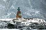
Svend Foyn (July 9, 1809 – November 30, 1894) was a Norwegian whaling, shipping magnate and philanthropist. He pioneered revolutionary methods for hunting...
13 KB (1,528 words) - 18:36, 31 May 2024

Nansen Island (redirect from Foyn Harbor)
and a rock patch on Nansen Island were used as leading marks when entering Foyn Harbor from the southeast. 64°32′S 62°00′W / 64.533°S 62.000°W / -64.533;...
8 KB (1,271 words) - 16:14, 29 May 2024
24472; -61.79333, which is 10.25 km east of Caution Point, 8.9 km west of Foyn Point and 35 km north of Cape Disappointment. Antarctic Digital Database (ADD)...
2 KB (183 words) - 12:55, 10 July 2019
Bulgaria. Kesten Point is located at 65°11′58″S 61°35′30″W / 65.19944°S 61.59167°W / -65.19944; -61.59167, which is 4.6 km north of Foyn Point, 9 km east...
2 KB (189 words) - 12:29, 10 July 2019
Vaughan Inlet to the north and Exasperation Inlet to the south, ending in Foyn Point to the southeast. The east coast of the peninsula is indented by Yamforina...
2 KB (217 words) - 17:34, 1 September 2024

the northeast, the coastal Whiteside Hill to the east, Foyn Point to the southeast, Kunino Point and Exasperation Inlet to the south, and Punchbowl Glacier...
2 KB (183 words) - 15:40, 16 October 2021
Monnier Point (67°6′S 64°45′W / 67.100°S 64.750°W / -67.100; -64.750) is a low, mainly ice-covered point forming the south side of the entrance to...
845 bytes (128 words) - 03:58, 11 September 2023
large ice-filled inlet, 16 miles (26 km) wide at its entrance between Foyn Point and Cape Disappointment, on the east coast of Graham Land. It was charted...
2 KB (161 words) - 07:51, 16 November 2022
Fleet Point (67°37′S 65°24′W / 67.617°S 65.400°W / -67.617; -65.400) is a rocky point 4 nautical miles (7 km) northwest of Tent Nunatak on the east...
1 KB (171 words) - 20:56, 1 July 2024

Hut Point Peninsula (77°47′S 166°51′E / 77.783°S 166.850°E / -77.783; 166.850) is a long, narrow peninsula from 2 to 3 nautical miles (3.7 to 5.6 km;...
16 KB (2,687 words) - 05:54, 8 July 2024
Point Wild is a point 11 km (6.8 mi) west of Cape Valentine, 2 km (1.2 mi) east of Saddleback Point, and directly adjacent to the Furness Glacier on the...
3 KB (313 words) - 01:30, 30 June 2023
Whiteside Hill, 15.15 km northwest of Foyn Point, 10.3 km north-northwest of Kunino Point, 7.8 km northeast of Diralo Point and 4.9 km south-southeast of St...
2 KB (190 words) - 17:32, 1 September 2024
78417, which is 5.5 km north of Kunino Point, 5.55 km southeast of Ravnogor Peak and 9.85 km northwest of Foyn Point. Antarctic Digital Database (ADD). Scale...
2 KB (175 words) - 17:31, 1 September 2024
Varad Point (Bulgarian: нос Варад, ‘Nos Varad’ \'nos va-'rad\) is the rocky point on Foyn Coast, Antarctic Peninsula situated 12.8 km west-southwest of...
2 KB (166 words) - 06:34, 12 July 2019
Fitzmaurice Point is a point on the northwest side of Cabinet Inlet, Foyn Coast, Antarctica, between Attlee Glacier and Bevin Glacier. It was photographed...
1 KB (155 words) - 19:26, 21 November 2015

Takev Point (Bulgarian: Такев нос, ‘Takev Nos’ \'ta-kev 'nos\) is the rocky point forming the south extremity of Heros Peninsula on Foyn Coast, Antarctic...
2 KB (161 words) - 08:56, 28 May 2023
Hodges Point (67°21′S 65°3′W / 67.350°S 65.050°W / -67.350; -65.050) is a rocky point terminating in an impressive black cliff, lying 6 nautical miles...
913 bytes (150 words) - 22:57, 9 February 2017
Balder Point (66°27′S 63°45′W / 66.450°S 63.750°W / -66.450; -63.750) is a headland in Antarctica marking the eastern tip of a narrow, rocky "cockscomb"...
892 bytes (129 words) - 22:56, 9 August 2023
Battle Point (67°10′S 64°45′W / 67.167°S 64.750°W / -67.167; -64.750) is a rocky and conspicuous coastal headland lying just below and southeast of...
785 bytes (123 words) - 03:41, 17 June 2018

Point Wordie is a headland on the western coast of Elephant Island, in the South Shetland Islands of Antarctica. The site is named after James Wordie...
2 KB (159 words) - 05:02, 25 December 2023

Petermann Island (redirect from Depeaux Point)
coordinates) 65°10′S 64°11′W / 65.167°S 64.183°W / -65.167; -64.183. A point forming the northwest end of Petermann Island,. Charted by the FrAE, 1908-10...
14 KB (1,941 words) - 23:44, 11 August 2024

Foyn Island, also known as Svend Foyn Island, is the second largest island in the Possession Islands, East Antarctica, lying 6 kilometres (4 mi) south-west...
3 KB (316 words) - 15:06, 13 February 2024

Cape Crozier (redirect from Wood Point (Antarctica))
169°24′E / 77.517°S 169.400°E / -77.517; 169.400) is the most easterly point of Ross Island in Antarctica. It was discovered in 1841 during James Clark...
13 KB (1,571 words) - 04:48, 29 May 2024

Paradise Harbour (redirect from Garzón Point)
indenting the west coast of Graham Land, Antarctica, between Duthiers Point and Leniz Point. The name was first applied by whalers operating in the vicinity...
12 KB (1,769 words) - 14:52, 19 July 2024
own gun. Rook runs out of bullets, and Callahan shoots Rook with a Svend Foyn harpoon cannon, impaling him. Callahan retrieves his gun and leaves with...
19 KB (2,307 words) - 22:03, 28 August 2024
Balabanski Crag (category Foyn Coast)
the rocky peak rising to 833 m in eastern Bigla Ridge on Heros Peninsula, Foyn Coast on the Antarctic Peninsula. It surmounts Cabinet Inlet to the northeast...
2 KB (214 words) - 13:29, 10 October 2021
Hope Bay (redirect from Sheppard Point)
them for its association with Sheppard Point. 63°22′S 56°58′W / 63.367°S 56.967°W / -63.367; -56.967. A point marking the north side of the entrance...
19 KB (2,867 words) - 23:37, 11 August 2024

Cape Evans (redirect from Tryggve Point)
around Cape Evans include North Bay, South Bay, Cape Evans Hut, Tryggve Point, Turks Head Bay, Turks Head, Inaccessible Island, Tent Island, Dellbridge...
7 KB (1,027 words) - 15:39, 14 February 2024
Chemish Ridge (category Foyn Coast)
west-northwest to east-southeast direction, 2 km wide and rising to 880 m on Foyn Coast, Antarctic Peninsula. The ridge surmounts Attlee Glacier to the north...
2 KB (222 words) - 18:36, 17 October 2021