A geocode is a code that represents a geographic entity (location or object). It is a unique identifier of the entity, to distinguish it from others in...
36 KB (3,173 words) - 13:50, 26 May 2024
Address geocoding, or simply geocoding, is the process of taking a text-based description of a location, such as an address or the name of a place, and...
29 KB (3,780 words) - 00:02, 20 June 2024
opposite of forward geocoding (often referred to as address geocoding or simply "geocoding"), hence the term reverse. Reverse geocoding permits the identification...
10 KB (1,240 words) - 09:38, 16 August 2024
ISO 3166-2 (redirect from ISO geocode)
states and dependent territories List of terms for administrative divisions Geocode "ISO 3166-2". International Organization for Standardization (ISO). "Country...
51 KB (655 words) - 20:31, 7 September 2024

Discrete global grid (redirect from List of geodesic-geocoding systems)
this context, it is common also to use a specific DGG as foundation for geocoding standardization. In the context of a spatial index, a DGG can assign unique...
43 KB (3,199 words) - 19:30, 1 March 2024

Geotagged photograph (redirect from Geocoded Photo)
entry of tags such as city, postal code or a street address. Geocoding and reverse geocoding can be used to convert between locations and addresses. Manual...
13 KB (1,532 words) - 13:09, 21 March 2024
the Interior, OCLC 20706997. Geocode coords estimated based on description in National Register nomination form. Geocode coords estimated based on description...
45 KB (452 words) - 18:15, 30 August 2024
Geocoder (Ruby) is a geocoding library for Ruby. Geocoding helps to enhance webpages by presenting location relevant information to the user. When used...
7 KB (696 words) - 21:07, 6 February 2023
position expressed in latitude and longitude is also a relative location. Geocode – Code that represents a geographic entity (location or object) Geographical...
3 KB (453 words) - 08:53, 21 August 2024

Postal addresses in the Republic of Ireland (redirect from Irish Geocodes)
A postal address in Ireland is a place of delivery defined by Irish Standard (IS) EN 14142-1:2011 ("Postal services. Address databases") and serviced by...
50 KB (4,605 words) - 23:18, 28 July 2024

International Territorial Level (ITL) is a geocode standard for referencing the subdivisions of the United Kingdom for statistical purposes, used by the...
5 KB (469 words) - 19:37, 17 July 2024

analysis, simply as Regions. International Territorial Level (ITL) is a geocode standard for referencing the subdivisions of the United Kingdom for statistical...
32 KB (2,753 words) - 12:10, 10 August 2024
an open source, cloud based SaaS model PaaS – Platform as a Service: geocoding or analysis/processing services ArcGIS Online FME Cloud Google Maps JavaScript...
29 KB (3,129 words) - 08:31, 24 April 2024

International Territorial Level (ITL) is a geocode standard for referencing the subdivisions of the United Kingdom for statistical purposes, used by the...
33 KB (1,246 words) - 12:55, 10 August 2024
automatically. Geographies can be grouped to create custom territories or custom geocoding used to extend existing geographic roles in the product. Tableau Software...
22 KB (1,848 words) - 04:16, 10 June 2024

(India) Quasi-Zenith Sat. Sys. (QZSS) (Japan) Discrete Global Grid and Geocoding Standards (history) International Terrestrial Reference System Spatial...
22 KB (2,491 words) - 15:04, 9 September 2024
What3words (category Geocodes)
What3words (stylized as what3words) is a proprietary geocode system designed to identify any location on the surface of Earth with a resolution of about...
29 KB (2,720 words) - 17:04, 5 September 2024
for the French nomenclature d'unités territoriales statistiques) is a geocode standard for referencing the administrative divisions of countries for...
31 KB (183 words) - 22:45, 18 July 2024
Maidenhead Locator System (category Geocodes)
The Maidenhead Locator System (a.k.a. QTH Locator and IARU Locator) is a geocode system used by amateur radio operators to succinctly describe their geographic...
16 KB (1,933 words) - 10:09, 4 September 2024
IATA airport code (category Geocodes)
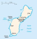
IATA station code, or simply a location identifier, is a three-letter geocode designating many airports and metropolitan areas around the world, defined...
51 KB (4,907 words) - 08:41, 10 September 2024

Time zone UTC+01:00 (CET) • Summer (DST) UTC+02:00 (CEST) Area codes 030 Geocode NUTS Region: DE3 ISO 3166 code DE-BE Vehicle registration B GeoTLD .berlin...
237 KB (19,469 words) - 12:34, 10 September 2024
Wikipedia content about locations shown in Google Maps using Wikipedia geocodes. On April 12, 2014, Google Maps was updated to reflect the annexation of...
152 KB (13,125 words) - 01:26, 5 September 2024

based on the Nomenclature of Territorial Units for Statistics (NUTS), a geocode standard for statistical purposes. The standard, adopted in 2003, is developed...
268 KB (23,430 words) - 22:44, 8 September 2024
which can be viewed by clicking the number. Geocode coordinates derived from NRHP nomination form. Geocode coordinates derived from NRHP nomination form...
130 KB (295 words) - 21:09, 15 July 2024

in Python or C++ extend QGIS's capabilities. Plugins can geocode using the Google Geocoding API, perform geoprocessing functions similar to those of the...
11 KB (905 words) - 21:06, 30 August 2024

ICAO airport code (category Geocodes)
countries performing air control such as NZ for New Zealand. Airspace class Geocode IATA airport code ICAO airline designators – a list of codes International...
31 KB (1,055 words) - 18:27, 9 September 2024

collectivity (New Caledonia) Overseas territory (French Southern and Antarctic Lands) Clipperton Island Geocodes of France ISO NUTS France portal v t e...
53 KB (6,411 words) - 08:01, 21 August 2024

address 1,000. Geocoding can also be applied against actual parcel data, typically from municipal tax maps. In this case, the result of the geocoding will be...
101 KB (13,126 words) - 16:51, 10 September 2024

(GMT) • Summer (DST) UTC+01:00 (BST) Postcodes EC, WC, E Area code 020 Geocode TQ32488134 (Grid ref.) 00AA (ONS) E09000001 (GSS) ISO 3166-2 GB-LND Police...
132 KB (12,062 words) - 11:10, 6 September 2024

(AKST) • Summer (DST) UTC-8 (AKDT) ZIP code 99501–99524, 99529–99530, 99599 Area code 907 Geocode 1398242 FIPS code 02-03000 Climate Dfc Website muni.org...
132 KB (11,514 words) - 13:14, 8 September 2024