
Gympie Road is a major road in the northern suburbs of Brisbane, Queensland, Australia. The road forms part of the main road route from the Brisbane Central...
16 KB (834 words) - 04:38, 30 August 2024

Gympie (/ˈɡɪmpi/ GHIM-pee) is a city and a locality in the Gympie Region, Queensland, Australia. Located in the Greater Sunshine Coast, Gympie is about...
56 KB (5,179 words) - 03:17, 23 September 2024
The Gympie Arterial Road is a freeway in the northern suburbs of Brisbane in Queensland, Australia. The road starts in Carseldine at Gympie Road and terminates...
4 KB (191 words) - 17:09, 25 July 2024
Tin Can Bay Road is a continuous 56.1 kilometres (34.9 mi) road route in the Gympie region of Queensland, Australia. Part of it is signed as State Route...
14 KB (1,138 words) - 03:15, 17 August 2024
local government authority Gympie Road, Brisbane, a road in Brisbane Gympie Arterial Road, a highway in Brisbane Gympie Gympie (Dendrocnide moroides), a...
576 bytes (74 words) - 11:56, 28 August 2019
Cooroy–Gympie Road is a continuous 29.1 kilometres (18.1 mi) road route in the Noosa and Gympie regions of Queensland, Australia. It is a state-controlled...
10 KB (688 words) - 01:31, 31 October 2023
Gympie–Brooloo–Kenilworth Road is a continuous 51.6 kilometres (32.1 mi) road route in the Gympie and Sunshine Coast regions of Queensland, Australia...
11 KB (960 words) - 17:10, 25 July 2024

Dendrocnide moroides (redirect from Gympie Gympie)
commonly known in Australia as the stinging tree, stinging bush, or gympie-gympie, is a plant in the nettle family Urticaceae found in rainforest areas...
25 KB (2,525 words) - 21:24, 28 July 2024
Gympie Road from Strathpine to Petrie. Dayboro Road from Petrie to Dayboro. Mount Mee Road from Dayboro to D'Aguilar. The road commences where Gympie...
19 KB (1,038 words) - 16:40, 25 July 2024

Bruce Highway (category WikiProject Australian Roads articles with a junction list using templates)
constantly being shortened. The road is a dual carriageway from Brisbane to Kybong with some dual carriageway lengths at Gympie, many of these upgrades being...
103 KB (5,373 words) - 07:55, 6 August 2024

Wide Bay Highway (redirect from Gympie–Woolooga Road)
south to Gympie or 69 kilometres north to Maryborough. The length of the highway is 62.6 kilometres. It is a state-controlled regional road (number 44A)...
9 KB (622 words) - 21:06, 25 July 2024
the goldfields at Gympie.[citation needed] A United Methodist Free church opened on Sunday 11 August 1878 on the corner of Gympie Road and Banfield Street...
45 KB (4,381 words) - 06:30, 6 August 2024

census, Kedron had a population of 9,907 people. Kedron is centered on Gympie Road and Kedron Brook. It is close to Westfield Chermside shopping centre...
33 KB (3,320 words) - 02:49, 1 September 2024

increased traffic on Gympie Road, the Royal Exchange Hotel was established in 1875 opposite the intersection of Gympie Road and Albany Creek Road. It also operated...
32 KB (3,455 words) - 17:55, 12 September 2024

the South Pine River and Four Mile Creek. Brisbane–Woodford Road, concurrent with Gympie Road enters the suburb from the south (Strathpine) and passes through...
23 KB (1,995 words) - 09:23, 21 September 2024
Connection Road Cooroy–Gympie Road Mary Valley Link Road Tin Can Bay Road Gympie–Woolooga Road Gympie Connection Road The following state-controlled roads intersect...
40 KB (3,168 words) - 15:45, 4 April 2024

Westfield. In the 2021 census, Strathpine had a population of 10,647 people. Gympie Road enters the suburb from the south-east (Bald Hills) and exits to the north...
19 KB (1,688 words) - 23:35, 4 June 2024
sandstone ridge, and is located on the Gympie Connection Road, some 5 km (3.1 mi) north-east of the town of Gympie in Queensland, Australia. It includes...
15 KB (1,731 words) - 19:10, 12 October 2022
district road (number 485), rated as a local road of regional significance (LRRS). It runs from Eumundi–Kenilworth Road in Belli Park to Cooroy–Gympie Road (Old...
13 KB (996 words) - 16:59, 25 July 2024

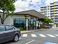
Gympie North railway station is located on the North Coast line in Queensland, Australia. It serves the town of Gympie. Gympie North was opened on 4 February...
6 KB (293 words) - 00:27, 7 May 2024
Strathpine and meeting Brisbane–Woodford Road (Gympie Road) (State Route 58) at a T-junction, where it ends. The road is four lanes for its entire length....
28 KB (1,649 words) - 17:25, 5 April 2024

Sunshine Coast railway line (redirect from Gympie North railway line, Queensland)
Sunshine Coast and as far north as Gympie. It is the longest line on the Queensland Rail Citytrain network. Nambour and Gympie North services use the Caboolture...
9 KB (644 words) - 00:50, 28 January 2024
M3/A3 (Brisbane) (category Australia road stubs)
Hills (A3) Lutwyche Road between Bowen Hills and Kedron (A3) Gympie Road between Kedron and Carseldine (M3) Gympie Arterial Road between Carseldine and...
1 KB (125 words) - 10:25, 9 February 2023
is for bus or transit lane level priority along the highly congested Gympie Road corridor. In August 2024 it was announced Brisbane Metro would be extended...
16 KB (1,161 words) - 02:33, 30 August 2024
Weyba Road, and Noosa Drive. The road is fully sealed to at least a two-lane standard. It is part of the shortest route to Noosa Heads from Gympie and all...
10 KB (751 words) - 13:50, 12 August 2024

Westfield shopping centre. The centre is located on the corner of Gympie Road and Hamilton Road. Majors: Myer Department Store - three levels David Jones Department...
14 KB (1,413 words) - 22:47, 29 June 2024

Tin Can Bay, Queensland (category Gympie Region)
school is Gympie State High School in Gympie to the south-west. The Gympie Regional Council operate a public library at the park on Tin Can Bay Road (25°54′53″S...
17 KB (1,527 words) - 10:00, 22 September 2024
Caboolture Connection Road in Caboolture. It runs north, passing Pumicestone Road (see below) to the north-east and Old Gympie Road to the north-west. It...
17 KB (741 words) - 16:35, 25 July 2024
The Gympie Local Heritage Register is a list of heritage sites within the Gympie Region, Queensland, Australia. It is maintained by the Gympie Regional...
66 KB (4,484 words) - 17:44, 27 September 2023
Redcliffe Peninsula road network is a group of roads that provide access to the Redcliffe Peninsula in Queensland, Australia, and enable travel between...
13 KB (1,117 words) - 17:59, 25 July 2024