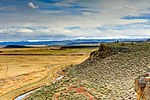
The Harney Basin is an endorheic basin in southeastern Oregon in the United States at the northwestern corner of the Great Basin. One of the least populated...
12 KB (1,285 words) - 06:06, 25 August 2024
The Harney Basin duskysnail, scientific name Colligyrus depressus, is a species of freshwater snail, an aquatic gastropod mollusk in the family Hydrobiidae...
2 KB (103 words) - 01:37, 8 December 2023
desert area, between the Harney Basin, the Blue Mountains and the Snake. In the past Malheur Lake (located in the enclosed Harney Basin to the southwest) outflowed...
11 KB (898 words) - 16:56, 25 October 2024
Malheur National Wildlife Refuge (category Landforms of Harney County, Oregon)
located roughly 30 miles (48 km) south of the city of Burns in Oregon's Harney Basin. Administered by the United States Fish and Wildlife Service, the refuge...
34 KB (3,619 words) - 02:35, 25 September 2023
Harney County is one of the 36 counties in the U.S. state of Oregon. As of the 2020 census, the population was 7,495, making it the sixth-least populous...
35 KB (3,403 words) - 16:47, 16 July 2024
Harney may refer to: Harney, Maryland, an unincorporated community Harney, Minnesota, an unincorporated community Harney Basin, arid basin in south-east...
768 bytes (126 words) - 23:11, 15 July 2020
Burns, Oregon (category Cities in Harney County, Oregon)
high-desert climate but was much wetter in the recent geologic past. The Harney Basin was the largest of many depressions in which lakes formed in southeastern...
42 KB (3,870 words) - 19:46, 5 September 2024
Malheur Lake (category Lakes of Harney County, Oregon)
periodically overflows into Mud Lake to the west and thence to Harney Lake, the sink of Harney Basin. The western area of Malheur Lake consists of ponds separated...
9 KB (913 words) - 16:56, 25 October 2024
Carson Sink (Nevada), 131 mi-long (211 km) Donner und Blitzen River – Harney Basin (Oregon), 61 mi-long (98 km) Little Blitzen River Humboldt River – Humboldt...
5 KB (481 words) - 15:11, 30 December 2023
Columbia River (redirect from Mid-Columbia Basin)
Basin watersheds that share a border with the Columbia watershed include Harney Basin, Humboldt River, and Great Salt Lake. The associated triple divide points...
196 KB (18,321 words) - 03:17, 27 October 2024
Columbia River Columbia River Gorge Eastern Oregon Goose Lake Valley Harney Basin High Desert Hood River Valley Mount Hood Corridor Northwest Oregon Oregon...
54 KB (3,960 words) - 11:00, 1 November 2024
[citation needed] Great Basin (California, Idaho, Nevada, Oregon, Utah and Wyoming) Oregon Lakes (California, Oregon) Harney Basin (Harney and Malheur lakes)...
12 KB (1,280 words) - 15:07, 10 April 2024
Harney Lake is a shallow alkali lake basin located in southeast Oregon, United States, approximately 30 miles (48 km) south of the city of Burns. The lake...
7 KB (678 words) - 21:57, 28 August 2024
Dry Well Creek (category Rivers of Harney County, Oregon)
Dry Well Creek is a stream in Harney County, Oregon, United States in the Harney Basin of Eastern Oregon. Its mouth is at an elevation of 5,000 feet (1...
4 KB (191 words) - 03:53, 10 May 2020
state, which include opossums, shrews, moles, little pocket mice, great basin pocket mice, dark kangaroo mouse, California kangaroo rat, chisel-toothed...
196 KB (16,669 words) - 06:57, 19 October 2024
trail at Vale, Oregon and followed the Malheur River to head into the Harney Basin. They then turned west towards Wagontire Mountain and northwest to the...
17 KB (2,439 words) - 19:52, 12 April 2024
the Blue Mountains is drained by the Silvies River, in the endorheic Harney Basin. List of mountain ranges of Oregon "Blue Mountains (OR)". summitpost...
15 KB (1,444 words) - 07:29, 6 October 2024
The Harney section is an intermontane plateau in eastern Oregon that borders the Great Basin section to the south, the Middle Cascade section to the west...
2 KB (88 words) - 00:27, 19 August 2024
found east of the higher mountains, especially in rainshadow areas. The Harney Basin of Oregon is an example of arid climate in the Pacific Northwest. Humid...
141 KB (14,118 words) - 01:01, 30 October 2024
uplift in the Late Miocene, blocking westerlies from coming into the Tarim Basin and drying it as a result. At the beginning of the Miocene, the northern...
100 KB (10,397 words) - 00:33, 2 November 2024
Bonneville was another such lake, overflowing its basin in the Bonneville flood. The Malheur/Harney lake system in Oregon is normally cut off from drainage...
33 KB (3,752 words) - 09:28, 29 October 2024
Oregon Coast Portland Metro Tualatin Valley Willamette Valley Eastern Harney Basin High Desert Palouse Treasure Valley Central Oregon Southern Rogue Valley...
4 KB (276 words) - 18:31, 5 April 2024
Fort Rock-Christmas Lake Valley Basin Four Craters Lava Field Glass Buttes Hager Mountain Harney Basin Harney Basin Volcanic Field Hole-in-the-Ground...
9 KB (925 words) - 09:17, 7 September 2024
Retrieved 2008-04-01. "The Boring Volcanic Field – Hills of the Portland Basin". USGS Cascades Volcano Observatory. Archived from the original on 2015-12-22...
13 KB (1,256 words) - 05:09, 25 August 2024
Cottidae. It is found in the United States, inhabiting the Harney Basin, and the Snake River basin, including Malheur River in Oregon and Idaho. It reaches...
1 KB (96 words) - 14:02, 12 August 2023
Fort Rock-Christmas Lake Valley Basin Four Craters Lava Field Glass Buttes Hager Mountain Harney Basin Harney Basin Volcanic Field Hole-in-the-Ground...
10 KB (1,038 words) - 01:20, 11 September 2024
Fort Rock-Christmas Lake Valley Basin Four Craters Lava Field Glass Buttes Hager Mountain Harney Basin Harney Basin Volcanic Field Hole-in-the-Ground...
4 KB (390 words) - 21:15, 20 April 2024
(Strawberry Range) Trout Creek Mountains (southern boundary of Alvord Basin) Harney County, Oregon 7,060 2,150 42°06′00″N 118°17′34″W / 42.10000°N 118...
13 KB (636 words) - 16:03, 1 December 2023
Carmacks Group, Yukon, 63,000 square kilometers (24,324 sq mi), 70 Ma. Harney Basin (Devine Canyon Tuff), McDermitt volcanic field, Owyhee-Humboldt volcanic...
40 KB (4,303 words) - 03:27, 14 September 2024
Harney, and Warner Lakes and along the Sprague River in the area now comprising Lake and Harney counties of Oregon, and hunted in the Klamath Basin,...
31 KB (4,000 words) - 02:07, 17 October 2024


