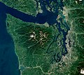
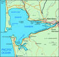
The Humptulips River is a river in Grays Harbor County, Washington, in the United States. Its main tributaries are the East Fork Humptulips River, about...
6 KB (555 words) - 17:35, 15 November 2024
Humptulips River. According to other sources the word means 'chilly region'. It has frequently been noted on lists of unusual place names. Humptulips...
12 KB (765 words) - 17:37, 15 November 2024
and Humptulips River Basins" (PDF). United States Geological Survey. Retrieved 2009-06-05. "Chehalis River Basin Nonpoint Action Plan = Newaukum River"....
8 KB (695 words) - 21:03, 14 May 2024
Clearwater River Snahapish River Solleks River Salmon River Sams River Raft River Quinault River Moclips River Copalis River Humptulips River Hoquiam River Chehalis...
15 KB (1,150 words) - 00:27, 26 October 2024
Resources Data-Washington Water Year 2005; Chehalis and Humptulips River Basins; 12026400 Skookumchuck River near Bucoda, WA" (PDF). United States Geological...
9 KB (708 words) - 18:40, 1 August 2024
Olympic Peninsula (section Rivers)
those locales. Major salmon-bearing rivers on the Olympic Peninsula include, clockwise from the southwest, the Humptulips, the Quinault, the Queets, the Quillayute...
9 KB (752 words) - 05:22, 5 January 2025
Village (former) Cohassett Beach Copalis Beach Grayland Hogans Corner Humptulips Junction City Malone Markham Moclips Neilton Ocean City Oyehut Pacific...
27 KB (2,360 words) - 09:13, 12 December 2024
averages about 220 inches (5,600 mm), giving rise to streams such as the Humptulips River. Olympic National Forest was originally created as Olympic Forest Reserve...
12 KB (1,048 words) - 01:08, 8 October 2024
Besides the Chehalis, many lesser rivers and streams flow into Grays Harbor, such as the Hoquiam River and Humptulips River. A pair of low peninsulas separate...
7 KB (958 words) - 00:15, 20 December 2024
River originates in the southwestern portion of the Olympic Peninsula a few miles south of the Quinault Reservation and just north of the Humptulips River...
5 KB (290 words) - 17:42, 15 November 2024
Pacific Ocean, the Humptulips River joins. Flood control and concerns for the Chehalis River and its watershed is managed by the Chehalis River Basin Flood Authority...
19 KB (1,745 words) - 20:39, 3 January 2025
Grays Harbor) Humptulips (x̣ʷəmtúl̕apš; on the north shore of Grays Harbor and along the Humptulips River) Hoquiam (along the Hoquiam River) Wishkah (along...
19 KB (2,406 words) - 20:34, 30 December 2024
2009. "Water Resources Data-Washington Water Year 2005; Chehalis and Humptulips River Basins" (PDF). United States Geological Survey. Retrieved 6 July 2009...
7 KB (666 words) - 00:19, 16 September 2024
Duwamish River Entiat, Entiat River Hamma Hamma River Hoh River Hoquiam Humptulips, Humptulips River Hyak Issaquah Kachess Lake Kahlotus Hole in the Ground...
108 KB (8,749 words) - 20:19, 11 November 2024
Resources Data-Washington Water Year 2005; Chehalis and Humptulips River Basins; 12035000 Satsop River near Satsop, WA" (PDF). United States Geological Survey...
15 KB (1,698 words) - 17:36, 15 November 2024
Hughes River - Virginia Hughes River - West Virginia Humboldt River - Nevada Humptulips River - Washington Hungry River - North Carolina Hunt River - Rhode...
4 KB (273 words) - 19:23, 14 March 2022
Chehalis River, the Humptulips by way of Grays Harbor at the mouth of the Chehalis River, and the Bogachiel and Sol Duc forming the Quillayute River within...
60 KB (7,558 words) - 00:15, 20 December 2024
west and travels across the Axford Prairie near Humptulips. The highway crosses the Humptulips River near a state fish hatchery and continues north into...
44 KB (3,928 words) - 00:34, 17 June 2024
shore around the northeast side of Grays Harbor. After crossing the Humptulips River, the highway turns west and passes several cranberry bogs along the...
22 KB (2,031 words) - 04:26, 15 June 2024
Snuneymuxw First Nation (redirect from Nanaimo River 2, British Columbia)
Canada. The nation previously had also occupied territory along the Fraser River, in British Columbia. Prior to European colonization of the Americas and...
27 KB (3,203 words) - 04:42, 25 December 2024
Lower Chehalis of the lower Chehalis River drainage. Other groups included the Copalis, Wynoochee, and Humptulips subtribes of the Upper Chehalis subtribe...
16 KB (1,797 words) - 17:19, 15 November 2024
Stó꞉lō (redirect from Fraser River Salish)
known and commonly referred to in ethnographic literature as the Fraser River Indians or Lower Fraser Salish, are a group of First Nations peoples inhabiting...
37 KB (4,744 words) - 06:54, 29 November 2024
the Lummi built a dike on the Nooksack River, allowing them to acquire and cultivate new land along the river delta. The mid-to-late 1900s marked a push...
15 KB (1,870 words) - 18:19, 1 December 2024
territories flank the mouth of the Columbia River and stretch up that river in a narrow band adjacent to that river, as far as Celilo Falls. Their group of...
46 KB (5,609 words) - 02:53, 12 November 2024
The Hoh or Chalá·at ("Those-Who-Live-on-the-Hoh River" or "People of the Hoh River") are a Native American tribe in western Washington state in the United...
6 KB (657 words) - 02:14, 28 November 2024
Lushootseed-speaking people in the Skagit River valley of Washington. The Nuwhaha primarily lived along the Samish River, as well as the coastal areas between...
17 KB (1,810 words) - 05:42, 5 December 2024
Hunquminum name for river grass. River grass was historically abundant in Musqueam territory; xʷməθkʷəy̓əm accordingly means "place of the river grass" or "place...
18 KB (1,862 words) - 14:37, 6 December 2024
language, come the Sutslhmc. From the Dean River come the Nutl'lmc, as well as lineages from the upper Dean River. From South Bentinck Arm (Ats'aaxlh) come...
7 KB (769 words) - 20:26, 14 June 2023
along the banks of the Sauk, Suiattle, Cascade, Stillaguamish, and Skagit rivers, in the area known as Sauk Prairie at the foot of Whitehorse Mountain in...
14 KB (1,420 words) - 18:24, 1 December 2024
as the Sq'éwlets, which is a Stó:lō-Coast Salish Community in the Fraser River Valley. There is also the People's Center Museum that opened in 1994 and...
19 KB (1,954 words) - 05:28, 17 November 2024


