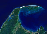
Kaitoke Beach is a long sandy beach and settlement on the east coast of Great Barrier Island in the Hauraki Gulf of the Auckland Region of New Zealand...
3 KB (328 words) - 04:31, 25 March 2024
Medlands Beach is directly south of Kaitoke Beach, with the Sugar Loaf hill and Pitokuku Island in-between. Sugar Loaf hill offers great views of the beach but...
8 KB (781 words) - 07:10, 21 October 2024
intermediate to expert surfers. Kaitoke Beach is south of Palmers Beach and Awana Bay is to the north. "Palmer's Beach". greatbarrierphotography.com. Great...
1 KB (104 words) - 04:39, 25 March 2024
needed] There are three primary schools: Mulberry Grove School at Tryphena, Kaitoke School at Claris, and Okiwi School. There is no secondary school, but there...
38 KB (3,506 words) - 08:33, 8 November 2024
Bay Harataonga Kaitoke Beach Medlands Beach Motairehe Palmers Beach Whangapoua Beach Waiheke Community Board: Oneroa Blackpool Palm Beach Surfdale Ostend...
22 KB (1,485 words) - 00:30, 8 November 2024
hills. Kaitoke Beach and Medlands Beach are located nearby. In January 2013, a vegetation fire burned over 100 hectares near Claris and Kaitoke Beach. A planned...
5 KB (459 words) - 04:26, 25 March 2024
Remutaka Rail Trail (section Cross Creek – Kaitoke)
the area; members of the public have limited vehicular access from the Kaitoke end to a car park, go-kart track and gun range. Access is also granted...
14 KB (1,711 words) - 07:40, 13 April 2024
duration, including the Southern Crossing that ends at Kaitoke 45 km northeast of Wellington. Ōtaki Beach spans the stretch of coastline between the Ōtaki River...
23 KB (2,024 words) - 23:47, 14 November 2024
Raglan, New Zealand (category Beaches of Waikato)
State Highway 23. It is known for its surfing, and volcanic black sand beaches. The Ngāti Māhanga iwi occupied the area around Raglan in the late 18th...
79 KB (7,153 words) - 05:47, 8 November 2024
39°16′55″S 175°33′55″E / 39.28194°S 175.56528°E / -39.28194; 175.56528 Kaitoke Lake Whanganui District 0.253 km2 Between the mouths of the Whanganui and...
165 KB (1,030 words) - 11:00, 13 October 2024
District is also home to other settlements with small populations, including Kaitoke, Upokongaro, Kai Iwi/Mowhanau, Aberfeldy, Westmere, Pākaraka, Marybank...
74 KB (7,089 words) - 03:38, 22 November 2024
‘whale trap’ because of its protruding coastlines and long, gently sloping beaches. The Māori name for the spit is Onetahua, translated as "heaped up sand"...
37 KB (3,290 words) - 04:33, 21 November 2024
Name MOE Years Area Authority Roll Website Notes Kaitoke School 1593 1–8 Medlands Beach State 46 - Mulberry Grove School 1385 1–8 Tryphena State 33 [138]...
145 KB (1,003 words) - 02:51, 3 November 2024
February 2015. Retrieved 18 February 2015. "Whanganui Iwi (Whanganui (Kaitoke) Prison and Northern Part of Whanganui Forest) On-account Settlement Act...
66 KB (5,952 words) - 04:01, 11 November 2024
2361 Kai Iwi School 1–8 Coed Kai Iwi State 105 [19] 2369 2369 Kaitoke School 1–8 Coed Kaitoke State 111 - 2372 2372 Kakatahi School 1–8 Coed Kakatahi State...
61 KB (885 words) - 05:37, 22 September 2023
Domain Gonville West Gonville North Cornmarket Whanganui East-Riverlands Kaitoke-Fordell Whanganui Central Gonville South Bastia-Durie Hill Putiki Mokai...
62 KB (4,617 words) - 09:01, 19 August 2024
Branch — — 17 September 1927 27 February 1960 5 February 1949 11 May 1965 Kaitoke Wairarapa Line — — 28 December 1877 30 October 1955 Kaiwharawhara — — 20...
29 KB (1,202 words) - 15:51, 27 August 2024
vehicles dropping down off the road. The original winding route between Kaitoke and Te Marua was significantly realigned between 2002 and 2006. The tightest...
25 KB (2,143 words) - 21:35, 11 November 2024
problems with sewage pollution of the Ōwhiro Stream and beach for at least ten years, and the beach has been closed for swimming for long periods. In March...
92 KB (9,108 words) - 04:13, 22 November 2024
1877 the line to Kaitoke was officially opened by the Governor,. On 1 January 1878 the line to Kaitoke was opened to the public; Kaitoke becoming the railhead...
41 KB (4,293 words) - 11:19, 28 August 2024
1987 41°03′36″S 174°56′24″E / 41.060°S 174.940°E / -41.060; 174.940 Kaitoke Regional Park Wellington Region 28.6 1983 41°04′08″S 175°11′56″E / 41...
28 KB (1,209 words) - 03:55, 20 November 2024
a trust in 2017 to protect local wildlife in the region from Wharariki Beach to the tip of Farewell Spit. The Farewell Wharariki HealthPost Nature Trust...
12 KB (794 words) - 04:10, 21 November 2024


