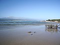
Keurboomstrand is a resort town near Plettenberg Bay on the Western Cape of South Africa. It takes its name from the indigenous keurboom tree which grows...
4 KB (157 words) - 00:32, 27 July 2023
Herbertsdale Herold Herolds Bay Hoekwil Jonkersberg Karatara Keurboomsrivier Keurboomstrand Knysna Kranshoek Kurland Estate Ladismith Little Brak River Matjiesrivier...
7 KB (316 words) - 17:51, 1 August 2024

Cape Town. Nelson Bay Cave on Robberg and Matjies River Cave at nearby Keurboomstrand were inhabited for over 100,000 years by Middle Stone Age man and then...
20 KB (1,720 words) - 16:33, 5 May 2024

Kempton Park Gauteng Kenton-on-Sea Eastern Cape Kestell Free State Keurboomstrand Western Cape Kgotsong Free State Khayelitsha Western Cape Kimberley...
39 KB (38 words) - 17:27, 10 June 2024
Bay Hibberdene Hondeklip Bay Jacobsbaai Jeffreys Bay Kenton-on-Sea Keurboomstrand Kidd's Beach Kleinmond Kleinzee Knysna Kommetjie Kosi Bay L'Agulhas...
55 KB (5,472 words) - 09:00, 30 August 2024

Keurbooms River mouth from Plettenberg Bay is the coastal resort of Keurboomstrand (pop. 475), while the resort of Nature's Valley (pop. 460) is situated...
17 KB (1,301 words) - 16:39, 9 August 2024

Franskraalstrand Gansbaai Gordon's Bay Hartenbos Hawston Hermanus Herolds Bay Keurboomstrand Kleinmond Knysna Kommetjie L'Agulhas Lambert's Bay Langebaan Llandudno...
8 KB (515 words) - 18:07, 15 May 2024
Kaapstad. May also refer to the wider surrounding area. Keurbooms - Keurboomstrand King - King William's Town Klerkies - Klerksdorp Kowie - Port Alfred...
6 KB (659 words) - 20:13, 25 May 2024

to extinction by competing salmonids. Keurboomsrivier (settlement) Keurboomstrand List of rivers of South Africa List of estuaries of South Africa Drainage...
5 KB (279 words) - 08:00, 1 July 2024

and Matjes River rock shelter which lies about 14 kilometres north at Keurboomstrand. Robberg shows notches, caves and other erosional features caused mainly...
8 KB (767 words) - 15:09, 1 July 2024

Zanthoxylum davyi Tsitsikamma National Park Garden Route Plettenberg Bay Keurboomstrand, Western Cape "Main Place Nature's Valley". Census 2011. https://www...
25 KB (2,478 words) - 23:37, 24 November 2023

Eastern Cape, 33°42′S 26°41′E / 33.700°S 26.683°E / -33.700; 26.683 Keurboomstrand, Plettenberg Bay, Western Cape, 34°02′17″S 23°23′31″E / 34.03806°S...
52 KB (7,939 words) - 00:03, 17 April 2024

to take on the farm she sold it and moved to a house on the coast at Keurboomstrand near Plettenberg Bay. But when her family were settled in England she...
13 KB (1,571 words) - 11:05, 1 July 2024
Gymnogongrus intermedius Kylin 1938, (Kalk Bay, Sea Point and possibly Keurboomstrand in Plettenberg Bay) Ahnfeltiopsis polyclada (Kützing) P.C.Silva & DeCew...
174 KB (22,879 words) - 01:02, 2 January 2024

Gymnogongrus intermedius Kylin 1938, (Kalk Bay, Sea Point and possibly Keurboomstrand in Plettenberg Bay) Ahnfeltiopsis polyclada (Kützing) P.C.Silva & DeCew...
128 KB (17,204 words) - 05:40, 29 October 2023
Eastern Cape, 33°42′S 26°41′E / 33.700°S 26.683°E / -33.700; 26.683 Keurboomstrand, Plettenberg Bay, Western Cape, 34°02′17″S 23°23′31″E / 34.03806°S...
38 KB (5,803 words) - 10:07, 14 October 2023
Eastern Cape, 33°42′S 26°41′E / 33.700°S 26.683°E / -33.700; 26.683 Keurboomstrand, Plettenberg Bay, Western Cape, 34°02′17″S 23°23′31″E / 34.03806°S...
37 KB (5,603 words) - 16:57, 24 May 2024
Eastern Cape, 33°42′S 26°41′E / 33.700°S 26.683°E / -33.700; 26.683 Keurboomstrand, Plettenberg Bay, Western Cape, 34°02′17″S 23°23′31″E / 34.03806°S...
45 KB (7,066 words) - 05:12, 8 October 2023