
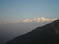
Salyan or Salyan Khalanga is the headquarters of Salyan District in the mid-west 'hills' of Nepal. It is located at 28°22'31N 82°9'42E at 1,530 metres...
4 KB (116 words) - 09:30, 21 March 2024
Khalanga is market center in Sharada Municipality in Salyan District of Karnali Province of Nepal. The place formerly existing as Village Development...
4 KB (139 words) - 07:48, 14 May 2021
Dadeldhura Khalanga, Dailekh Khalanga, Darchula Khalanga, Jajarkot Khalanga, Salyan This disambiguation page lists articles about distinct geographical...
211 bytes (54 words) - 03:25, 9 May 2020
241,716 in 2011. The district's administrative center is named Salyan or Salyan Khalanga, today it is part of Shaarada Municipality. The district is known...
15 KB (961 words) - 09:12, 7 September 2024
Salyan rayon (district) Shirvan-Salyan economic region, an economic region of Azerbaijan Salyan District, Nepal, a district of Nepal Salyan Khalanga,...
1 KB (168 words) - 07:28, 20 September 2024
Salyan District Hospital is a government hospital located in Khalanga, Salyan in Karnali Province of Nepal. The hospital is considered a crucial resource...
3 KB (187 words) - 07:57, 1 January 2024
Hospital Rajbiraj Salyan District Hospital Khalanga, Salyan, Karnali Province, Nepal Government hospital located in Khalanga, Salyan in Karnali Province...
14 KB (284 words) - 07:52, 20 September 2024
districts. The remainder of Dang and part of Salyan district are drained by the Babai. The remainder of Salyan and all of Rukum districts are drained by...
11 KB (1,224 words) - 15:30, 4 May 2024

Highway was under construction (as of 2010) to connect Musikot to Salyan Khalanga, Tulsipur, and Mahendra Highway to the south. On the other hand, Nepal's...
16 KB (1,300 words) - 07:31, 21 September 2024

राजमार्ग) is a highway in central Nepal that crosses the districts of Dang, Salyan and West Rukum in a south to north direction. The 176 km highway branches...
2 KB (127 words) - 03:22, 3 August 2024
Khara, Kholagaun, Kol, Kotjahari, Magma, Mahat, Morawang, Muru, Musikot Khalanga, Nuwakot, Pipal, Pokhara, Purtim Kanda, Pwang, Pyaugha, Rangsi, Ranmamekot...
80 KB (4,502 words) - 10:49, 9 September 2024

Marich Man Singh Shrestha (category People from Salyan District, Nepal)
politician and former Prime Minister of Nepal. He was born in 1942 in Khalanga Bazar, Salyan, Nepal. He served as the Prime Minister of Nepal from 15 June 1986...
6 KB (479 words) - 01:04, 27 July 2024
Shaarada (category Populated places in Salyan District, Nepal)
merging seven Village Development Committees: Dandagaun, Hiwalcha, Kajeri, Khalanga, Marke, Saijuwal Takura and Syanikhal. At the time of the 1991 Nepal census...
8 KB (304 words) - 10:08, 22 September 2024

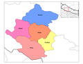
Province Humla Mugu Dolpa Jumla Kalikot Dailekh Jajarkot Rukum west Surkhet Salyan Gandaki Lumbini China (Tibet) Sudurpashchim India (UP) Divisions of Karnali...
25 KB (1,475 words) - 15:44, 13 September 2024
Province Humla Mugu Dolpa Jumla Kalikot Dailekh Jajarkot Rukum west Surkhet Salyan Gandaki Lumbini China (Tibet) Sudurpashchim India (UP) Darchula Bajhang...
28 KB (768 words) - 14:49, 17 September 2024

Hill Pyuthan District (Pyuthan Khalanga) Rolpa District (Liwang) Rukum District (Musikot) Salyan District (Salyan Khalanga) Mountain Dolpa District (Dunai)...
23 KB (1,268 words) - 07:00, 30 September 2024

Highway was under construction (as of 2010) to connect Musikot to Salyan Khalanga, Tulsipur, and Mahendra Highway to the south. On the other hand, Nepal's...
10 KB (700 words) - 22:44, 28 March 2024

Highway 27 (Shitalpati - Raikar) is a National Highway of Nepal, located in Salyan District of Karnali Province. The total length of the highway is 39.42 kilometres...
2 KB (78 words) - 13:40, 26 July 2024
Lake Tribeni Rukum Upload Photo Upload Photo NP-WRUK-03 Sital Pokhari Khalanga Rukum Upload Photo Upload Photo NP-WRUK-04 Sankha Lake Tribeni Rukum Upload...
16 KB (396 words) - 12:07, 12 November 2023
running from Jajarkot to Dunai, while another landslide was reported at the Khalanga-Panchkatiya section. A bridge in Rimna in Jajarkot suffered minor damage...
50 KB (3,959 words) - 22:35, 5 April 2024
Karnali Salyan सल्यान Salyan 1462 Sharada Municipality 15 Karnali Salyan सल्यान Salyan 1462 Bagachour Municipality 12 Karnali Salyan सल्यान Salyan 1462 Banagad...
81 KB (154 words) - 17:42, 26 August 2024
166354.00 81063.00 85291.00 1213.00 95.04 4.41 137.00 0.65 9 Salyan District सल्यान जिल्ला Salyan 242444.00 51984.00 55400.00 238668.00 114953.00 123715.00...
34 KB (1,131 words) - 14:24, 30 August 2024
कुपिण्डे Salyan 36,052 338.21 [14] 5 Chhedagad छेडागाड Jajarkot 35,295 284.2 [15] 6 Bagchaur बागचौर Salyan 34,118 163.14 [16] 7 Shaarda शारदा Salyan 33,730...
15 KB (201 words) - 14:57, 7 August 2022