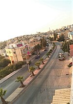
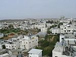
Khirbat al-Simia (Arabic: خربة السيميا) is a Palestinian village located four kilometers north-west of As-Samu .The village is in the Hebron Governorate...
10 KB (970 words) - 20:59, 30 October 2024
Masafer Yatta (redirect from Khirbat al-Mufkara)
approximately 80 to 100 masked Israeli settlers invaded the village of Khirbat al-Mufkara, one of the hamlets that compose Masafer Yatta, throwing stones...
19 KB (1,772 words) - 23:08, 27 October 2024
ed-Darb and Mokata 'Aboud, and in the Western Hebron Hills, including Khirbat al-Simia, Rujm el-Fihjeh and Khirbet el Jof. The great similarity between these...
126 KB (16,126 words) - 05:39, 28 October 2024
The Hebron Governorate (Arabic: محافظة الخليل, romanized: Muḥāfaẓat al-Ḫalīl) is an administrative district of Palestine in the southern West Bank. The...
12 KB (653 words) - 20:38, 23 October 2024
As-Samu (called: Al Samu) had an entirely Muslim population of 1,600 inhabitants. In the 1931 census, As-Samu, together with Khirbat al-Simia and Kh. Rafat...
30 KB (2,825 words) - 01:02, 24 October 2024
ed-Darb and Mokata 'Aboud, and in the Western Hebron Hills, including Khirbat al-Simia, Rujm el-Fihjeh and Khirbet el Jof. The great similarity between these...
23 KB (2,865 words) - 02:24, 18 October 2024
to several clan, such as Al Swaty, Al 'Amayra, Amro, Al Sharha, Al Darweash, Al Maslamea', Al Darbeai', and Al Awawda'. The Al 'Amayra (or 'Amr) clan,...
31 KB (3,006 words) - 03:24, 2 November 2024
Liquorice Plant", after a common species growing there. "Carmel", today's Khirbat al-Karmil, was mentioned in Crusader sources in 1172/3, as the place King...
20 KB (1,923 words) - 05:14, 28 October 2024
Yatta, Hebron (section Maqam al-Khidr)
Maltese cross on a lintel. Locals said it originated from the nearby ruins of al-Karmil, the ancient Carmel. Also within the borders of modern Yatta is Khirbet...
33 KB (3,203 words) - 06:57, 24 October 2024
Ad-Dhahiriya (redirect from Al-Dhahiriyyah)
Jul, al-Ras, Deir al-Loz, Um Sir, al-Rawha, al-Ja'bari, Asilah, Badghosh, Deir Sa'idah, Deir al-Hawa, Atir, Umm al-Dimnah, Tell Awad and Umm al-Nakhla...
25 KB (2,506 words) - 21:32, 23 October 2024
Academy of Sciences and Humanities. p. 261. ISBN 965-208-107-8. Welcome To Khirbat Zanuta Survey of Western Palestine, Map 25: IAA, Wikimedia commons Khirbet...
26 KB (2,814 words) - 15:09, 28 October 2024
Governorate of Palestine. The town, bordered by Sa'ir and al-Shuyukh to the east, Beit Ummar and al-Arroub refugee camp to the north, and Kharas and Nuba...
40 KB (4,079 words) - 01:15, 24 October 2024
town its current name, Bani Na'im, first used by Muslim scholar Abd al-Ghani al-Nabulsi in 1690. During the late 1930s, the population took part in the...
40 KB (4,303 words) - 22:58, 23 October 2024
Al-Arroub (Arabic: مخيّم العروب, lit. 'Camp al-'Arrub') is a Palestinian refugee camp located adjacent to the town of Shuyukh al-Arrub in the southern...
6 KB (355 words) - 22:23, 23 October 2024
Al-Burj (Arabic: البرج) is a Palestinian village located twenty kilometers (12 mi) southwest of Hebron, in the Hebron Governorate of State of Palestine...
12 KB (1,071 words) - 01:38, 31 October 2024
at Khirbat Asida, to the east of the centre of Beit Ummar. According to some traditions, the town was named after the Islamic Caliph Umar ibn al-Khattab...
25 KB (2,220 words) - 13:35, 23 October 2024
south of Hebron. It is bordered by the villages of at-Tuwani to the east, al-Karmil village to the north, Khallet Salih to the west, and Qawawis to the...
7 KB (626 words) - 21:09, 20 October 2024
(incl: ad-Duwwara • al-Uddeisa • Beit Einun • Kuziba) as-Samu (incl: Khirbat al-Simia) Tarqumiyah Yatta Towns Beit Awwa Beit Kahil Beit Ula (Qila) Beit Ummar...
3 KB (73 words) - 00:18, 20 April 2024
Al-Kum (Arabic: الكوم, romanized: al-Kūm, officially known as al-Kum-al-Muwarraq-Beit Maqdum-Humsa) is a Palestinian village in the southern West Bank...
11 KB (756 words) - 18:51, 30 October 2024
Ash-Shuyukh or al-Shuyukh (Arabic: الشيوخ) is a Palestinian town in the Hebron Governorate of the State of Palestine, located 6 km northeast of the city...
12 KB (910 words) - 16:08, 30 October 2024
kilometers (5.0 mi) northeast of Hebron. Nearby localities include Beit Fajjar and al-Arroub to the north, Beit Ummar to the northwest, Halhul to the west and Beit...
25 KB (2,150 words) - 22:46, 20 October 2024
Al Bowereh or Al-Bweireh, also known as Aqabat Injeleh, is a Palestinian village located just east of Hebron. It is situated adjacent to and north of the...
8 KB (858 words) - 08:44, 16 May 2024
Deir al-'Asal al-Fauqa (Arabic: دير العسل الفوقا) is a Palestinian town located sixteen kilometers west of Hebron.The town is in the Hebron Governorate...
11 KB (841 words) - 10:45, 31 October 2024
according to Regavim, a survey from 1967, done after Six-Day War, refers to Khirbat Susya as ruins in contrast to nearby villages such as At-Tuwani, Yatta...
44 KB (5,411 words) - 07:56, 31 May 2024
(incl: ad-Duwwara • al-Uddeisa • Beit Einun • Kuziba) as-Samu (incl: Khirbat al-Simia) Tarqumiyah Yatta Towns Beit Awwa Beit Kahil Beit Ula (Qila) Beit Ummar...
14 KB (1,099 words) - 13:42, 28 October 2024
Palestine Exploration Fund. Welcome To Khirbat al-Majd Survey of Western Palestine, Map 21: IAA, Wikimedia commons Al Majd Village (Fact Sheet), Applied Research...
8 KB (526 words) - 03:14, 31 October 2024
miles) or more. Around 20 children from the villages of Tuba and Maghaer Al Abeed often risk to be attacked by extremist Israeli settlers from Havat Ma'on...
25 KB (2,581 words) - 11:15, 28 October 2024
Idna is physically divided into southern and northern parts by the Wadi al-Feranj. Idna's primary source of income is agriculture and the town's total...
19 KB (1,512 words) - 08:05, 28 October 2024
al-Heila (Arabic: الحيلة) is a Palestinian village located eight kilometers south of Hebron. The village is in the Hebron Governorate Southern West Bank...
4 KB (148 words) - 14:26, 30 October 2024


