
The Kitimat River is a river in the Canadian province of British Columbia. It originates in the Kitimat Ranges, near the sources of the Dala River, Kemano...
9 KB (842 words) - 08:22, 2 November 2023

Kitimat is a district municipality in the North Coast region of British Columbia, Canada. It is a member municipality of the Regional District of Kitimat–Stikine...
42 KB (2,978 words) - 07:37, 5 June 2024

Stewart–Cassiar Highway (redirect from Terrace–Kitimat Highway)
Yellowhead Highway). In 1975, with the completion of a new bridge over the Kitimat River, the highway's Yellowhead junction was relocated to a point on Highway...
11 KB (826 words) - 03:04, 15 August 2024

principal inlets (or fjords) of the British Columbia Coast, into which the Kitimat River flows. The channel was named in honour of Sir James Douglas, the first...
6 KB (485 words) - 02:35, 19 August 2024
North Coast region of British Columbia Kitimat River - A river in British Columbia Regional District of Kitimat–Stikine - A district in British Columbia...
383 bytes (76 words) - 22:01, 22 August 2021

Ranges to the north. The Kitimat Ranges lie between the Nass River and Portland Inlet in the north and the Bella Coola River and Burke Channel on the...
5 KB (328 words) - 00:35, 1 February 2024
River Kemano River Kitimat River Moose River Moose Lake Robson River Swiftcurrent Creek McLennan River Tete Creek Kiwa Creek Raush River Holmes River...
32 KB (2,460 words) - 00:54, 16 August 2024

Tseax Cone (redirect from Tseax River Cone)
Wedeene River which is a tributary of the Kitimat River, the Zymoetz, Kitwanga and Kitsumkalum rivers which are tributaries of the Skeena River, and the...
40 KB (4,766 words) - 21:19, 12 September 2024

Mehatl Creek Nahatlatch Nicolum River Rolley Lake Sasquatch Silver Lake Skagit Valley Sx̱ótsaqel/Chilliwack Lake Kitimat-Stikine RD Anderson Flats Bear...
9 KB (1,061 words) - 22:15, 29 July 2024
Kitimat River Provincial Park is a provincial park in British Columbia, Canada. It was established on May 17, 2004, and is 57 ha. in size. "Kitimat River...
1 KB (56 words) - 01:14, 20 May 2022

Mehatl Creek Nahatlatch Nicolum River Rolley Lake Sasquatch Silver Lake Skagit Valley Sx̱ótsaqel/Chilliwack Lake Kitimat-Stikine RD Anderson Flats Bear...
19 KB (2,121 words) - 01:17, 1 August 2024

Mehatl Creek Nahatlatch Nicolum River Rolley Lake Sasquatch Silver Lake Skagit Valley Sx̱ótsaqel/Chilliwack Lake Kitimat-Stikine RD Anderson Flats Bear...
21 KB (1,953 words) - 04:44, 2 September 2024

Mehatl Creek Nahatlatch Nicolum River Rolley Lake Sasquatch Silver Lake Skagit Valley Sx̱ótsaqel/Chilliwack Lake Kitimat-Stikine RD Anderson Flats Bear...
14 KB (1,319 words) - 20:22, 29 June 2024

Squamish Nation had a large village in the park. From the lower Fraser River area, Musqueam Nation used its natural resources.: 20 Where Lumberman's...
69 KB (7,328 words) - 22:22, 26 August 2024

Kitimat Airport (TC LID: CBW2) is located 7 nautical miles (13 km; 8.1 mi) north of Kitimat, British Columbia, Canada. Terrace–Kitimat Airport Wikimedia...
1 KB (48 words) - 06:48, 17 June 2023

Glacier National Park (Canada) (section Rivers)
Thompson of the North West Company skirted around them on the Columbia River in 1811. He named them Nelson's Mountains, after Lord Horatio Nelson, but...
42 KB (4,188 words) - 00:52, 6 June 2024

Mehatl Creek Nahatlatch Nicolum River Rolley Lake Sasquatch Silver Lake Skagit Valley Sx̱ótsaqel/Chilliwack Lake Kitimat-Stikine RD Anderson Flats Bear...
18 KB (1,833 words) - 18:51, 26 August 2024

Columbia River from Revelstoke on the west to Donald, near Golden, on the east. The pass is formed by the headwaters of the Illecillewaet River to the west...
58 KB (5,039 words) - 22:55, 3 September 2024
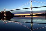
bridge's north approach, and was followed by a new bridge over the Capilano River to address congestion issues. The toll instituted by the Guinness family...
24 KB (2,311 words) - 16:48, 26 August 2024
Liard River Hot Springs Provincial Park is a provincial park in British Columbia, Canada. It is home to the second largest natural hot springs in Canada...
5 KB (507 words) - 02:38, 21 June 2022

E. C. Manning Provincial Park (section Major rivers)
alpine meadows filled with wildflowers, to a chain of small lakes, and broad river beds along the valley floors. A network of trails crosses the park, some...
16 KB (1,952 words) - 00:46, 16 August 2024

Mountains at Kicking Horse and Rogers Passes, then followed the Fraser River for the remainder of the distance to Vancouver. This selected routing was...
21 KB (2,983 words) - 22:28, 19 May 2024

Mehatl Creek Nahatlatch Nicolum River Rolley Lake Sasquatch Silver Lake Skagit Valley Sx̱ótsaqel/Chilliwack Lake Kitimat-Stikine RD Anderson Flats Bear...
51 KB (4,160 words) - 20:40, 10 September 2024
River Keogh River Kettle River Kicking Horse River Kiskatinaw River Kispiox River Kitimat River Kitlope River Kitnayakwa River Kitsumkalum River, Kitsumkalum...
13 KB (1,123 words) - 22:09, 13 May 2024
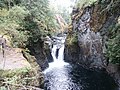
Englishman River Falls Provincial Park is a provincial park in British Columbia, Canada. It is located west of Parksville and borders the small community...
4 KB (256 words) - 23:01, 28 May 2024

smaller lakes. The park is also the origin of the Pitt River, a tributary of the Fraser River. Garibaldi Lake is retained by a lava dam known as The Barrier...
28 KB (2,917 words) - 18:04, 25 March 2024

Mehatl Creek Nahatlatch Nicolum River Rolley Lake Sasquatch Silver Lake Skagit Valley Sx̱ótsaqel/Chilliwack Lake Kitimat-Stikine RD Anderson Flats Bear...
32 KB (3,336 words) - 20:54, 25 July 2024

chose Kitimat instead, thereby flooding northern Tweedsmuir Park instead of Wells Gray. In 1959, a comprehensive development of the Murtle River was proposed...
37 KB (4,577 words) - 05:29, 1 September 2024

Mehatl Creek Nahatlatch Nicolum River Rolley Lake Sasquatch Silver Lake Skagit Valley Sx̱ótsaqel/Chilliwack Lake Kitimat-Stikine RD Anderson Flats Bear...
12 KB (1,074 words) - 13:16, 21 August 2024

900 ft). The Kicking Horse River, a Canadian Heritage River, originates in the Wapta and Waputik icefields in the park. This river has created a natural bridge...
12 KB (1,083 words) - 11:09, 18 May 2024