
Kollbach is a river of Bavaria, Germany. It flows into the Vilskanal, an artificial branch of the Vils, near Roßbach. List of rivers of Bavaria Complete...
1 KB (47 words) - 14:32, 20 April 2021
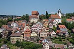
Portions of the Federally protected Egenhäuser Kapf at Bömbachtal [de], Köllbach valley [de], and Schmalzmisse [de] nature reserves are located in Altensteig's...
4 KB (436 words) - 15:25, 20 August 2024
and the following villages: Angerbach, Dirnaich, Engersdorf, Hölsbrunn, Kollbach, Malling, Obertrennbach, Panzing, Radlkofen, Reicheneibach und Seemannshausen...
7 KB (888 words) - 03:37, 2 September 2024
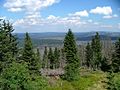
Grafling Saddle (Graflinger Paßsenke), which follows the valleys of the Kollbach and Teisnach rivers from Gotteszell in the north to Grafling in the south...
31 KB (3,303 words) - 00:24, 30 June 2024

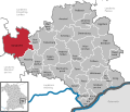
Odelzhausen, Erdweg, Markt Indersdorf, Weichs, Petershausen and Hohenkammer. Kollbach Röhrersbach (left) Tegernbach (left) Rettenbach (left) Schweinbach (right)...
2 KB (145 words) - 03:24, 29 December 2023

Kammerberg is surrounded by the neighboring villages of Gramling, Giebing, Kollbach, Weißling, Lauterbach, Bachenhausen and Viehbach. The B13 runs about one...
5 KB (628 words) - 09:45, 4 August 2024

low of 465 meters (1,526 ft) NN. A portion of the federally protected Köllbach valley [de] nature reserve is located in Simmersfeld's municipal area....
5 KB (538 words) - 06:27, 15 August 2020

8 km2 catchment, which joins the Nagold before the town of Altensteig Köllbach, a left-hand tributary, 10.0 km long with a 29.9 km2 catchment, which joins...
11 KB (1,242 words) - 22:46, 19 June 2024
of Haunersdorf it climbed up to the second ridge between the Vils and Kollbach valleys at a height of 445 metres. Running alongside the district highway...
7 KB (848 words) - 23:02, 31 August 2024
Kleinlaudenbach Klingenbach Klosterbach Klosterbeurener Bach Kohlbach Kollbach Königsseer Ache Konstanzer Ach Köschinger Bach Koser, alternative name...
20 KB (1,453 words) - 15:55, 30 March 2022

440 ft) NN. Portions of the Federally protected Falchenwiesen [de] and Köllbach valley [de] nature reserves are located in Neuweiler's municipal area....
5 KB (432 words) - 11:23, 13 June 2024