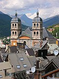
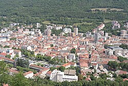
La Fare-en-Champsaur (French pronunciation: [la faʁɑ̃ ʃɑ̃psɔʁ]; Occitan: La Fara de Champsaur, [la ˈfaɾɔ ˈde ʃampˈsaw]) is a commune in the department...
6 KB (659 words) - 02:31, 28 December 2024
La Fare may refer to: La Fare-en-Champsaur, a commune in the Hautes-Alpes department in southeastern France La Fare-les-Oliviers, a commune in the Bouches-du-Rhône...
585 bytes (114 words) - 17:27, 26 January 2017
La Motte-en-Champsaur is a commune in the Hautes-Alpes department in southeastern France. Communes of the Hautes-Alpes department "Répertoire national...
2 KB (71 words) - 20:08, 30 May 2024
La Chapelle-en-Valgaudémar La Fare-en-Champsaur Forest-Saint-Julien Le Glaizil Laye La Motte-en-Champsaur Le Noyer Orcières Poligny Saint-Bonnet-en-Champsaur...
3 KB (193 words) - 10:18, 17 March 2021
Saint-Bonnet-en-Champsaur (Occitan: Sant Bonet; named for Saint Bonitus, before 1988: Saint-Bonnet) is a commune in the Hautes-Alpes department in southeastern...
8 KB (501 words) - 14:35, 4 November 2024
Saint-Julien-en-Champsaur (Vivaro-Alpine: Sant Julian de Champsaur) is a commune in the Hautes-Alpes department in southeastern France. Street photographer...
2 KB (169 words) - 03:26, 1 August 2023
to the village of St Christophe en Oisans from which alternative transport must be arranged in order to return to La Grave or to join the Deux Alpes lift...
6 KB (744 words) - 13:10, 3 January 2025
Jerusalem Itinerary, which makes the Alpes Cottiae commence at Rama (near modern La Roche-de-Rame) between Embrun and Briançon. In the 1040s it came into the...
16 KB (1,465 words) - 14:48, 5 March 2025
Briançonnais Communauté de communes Buëch Dévoluy Communauté de communes Champsaur-Valgaudemar Communauté de communes du Guillestrois et du Queyras Communauté...
8 KB (95 words) - 11:33, 17 January 2025
Studies. 19 December 2024. Population en historique depuis 1968, INSEE Official Web site (in French) L'Argentiere-la-Bessee - Description in French and pictures...
3 KB (184 words) - 19:58, 6 April 2025
June 2022. "Le sillon subalpin entre le Champsaur et la vallée de la Durance" [Subalpine trench between Champsaur and the Durance Valley] (in French). Retrieved...
86 KB (8,729 words) - 04:04, 15 February 2025
quality of life. The Association organises various events, like Serres à la lumière du passé, with the participation of artistic craftworkers (luthiers...
4 KB (430 words) - 10:47, 21 August 2024
La Roche-des-Arnauds (French pronunciation: [la ʁɔʃ dez‿aʁno]; Occitan: La Ròca deis Arnauds) is a commune in the Hautes-Alpes department in southeastern...
2 KB (81 words) - 04:20, 4 November 2024
Eygliers La Fare-en-Champsaur La Faurie Forest-Saint-Julien Fouillouse Freissinières La Freissinouse Furmeyer Gappref Garde-Colombe Le Glaizil La Grave Guillestre...
10 KB (838 words) - 15:37, 24 April 2025
officiel de la République française n° 30, 5 February 1987, p. 1330. "La Salle les Alpes - Villeneuve", Serre Chevalier Vallée Briançon. Population en historique...
3 KB (198 words) - 11:03, 25 September 2024
La Chapelle-en-Valgaudémar (Occitan: La Capèla) is a commune in the Hautes-Alpes department in southeastern France. La Chapelle-en-Valgaudémar has a humid...
5 KB (198 words) - 03:07, 2 March 2025
Statistics and Economic Studies. 19 December 2024. Population en historique depuis 1968, INSEE Wikimedia Commons has media related to La Haute-Beaume. v t e...
2 KB (84 words) - 14:27, 4 November 2024
communes d'aujourd'hui: Commune data sheet Embrun, EHESS (in French). Population en historique depuis 1968, INSEE "Normales et records pour Embrun (05)". Meteociel...
12 KB (868 words) - 13:23, 17 January 2025
La Rochette (French pronunciation: [la ʁɔʃɛt] ; Occitan: La Rocheta) is a commune in the Hautes-Alpes department in southeastern France. It is located...
2 KB (86 words) - 06:14, 4 November 2024
La Roche-de-Rame (French pronunciation: [la ʁɔʃ də ʁam]; Occitan: La Ròcha de Rama) is a commune in the Hautes-Alpes department in southeastern France...
2 KB (82 words) - 07:55, 4 November 2024
Étoile-Saint-Cyrice (05051) La Fare-en-Champsaur (05054) La Faurie (05055) Forest-Saint-Julien (05056) Fouillouse (05057) La Freissinouse (05059) Furmeyer...
9 KB (580 words) - 11:34, 17 January 2025
Statistics and Economic Studies. 19 December 2024. Population en historique depuis 1968, INSEE Wikimedia Commons has media related to La Bâtie-Vieille. v t e...
2 KB (115 words) - 23:42, 3 November 2024
Statistics and Economic Studies. 19 December 2024. Population en historique depuis 1968, INSEE Wikimedia Commons has media related to La Saulce. v t e...
2 KB (80 words) - 01:03, 4 November 2024
Commune data sheet La Bâtie-Neuve, EHESS (in French). Population en historique depuis 1968, INSEE Wikimedia Commons has media related to La Bâtie-Neuve. v...
2 KB (118 words) - 20:56, 3 November 2024
more than 70 km (43.4 mi) of cross-country skiing terrain. In the Monts de la Lune ski area, which is the connection between Montgenèvre and Claviere-Cesana...
13 KB (1,469 words) - 10:47, 8 February 2025
Saint-Jacques-en-Valgodemard (Vivaro-Alpine: Sant Jaume en Gaudemar) is a commune in the Hautes-Alpes department in southeastern France. Communes of the...
2 KB (77 words) - 03:26, 1 August 2023
Institute of Statistics and Economic Studies. 19 December 2024. Population en historique depuis 1968, INSEE Wikimedia Commons has media related to Éourres...
2 KB (76 words) - 15:50, 15 October 2024
Statistics and Economic Studies. 19 December 2024. Population en historique depuis 1968, INSEE Wikimedia Commons has media related to La Freissinouse. v t e...
2 KB (77 words) - 22:13, 24 August 2024
La Piarre (French pronunciation: [la pjaʁ]; Occitan: La Piara) is a commune in the Hautes-Alpes department in southeastern France. Communes of the Hautes-Alpes...
2 KB (74 words) - 23:10, 3 November 2024
La Beaume (French pronunciation: [la bom]; Occitan: La Bauma) is a commune in the Hautes-Alpes department in southeastern France. Communes of the Hautes-Alpes...
2 KB (74 words) - 11:33, 21 October 2024


