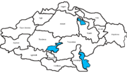
The Lankaran Lowland (Azerbaijani: Lənkəran ovalığı) is a narrow strip of lowland in southern Azerbaijan by the Caspian Sea. It is the southward extension...
3 KB (356 words) - 16:52, 10 November 2024
Lankaran (Azerbaijani: Lənkəran, (listen), Talysh: Lánkon) is a city in Azerbaijan, on the coast of the Caspian Sea, near the southern border with Iran...
25 KB (1,838 words) - 02:43, 4 January 2025
Lankaran-Astara Economic Region (Azerbaijani: Lənkəran-Astara iqtisadi rayonu) is one of the 14 economic regions of Azerbaijan. It borders Iran to the...
12 KB (1,505 words) - 13:47, 7 November 2024
Lankaran District (Azerbaijani: Lənkəran rayonu) is one of the 66 districts of Azerbaijan. It is located in the south-east of the country, in the Lankaran-Astara...
18 KB (1,873 words) - 04:24, 2 December 2024
Talysh Mountains (category Lankaran District)
Gilan Province. The Talysh Mountains extend southeastward from the Lankaran Lowland in southeastern Azerbaijan to the lower part of the Sefid Rud (White...
3 KB (286 words) - 22:39, 4 December 2024
located between the Talysh Mountains and the agricultural plain of the Lankaran Lowland. Lerik district was established in August 1930. It was called "Zuvand...
11 KB (1,029 words) - 17:36, 16 December 2024
Hirkan National Park (category Lankaran District)
broadleaved lowland and montane forests (subtropical and temperate rainforests) that completely cover the Talysh Mountains and partially cover the Lankaran Lowland...
9 KB (980 words) - 06:00, 23 November 2024
Caucasus mountain range, the Colchis Lowlands, the Kura-Aras Lowlands, Qaradagh, the Talysh Mountains, the Lankaran Lowland, Javakheti and the eastern portion...
26 KB (2,256 words) - 19:02, 20 November 2024
Greater Caucasus Lesser Caucasus South Caucasus Shirvan Kur-Araz Lowland Lankaran Lowland Alborz Absheron Peninsula Kartli Anatolia Taurus Mountains Aeolis...
141 KB (13,483 words) - 00:06, 8 December 2024
1904 for a skull and mounted skins of tigers that were killed in the Lankaran Lowland in the 1860s. Felis tigris lecoqi and Felis tigris trabata were proposed...
42 KB (4,740 words) - 19:50, 2 December 2024
Caspian Tiger. In southeast Azerbaijan, this ecoregion includes the Lankaran Lowland and the Talysh Mountains, the latter being evenly divided with Iran...
55 KB (6,069 words) - 23:45, 27 December 2024
Caucasus and Talysh Mountains and run along the Samur–Devechi and Lankaran lowlands. Yanar Dag, translated as "burning mountain", is a natural gas fire...
251 KB (22,387 words) - 08:16, 3 January 2025
Caucasus Mountains, 15% in the Talysh Mountains-Lankaran Lowland region, 2% in the Kur-Araz Lowland, and 0.5% in the Nakhchivan Autonomous Republic....
15 KB (1,696 words) - 22:12, 15 November 2024
Old-growth extent WWF ecoregion Old-growth forest type Azerbaijan Lankaran lowland and Talysh mountains Caspian Hyrcanian mixed forest temperate broadleaf...
87 KB (1,743 words) - 05:46, 16 September 2024
Hyrcanian forests (category Lankaran District)
steppe. In southeastern Azerbaijan the ecoregion spans through the Lankaran Lowland and the Talysh Mountains. The ecoregion's climate is humid subtropical...
18 KB (1,738 words) - 14:12, 14 December 2024
of internationally important wetlands. Hirkan National Park, on the Lankaran Lowland and in the Talysh Mountains, is 99% forested and strictly protected...
31 KB (3,154 words) - 07:43, 23 September 2024
داغلارى; Persian: کوههای تالش, Kuhhâye Tâleš) lies southeastward from the Lankaran Lowland in southeastern Azerbaijan to the lower part of the Sefid Rud in northwestern...
4 KB (300 words) - 10:16, 8 November 2024
Vilash River, at the foot of the Talish Mountains, in the Lankaran lowland. The Lankaran lowland is located between the Talish Mountains and the Caspian...
5 KB (630 words) - 17:37, 16 December 2024
tiger used to invade Apsheron Peninsula from the Talysh Mountains and Lankaran Lowland, before disappearing in the 20th century. The Caucasian leopard, lynx...
5 KB (442 words) - 17:17, 6 November 2024
the southeast of the country, in the Lankaran-Astara Economic Region. The district borders the districts of Lankaran and Lerik, as well as the Ardabil and...
17 KB (2,048 words) - 10:54, 6 December 2024
Region. The district borders the districts of Jalilabad, Bilasuvar, Salyan, Lankaran, and Masally. Its capital and largest city is Neftchala. As of 2020, the...
11 KB (705 words) - 04:28, 2 December 2024
Göyşaban (category Lankaran District geography stubs)
Goyshaban village is located in the Lankaran lowland, on the shores of the Caspian Sea. Before the opening of the Baku-Lankaran Silk Road, the main highway passed...
2 KB (202 words) - 07:37, 17 January 2021
"robber". The distribution of Hyrcanolestes velitaris includes: Iran Lankaran Lowland, Azerbaijan Talysh Mountains Lesser Caucasus Greater Caucasus The type...
4 KB (178 words) - 20:13, 27 August 2024
Orography of Azerbaijan (section Kur-Araz lowland)
alluvial marine plain Shirvan is situated. The Kur-Araz lowland joins to the Lankaran lowland by the Mughan and Salyan plains in the south. Several elevations...
12 KB (1,556 words) - 17:21, 24 September 2024
to have encompassed the greater part of the Mughan Plain and the Lankaran Lowlands. Paytakaran had a dry climate and is described in Ashkharatsʻoytsʻ...
11 KB (1,206 words) - 23:48, 19 November 2024
observed in Julfa and Ordubad. The maximum annual precipitation falls in Lankaran (1,600 to 1,800 mm or 63 to 71 in) and the minimum in the Absheron Peninsula...
27 KB (1,930 words) - 08:50, 3 July 2024
sq. centimeter. It is 125-134 kcal per sq. cm in the Kura-Araz and Lankaran lowlands. The highest figure is in Nakhchivan (145-160 kcal per sq. cm). Sumgait-located...
7 KB (947 words) - 14:11, 30 December 2024
Mingachevir Qaraçuxur Shirvan Nakhchivan City Bakıxanov Shaki Yevlakh Khankedi Lankaran The country's highest peak, Bazardüzü, rises to 4,485 m in this range at...
15 KB (1,469 words) - 02:35, 16 September 2024
(Balakan, Zagatala, Gakh, Sheki and Khachmaz regions) and the Talysh (Astara, Lankaran, Masalli regions). Outside Azerbaijan - Eastern Transcaucasia, Iran. In...
4 KB (490 words) - 06:36, 10 May 2024
coastline (Gilan province and the western side of Babolsar County in Iran, and Lankaran-Astara Economic Region in Azerbaijan), where over half of the over-lake...
12 KB (1,368 words) - 23:46, 9 December 2024


