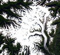
The Lillooet Icecap, also called the Lillooet Icefield or the Lillooet Crown, is a large icefield in the Pacific Ranges of the Coast Mountains in southwestern...
3 KB (437 words) - 10:18, 10 April 2023
The Lillooet Icecap an icefield in the Coast Mountains, about 200k north of Vancouver and at the head of the Lillooet and Bridge Rivers The Lillooet Glacier...
2 KB (344 words) - 23:34, 12 December 2023

River, resulted in the disappearance of Smith's party. Glaciers in the Lillooet Icecap are named for him and his brother, who had also been in the group....
3 KB (321 words) - 17:57, 12 October 2023

Mountains Krieger Mountains Lardeau Range Level Mountain Range Lillooet Icecap Lillooet Ranges Long Range Mountains, Newfoundland MacDonald Range, British...
51 KB (4,774 words) - 22:11, 11 July 2024

List of glaciers in Canada (section Lillooet Ranges)
Homathko Icefield Lillooet Icecap Lord Glacier Tchaikazan Glacier Stanley Smith Glacier Frank Smith Glacier Bridge Glacier Lillooet Glacier Necwtinoaz...
6 KB (486 words) - 13:14, 19 March 2024
Bridge River Cones (redirect from Lillooet Cones)
(25 mi) west of the town of Gold Bridge. The cones are in the lee of the Lillooet Icecap and sit astride a group of passes between the Bridge River, which flows...
5 KB (507 words) - 18:37, 29 February 2024
district include the Pemberton Icecap and the Lillooet Icecap. Municipalities within the land district are Pemberton, Lillooet, 100 Mile House and Clinton...
5 KB (711 words) - 08:10, 11 June 2024

Juneau Icefield (redirect from Juneau Icecap)
Retreat of glaciers since 1850 Ha-Iltzuk Icefield Homathko Icefield Lillooet Icecap Juneau Icefield showing Devils Paw and Nelles Peak Spirit Range, over...
5 KB (553 words) - 05:40, 2 June 2024

The Lillooet River is a major river of the southern Coast Mountains of British Columbia. It begins at Silt Lake, on the southern edge of the Lillooet Crown...
6 KB (472 words) - 18:54, 3 November 2023

Icefield Stikine Icecap Ha-Iltzuk Icefield (Silverthrone Glacier) Monarch Icefield Waddington Icefield Homathko Icefield Lillooet Icecap (Lillooet Crown) Pemberton...
17 KB (1,775 words) - 14:24, 15 June 2024

(Silverthrone Glacier) Waddington Range Homathko Icefield Lillooet Icecap (Lillooet Crown) Pemberton Icecap Mount Waddington Monarch Mountain Mount Tiedemann...
10 KB (1,046 words) - 22:11, 9 April 2023

four of the five major coastal icecaps in the southern Coast Mountains. These are the largest temperate-latitude icecaps in the world and fuel a number...
28 KB (2,065 words) - 15:58, 11 April 2024
of the Coast Mountains, flowing west from the western edge of the Lillooet Icecap to join the Southgate River east of the Homathko Icefield. Bishop River...
2 KB (268 words) - 04:36, 2 November 2023

Pemberton Icefield (redirect from Pemberton Icecap)
The Pemberton Icefield or Pemberton Icecap, is the southernmost of the series of very large icefields studding the Pacific Ranges of the southern Coast...
3 KB (416 words) - 20:48, 25 March 2024
lies west of the Lillooet Icecap and is connected to it by the Ring Glacier, which sits astride Ring Pass, the divide between the Lillooet and Bishop Rivers...
1 KB (111 words) - 22:16, 3 January 2024

the other Coast Mountains icefields, by lack of any major ones. The Lillooet Icecap and the Compton Névé, both similar in size to the Homathko Icefield...
3 KB (380 words) - 02:42, 16 May 2022
of the central Pacific Ranges, which begins on the west side of the Lillooet Icecap. Its lower valley adjacent to the inlet's shores is called Pigeon Valley...
10 KB (1,342 words) - 23:13, 26 September 2023

Monmouth Mountain (category Lillooet Land District)
highest summit of the Chilcotin Ranges. It stands just north of the Lillooet Icecap between the heads of Chilko Lake and the Taseko Lakes. West of Chilko...
3 KB (182 words) - 02:57, 9 January 2024
Southgate River, from the Bishop's source at the western side of the Lillooet Icecap to midway along its course above its confluence with the Southgate...
3 KB (161 words) - 17:55, 28 May 2024

the Compton Neve to the west and the Lillooet Icecap to the east and forms the divide with the uppermost Lillooet River. Other major tributaries include...
6 KB (491 words) - 01:41, 20 December 2022
mountains Polar cap capping the poles Snowcap Creek, a tributary of the Lillooet River, British Columbia, Canada; see List of tributaries of the Fraser...
2 KB (274 words) - 05:04, 15 November 2019

Columbia Gordon Light Lighthouse Park Lillooet Lillooet Country Lillooet Icecap Lillooet Land District Lillooet River Lillooet Tribal Council Lil'wat First Nation...
19 KB (2,066 words) - 20:09, 14 July 2023

Icecap Peak is a 2,435-metre (7,989-foot) glaciated summit in British Columbia, Canada. Icecap Peak is located in the Coast Mountains, 36 kilometres (22 mi)...
4 KB (339 words) - 14:14, 28 June 2024
pronunciation for the term Heiltsuk. Heiltsuk List of glaciers Pacific Ranges Lillooet Icecap Homathko Icefield Bivouac.com - Canadian Mountain Encyclopedia 51°25′N...
2 KB (225 words) - 00:11, 14 February 2020
divide with the Lillooet River at Ring Pass, which is at the southeastern edge of the Lillooet Icefield and just north of the Pemberton Icecap. It is also...
3 KB (323 words) - 14:18, 3 July 2023

Powder Mountain Icefield (redirect from Powder Mountain Icecap)
The Powder Mountain Icefield, also called the Powder Mountain Icecap and the Cayley Icefield, is a glacial field in the Pacific Ranges of southwestern...
6 KB (808 words) - 08:04, 26 April 2024
Rutherford Creek (category Lillooet Land District)
the private Rutherford Creek Power Ltd. in cooperation with the Squamish-Lillooet Regional District, the BC Whitewater Kayaking Association and the Pemberton...
3 KB (394 words) - 06:08, 24 January 2024
the Alaskan city of the same name and Atlin Lake in B.C.; and the Stikine Icecap, which lies between the lower Stikine River and the Whiting River. Some...
6 KB (516 words) - 00:41, 16 January 2021

west-southwest of Whistler and 1.52 kilometres (0.94 mi) west-northwest of Icecap Peak, which is the nearest neighbor. Precipitation runoff and glacial meltwater...
4 KB (320 words) - 14:14, 28 June 2024

factors below −10 °F. This climate supports the Baird Glacier and the Stikine Icecap surrounding the peak. Southeast Alaska Geography of Alaska Donald J. Orth...
7 KB (559 words) - 09:43, 5 July 2024