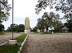
Macanga is a district situated in the north part of Tete Province in the central region of Mozambique. Its administrative center is the town of Furancungo...
6 KB (349 words) - 17:39, 28 March 2024
population of the district is 326,575 inhabitants. District profile (PDF) "Distrito de Cuamba" (in Portuguese). Instituto de Estudos Sociais e Económicos....
1 KB (73 words) - 21:20, 7 November 2024
de Maputo Distrito Urbano de KaMpfumo (former Distrito Urbano Nº1) Cidade de Maputo Distrito Urbano de Nlhamankulu/Chamanculo (former Distrito Urbano Nº...
30 KB (39 words) - 19:46, 8 February 2024
Chicualacuala District (Portuguese: Distrito de Chicualacuala) is a district of Gaza Province in south-western Mozambique. It has a population of 41,638...
8 KB (528 words) - 16:07, 24 March 2021
(postos), Nacala-a-Velha (pop. 80,155), and Covo (pop. 26,387). "Perfil do Distrito de Nacala Província de Nampula". Ministério da Administração Estatal, República...
1 KB (158 words) - 13:53, 5 February 2023
province, and borders with Zambia in the north, Malawi in the northeast, Macanga District in the east, Chiuta District in the south, and with Marávia District...
6 KB (334 words) - 16:03, 14 April 2021
center of the province, and borders with Chifunde District in the north, Macanga District in the northeast, Tsangano District in the east, Moatize District...
6 KB (340 words) - 22:58, 9 January 2021
consists of two secondary roads, ER428 and ER429, in a bad state. "Perfil do Distrito do Machanga" (PDF) (in Portuguese). Ministry of State Administration. 2005...
6 KB (322 words) - 10:33, 28 April 2021
stretches of national roads EN2, connecting Maputo and Eswatini. "Perfil do Distrito de Namaacha" (PDF) (in Portuguese). Ministry of State Administration. 2005...
6 KB (329 words) - 14:12, 16 March 2021
District of Malawi in the east, Tsangano District in the south, and with Macanga District in the west. The area of the district is 3,277 square kilometres...
7 KB (536 words) - 12:50, 27 March 2021
of the roads in Homoine District is 300 kilometres (190 mi). "Perfil do Distrito de Homoine" (PDF) (in Portuguese). Ministry of State Administration. 2005...
6 KB (387 words) - 21:34, 9 January 2021
the district from south to north. There is also an airfield. "Perfil do Distrito do Chibabava" (PDF) (in Portuguese). Ministry of State Administration....
6 KB (337 words) - 08:52, 18 December 2022
road network in the district 374 kilometres (232 mi) long. "Perfil do Distrito do Maringué" (PDF) (in Portuguese). Ministry of State Administration. 2005...
6 KB (369 words) - 14:20, 1 February 2021
roads, mainly connecting Chibuto with the rest of the district. "Perfil do Distrito do Chibuto" (PDF) (in Portuguese). Ministry of State Administration. 2005...
6 KB (365 words) - 17:21, 28 March 2024
Zimbabwe. The railway from Beira to Zimbabwe crosses the district. "Perfil do Distrito do Nhamatanda" (PDF) (in Portuguese). Ministry of State Administration...
6 KB (369 words) - 18:56, 25 January 2021
running from Maputo along the coast to the north of Mozambique. "Perfil do Distrito da Manhiça" (PDF) (in Portuguese). Ministry of State Administration. 2005...
6 KB (403 words) - 17:25, 18 October 2022
connecting Chimoio and Mossuriz. EN216 passes Sussundenga. "Perfil do Distrito de Sussundenga" (PDF) (in Portuguese). Ministry of State Administration...
6 KB (356 words) - 20:58, 14 March 2021
kilometres (146 mi) long. Most of the roads are in a bad state. "Perfil do Distrito de Mossurize" (PDF) (in Portuguese). Ministry of State Administration....
6 KB (312 words) - 16:35, 9 October 2023
national road EN1, crossing the eastern part of the district. "Perfil do Distrito de Jangamo" (PDF) (in Portuguese). Ministry of State Administration. 2005...
6 KB (369 words) - 14:27, 22 August 2023
network in the district which is 576 kilometres (358 mi) long. "Perfil do Distrito de Cahora Bassa" (PDF) (in Portuguese). Ministry of State Administration...
6 KB (367 words) - 03:10, 23 February 2023
(310 mi) of secondary roads become impassable in the rainy season. "Perfil do Distrito de Mabote" (PDF) (in Portuguese). Ministry of State Administration. 2005...
6 KB (385 words) - 23:26, 9 January 2021
potable water from boreholes (hand pumps / solar pumps): ??. "Perfil do Distrito de Xai-Xai" (PDF) (in Portuguese). Ministry of State Administration. 2005...
6 KB (436 words) - 09:46, 9 March 2024
1978, and a new bridge was only completed at the end of 2007. "Perfil do Distrito de Guijá" (PDF) (in Portuguese). Ministry of State Administration. 2005...
6 KB (384 words) - 00:16, 7 April 2021
a bad state. There is passenger navigation on the Zambezi. "Perfil do Distrito do Caia" (PDF) (in Portuguese). Ministry of State Administration. 2005...
6 KB (378 words) - 22:52, 9 January 2021
length of the roads in the district is 233 kilometres (145 mi). "Perfil do Distrito de Zavala" (PDF) (in Portuguese). Ministry of State Administration. 2005...
6 KB (363 words) - 17:35, 28 March 2024
It is used by lodges which charter flights from Vilankulo. "Perfil do Distrito de Inhassoro" (PDF) (in Portuguese). Ministry of State Administration....
7 KB (431 words) - 14:40, 17 January 2021
Limpopo Railroad (Southern System) runs through the district. "Perfil do Distrito de Mabalane" (PDF) (in Portuguese). Ministry of State Administration. 2005...
6 KB (439 words) - 17:26, 28 March 2024
national road EN1, running from Maputo north along the coast. "Perfil do Distrito de Marracuene" (PDF) (in Portuguese). Ministry of State Administration...
6 KB (339 words) - 17:16, 20 August 2021
Bazaruto Island Airport located on the Bazaruto Archipelago. "Perfil do Distrito de Vilankulo" (PDF) (in Portuguese). Ministry of State Administration....
6 KB (363 words) - 16:50, 23 May 2021
Inhambane, as well as 274 kilometres (170 mi) of secondary roads. "Perfil do Distrito de Manjacaze" (PDF) (in Portuguese). Ministry of State Administration....
6 KB (380 words) - 14:44, 1 June 2024


