
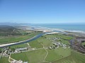
The Maruia River is located in the northwestern South Island of New Zealand. It is a major tributary of the Buller River, flowing for 80 km before joining...
3 KB (283 words) - 22:08, 14 July 2024

Reefton is 63 km west by road. The Maruia River flows past to the west. According to the 2013 New Zealand census, Maruia and its surrounds have a population...
3 KB (233 words) - 22:02, 14 July 2024

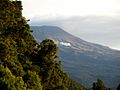
Maruia Springs is a settlement in the West Coast Region of New Zealand's South Island. It is located on the south bank of the Maruia River on State Highway...
4 KB (258 words) - 22:02, 14 July 2024

Alfred River is a river in New Zealand's Tasman region. It runs west-southwest from its source in the Spenser Mountains to its junction with the Maruia River...
1 KB (111 words) - 01:41, 13 April 2024

of the Maruia River to the northwest in the West Coast Region and the Lewis River to the southeast in north Canterbury. The small spa of Maruia Springs...
6 KB (439 words) - 21:26, 22 July 2024
The Shenandoah River is a river in New Zealand's West Coast Region. It flows northwest to reach the Maruia River 25 kilometres southeast of Inangahua...
1 KB (68 words) - 22:09, 14 July 2024
Woolley River is a river of the West Coast Region of New Zealand's South Island. It initially flows east before turning north to reach the Maruia River close...
3 KB (59 words) - 22:11, 14 July 2024

Water in New Zealand (section Rivers and streams)
836 m depending on what is considered to be the source. The Maruia Falls on the Maruia River are a relatively new waterfall formed as a result of the 1929...
12 KB (1,246 words) - 00:14, 20 October 2023
Rahu flows initially southeast before turning north to flow into the Maruia River 5 kilometres (3.1 mi) north of Springs Junction. State Highway 7 follows...
1 KB (128 words) - 22:09, 14 July 2024
Warwick River is a river of the Tasman Region of New Zealand's South Island. It flows southwest to reach the Maruia River 10 kilometres north of Maruia. State...
1 KB (86 words) - 02:50, 13 April 2024
Warwick River five kilometres from the latter's outflow into the Maruia River. List of rivers of New Zealand "Place name detail: Rappahannock River, New...
1 KB (82 words) - 02:39, 13 April 2024
Maramataha River Mararoa River Marchburn River Marokopa River Maropea River Martyr River Maruia River Mason River Mata River Matahaka River Mataikona River Matakana...
31 KB (2,843 words) - 05:08, 4 May 2024

metres (2,360 ft). Cannibal Gorge is formed by the right branch of the Maruia River, and the track follows it to Cannibal Gorge Hut and continues to Ada...
7 KB (477 words) - 20:32, 22 July 2024

Nearby rivers include the Gowan River, Mangles River, Matiri River, Glenroy River, Matakitaki River, Maruia River, and the Buller. These rivers vary from...
20 KB (1,791 words) - 23:57, 11 August 2024

(in order from Lake Rotoiti) the Gowan River, the Matakitaki River, the Maruia River, and the Inangahua River. Other smaller tributaries include the Hinemoatū...
53 KB (4,916 words) - 06:13, 4 October 2024

the South Island. It is 71 km long and runs south to north down the Maruia river valley from SH 7 at Springs Junction, 15 km west of the main divide at...
3 KB (219 words) - 20:01, 25 August 2024
Spring) Hanmer Springs Hurunui River Maruia Springs, Maruia River Otehake River Wanganui River Welcome Flat, Copland River Geothermal areas in New Zealand...
4 KB (322 words) - 16:38, 21 August 2024

of 34 kilograms (75 lb), trekked to the Buller River and walked its banks as far as the Maruia River. As they believed they were only 32 kilometres (20 mi)...
36 KB (4,845 words) - 08:02, 29 July 2024

detected in the Waimakariri River. In May 2010, didymo was detected in the Riuwaka River, the Pearse River and the Maruia River in the Nelson-Tasman region...
7 KB (702 words) - 11:11, 20 August 2024

highway enters the small spa town of Maruia Springs, before continuing northwest along the valley of the Maruia River to Springs Junction, where it meets...
5 KB (409 words) - 19:58, 25 August 2024

where he discovered a new route from the headwaters of Mangles to the Maruia River (via the headwaters of the Matakitaki and its large tributary the Glenroy)...
25 KB (3,160 words) - 06:50, 30 July 2024

exploring the area. They gained the Buller River on 18 February and walked its banks as far as the Maruia River. Here, believing themselves to be only 20...
29 KB (3,861 words) - 19:46, 22 August 2024
engineer in charge of the survey party also considered a route up the Maruia River valley, which would have joined the Stillwater – Westport line between...
12 KB (1,741 words) - 13:40, 10 September 2024
they discovered a pass from the Upper Maruia to a new river, which was later named the Lewis. Because the Maruia Plain was easier to access from Nelson...
12 KB (1,335 words) - 20:16, 30 May 2022

National Park (1,017.53 km2) and Kahurangi National Park (4,520 km2). The Maruia Falls, 8 kilometres (5.0 mi) southwest of Murchison, were created by the...
18 KB (1,439 words) - 06:11, 4 October 2024
of Lewis Pass. From there, it stayed at some distance south from the Maruia River, then went for a long distance in a straight line towards the coast to...
8 KB (658 words) - 21:59, 14 July 2024
Grey River is a river in New Zealand. It is an upper tributary of the Grey River, flowing from Lake Christabel, close to the township of Maruia Springs...
1 KB (88 words) - 22:05, 14 July 2024
Māpua* Maraetai* Mārahau Marco Maromaku Marsden Bay* Martinborough* Marton* Maruia Masterton* Matakana Matakohe Matamata* Matapu Matarangi Matarau Matatā Mataura*...
15 KB (942 words) - 19:15, 12 August 2024
Karamea (section Karamea River)
2022. Retrieved 21 July 2022 – via Papers Past. "Westpost-Nelson route via Maruia". Nelson Evening Mail. 19 December 1929. Archived from the original on 23...
50 KB (5,266 words) - 06:11, 4 October 2024

cutting new tracks and building huts. An environmental lobby group, the Maruia Society, advocated for the establishment of a new national park in the area...
85 KB (8,146 words) - 22:38, 15 August 2024