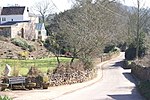
The Mendip Way is an 80-kilometre (50 mi) long-distance footpath across the Mendip Hills from Weston-super-Mare to Frome. It is divided into two sections...
11 KB (1,221 words) - 19:02, 4 September 2021

The Mendip Hills (commonly called the Mendips) is a range of limestone hills to the south of Bristol and Bath in Somerset, England. Running from Weston-super-Mare...
68 KB (6,696 words) - 04:06, 23 August 2024
Somerset, England Mendip Way, a footpath across the Mendip Hills Mendip TV Mast, a transmitter in the Mendips area Forest of Mendip, an ancient forest...
964 bytes (167 words) - 14:32, 3 April 2023
Shepton Mallet (category Towns in Mendip District)
It had an estimated population of 10,810 in 2019. Mendip District Council was based there. The Mendip Hills lie to the north and the River Sheppey runs...
101 KB (10,734 words) - 10:51, 16 August 2024

Chewton Mendip is a village and civil parish in Somerset, England. It is situated 4 miles (6 km) north of Wells, 16 miles (26 km) south of Bath and Bristol...
21 KB (2,715 words) - 10:36, 11 August 2024
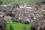
Wells, Somerset (category Towns in Mendip District)
city and civil parish in Somerset, located on the southern edge of the Mendip Hills, 21 miles (34 km) south-east of Weston-super-Mare, 22 mi (35 km) south-west...
82 KB (7,871 words) - 23:08, 25 August 2024

The caves of the Mendip Hills are formed by the particular geology of the Mendip Hills: large areas of limestone worn away by water makes it a national...
16 KB (1,100 words) - 22:27, 23 August 2024
Cheddar, Somerset (category Mendip Hills)
English county of Somerset. It is situated on the southern edge of the Mendip Hills, 9 miles (14 km) north-west of Wells, 11 miles (18 km) south-east...
63 KB (6,009 words) - 14:07, 29 August 2024

Wookey Hole Caves (category Caves of the Mendip Hills)
tourist attraction in the village of Wookey Hole on the southern edge of the Mendip Hills near Wells in Somerset, England. The River Axe flows through the cave...
55 KB (6,575 words) - 04:18, 16 August 2024
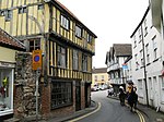
Axbridge (category Mendip Hills)
town in Somerset, England, on the River Axe, near the southern edge of the Mendip Hills. Its population according to the 2011 census was 2,057. Axanbrycg...
17 KB (1,832 words) - 17:30, 11 August 2024

Cheddar Gorge (category Mendip Hills)
Cheddar Gorge Cheddar Gorge is a limestone gorge in the Mendip Hills, near the village of Cheddar, Somerset, England. The gorge is the site of the Cheddar...
33 KB (3,168 words) - 13:35, 28 July 2024

parish is crossed by the national Monarch's Way long distance footpath, as well as the more local Mendip Way footpath, and National Cycle Route 3. Burcott...
10 KB (1,115 words) - 11:44, 11 August 2024

Leigh-on-Mendip or Leigh upon Mendip (on Ordnance Survey maps) is a small village on the Mendip Hills in Somerset, England. It lies roughly equidistant...
9 KB (825 words) - 11:14, 11 August 2024
Wookey Hole (category Mendip Hills)
one mile north-west of the city of Wells, and lies on the border of the Mendip Hills Area of Outstanding Natural Beauty (AONB). One possible origin for...
5 KB (466 words) - 17:11, 11 August 2024

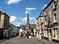
Frome (category Towns in Mendip District)
parish in Somerset, England, on uneven high ground at the eastern end of the Mendip Hills and on the River Frome, 13 miles (21 km) south of Bath. The population...
146 KB (15,251 words) - 11:38, 28 August 2024
1939, she finally married him. They bought a semi-detached house called Mendips, named after the range of hills, at 251 Menlove Avenue, Liverpool. Lennon...
17 KB (1,908 words) - 14:26, 29 May 2024

Canal Cheddar Valley line East Somerset Railway Transport Mendip Rail Mendip Way Monarch's Way National Cycle Route 24 A37 road A39 road A368 road A371...
2 KB (208 words) - 06:41, 25 July 2024

Statue of Romulus and Remus, Beechbarrow (category Grade II listed buildings in Mendip District)
ran along the main Bristol to Wells road, now the A39 road, close to the Mendip transmitting station on Pen Hill. A stray bomb, dropped during the Bristol...
37 KB (3,116 words) - 01:13, 31 August 2024

Westbury-sub-Mendip is a village and civil parish in Somerset, England. The village is on the southern slopes of the Mendip Hills, 4 miles (6.4 km) from...
9 KB (937 words) - 12:10, 11 August 2024

The Mendip transmitting station is a broadcasting and telecommunications facility on the summit of Pen Hill, part of the Mendip Hills range in Somerset...
19 KB (1,405 words) - 00:58, 22 August 2024
Black Down, Somerset (category Mendip Hills)
Black Down is the highest hill in the Mendip Hills, Somerset, in south-western England. Black Down lies just a few miles eastward of the Bristol Channel...
10 KB (1,088 words) - 00:43, 12 April 2024
Swildon's Hole (category Caves of the Mendip Hills)
Somerset. At 9,144 metres (30,000 ft) in length, it is the longest cave on the Mendip Hills. It has been found to be connected to Priddy Green Sink and forms...
8 KB (847 words) - 11:51, 23 August 2023
more in length and mainly off-road." They usually follow existing rights of way, often over private land, joined together and sometimes waymarked to make...
96 KB (2,055 words) - 11:32, 20 August 2024

Cranmore Tower (category Grade II listed buildings in Mendip District)
280 metres (919 ft) above sea level, and is the highest point on the Mendip Way. The tower was built in 1862-1864, by Thomas Henry Wyatt for John Moore...
3 KB (315 words) - 19:53, 16 August 2024

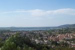
Chew Valley Lake (category Mendip Hills)
for the city of Bristol and surrounding area, taking its supply from the Mendip Hills. Some of the lake water is used to maintain the flow in the River...
31 KB (3,305 words) - 15:05, 29 May 2024

The Mendip Hills, (Mendips) in northern Somerset, are the most southerly Carboniferous Limestone uplands in Britain. The Mendips comprise three major anticlinal...
4 KB (273 words) - 18:13, 3 February 2023

Gough's Cave (category Caves of the Mendip Hills)
Gough's Cave (/ɡɒf/ GOF) is located in Cheddar Gorge on the Mendip Hills, in Cheddar, Somerset, England. The cave is 115 m (377 ft) deep and is 3.405 km...
17 KB (1,804 words) - 23:56, 6 September 2023

River Chew (category Mendip Hills)
Mendip. Strode Brook and Winford Brook are the main tributaries, both joining the Chew from the left. The river flows northwest from Chewton Mendip through...
9 KB (690 words) - 18:43, 8 May 2024

Compton Bishop (category Mendip Hills)
Compton Bishop is a small village and civil parish, at the western end of the Mendip Hills in the English county of Somerset. It is located close to the historic...
9 KB (979 words) - 14:27, 28 August 2024

Crook Peak to Shute Shelve Hill (category Mendip Hills)
biological Site of Special Scientific Interest near the western end of the Mendip Hills, Somerset. The line of hills runs for approximately 5 kilometres (3...
15 KB (1,525 words) - 23:46, 26 November 2021