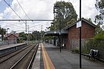
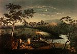
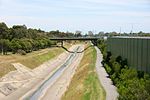
144°58′53″E / 37.759756°S 144.981482°E / -37.759756; 144.981482 The Merri Creek is a waterway in southern parts of Victoria, Australia, which flows through...
15 KB (1,664 words) - 07:36, 9 November 2024
/ -37.76839; 144.98405 The Merri Creek Trail is a shared use path for cyclists and pedestrians that follows the Merri Creek through the northern suburbs...
5 KB (421 words) - 19:06, 25 September 2024
have any official borders, it is generally considered to extend from Merri Creek in the west to the boundary of Fairfield in the east. Before European...
13 KB (1,666 words) - 12:22, 19 August 2024
to the Merri Creek, and is connected to Westgarth by a narrow, 80-metre-long footbridge for pedestrians and cyclists, crossing the Merri Creek as part...
9 KB (522 words) - 03:40, 15 October 2024
Coburg North, Victoria (category Suburbs of the City of Merri-bek)
features in North Coburg include: The Coburg Olympic Pool Edgars Creek Merlynston Creek Merri Creek Village Coburg Drive-In Coburg Lake Cash Reserve Richards...
10 KB (886 words) - 09:10, 8 October 2024
consists of sections of other trails, such as the Merri Creek Trail, Main Yarra Trail, Moonee Ponds Creek Trail and Inner Circle Rail Trail. A popular starting...
7 KB (591 words) - 02:37, 16 September 2024
Coburg, Victoria (category Suburbs of the City of Merri-bek)
are Gaffney Street and Murray Road in the north, Elizabeth Street and Merri Creek in the east, Moreland Road in the South and Melville Road, Devon Avenue...
28 KB (2,535 words) - 08:52, 8 October 2024
Fawkner, Victoria (category Suburbs of the City of Merri-bek)
census. The major portion within the City of Merri-bek is bounded by Merri Creek on the east, Sydney Road and the Upfield railway line on the west, the...
14 KB (1,390 words) - 01:34, 28 July 2024
Trail uses the same path up to Dights Falls, where it continues up the Merri Creek Trail as part of its loop around the city. The first section to be built...
15 KB (1,677 words) - 07:17, 6 October 2024
Brunswick East, Victoria (category Suburbs of the City of Merri-bek)
Bordered generally by Lygon Street and Holmes Street in the west; the Merri Creek in the east adjoining Northcote; Park Street, Nicholson Street and Glenlyon...
24 KB (2,382 words) - 23:35, 1 March 2024
005 at the 2021 census. Thornbury is bordered by the Merri Creek to the west, and the Darebin Creek to the east. The heart of Thornbury is known as Thornbury...
13 KB (1,233 words) - 15:09, 8 November 2024
Isabel; Christiansen, Peter (2001). People of the Merri Merri. The Wurundjeri in Colonial Days. Merri Creek Management Committee. ISBN 978-0-9577728-0-9....
28 KB (2,567 words) - 18:55, 22 October 2024
Road Trail will take you to Jacana station and further still to the Merri Creek Trail at Fawkner. Heading west along the Western Ring Road Trail will...
6 KB (690 words) - 02:53, 16 September 2024
Street while Clifton Hill's border with Collingwood is Alexandra Parade. Merri Creek defines the eastern and northern borders of Clifton Hill with Northcote...
19 KB (2,110 words) - 11:43, 12 September 2024
Mount Ridley Road, the Hume Freeway and Donnybrook Road in the north, Merri Creek in the east, Patullos Lane, the Craigieburn/North East railway line and...
23 KB (2,224 words) - 11:56, 10 August 2024
reaches Merri Parade, where it narrows to a four-lane, single-carriageway road, sharing surface tram tracks. Running south-west, it crosses Merri Creek through...
11 KB (895 words) - 02:38, 19 August 2023
to Clifton Hill in the south, with Merri Creek providing the vast majority of the western boundary and Darebin Creek, parts of Macleod and Plenty Road...
11 KB (564 words) - 14:12, 26 April 2024
microbreweries are also located in Abbotsford. Dights Falls, where the Merri Creek and Yarra River converge, is a short walk from the Collingwood Children's...
17 KB (1,924 words) - 08:51, 17 November 2024
and Westgarth was duplicated, including the construction of a second Merri Creek river crossing at Clifton Hill. The rarely used centre running line at...
61 KB (3,943 words) - 18:49, 14 November 2024
Road and Glenlyon Road between the Yarra River, Maribyrnong River and Merri Creek. The division also contains the main Parkville Campus of the University...
13 KB (703 words) - 14:07, 26 April 2024
is the Bald Hill volcano that last erupted over a million years ago. Merri Creek runs through Kalkallo, to the east of the area. The Kalkallo Grasslands...
13 KB (1,231 words) - 11:17, 14 November 2024
been Merri Creek, in what is currently Northcote. Alternative locations have been suggested on the Plenty River near Greensborough, Edgars Creek, and...
17 KB (1,919 words) - 03:56, 4 March 2024
Ellender and Peter Christiansen, People of the Merri Merri. The Wurundjeri in Colonial Days, Merri Creek Management Committee, 2001 ISBN 0-9577728-0-7...
59 KB (6,796 words) - 19:22, 4 November 2024
River in Melbourne, Victoria, just downstream of the junction with the Merri Creek. At this point the river narrows and is constricted between 800,000-year-old...
8 KB (910 words) - 10:01, 30 August 2024
Toby (2004). A Bend in the Yarra: A History of the Merri Creek Protectorate Station and Merri Creek Aboriginal School 1841–1851. Aboriginal Studies Press...
31 KB (3,441 words) - 21:23, 2 August 2024
of 2,100 at the 2021 census. Bounded to the west by Merri Creek and in the east by Darebin Creek, the suburb consists of a railway station, general store...
7 KB (452 words) - 07:39, 25 January 2024
Ellender and Peter Christiansen, People of the Merri Merri. The Wurundjeri in Colonial Days, Merri Creek Management Committee, 2001 ISBN 0-9577728-0-7...
205 KB (17,169 words) - 04:31, 14 November 2024
145.00709 Edgar's Creek is a minor creek tributary of the Merri Creek in the northern suburbs of Melbourne, Australia. Edgars Creek has a catchment on...
3 KB (297 words) - 07:43, 19 June 2023
Maribyrnong River, Moonee Ponds Creek, Merri Creek, Darebin Creek, Plenty River, Mullum Mullum Creek and Olinda Creek. The river hosts many geographical...
63 KB (6,443 words) - 18:30, 30 September 2024
Distribution Centre. It is bounded by Patullos Lane in the north, the Merri Creek in the east, Somerton Road/Cooper Street in the south and the Craigieburn/North...
5 KB (338 words) - 12:25, 12 June 2023


