Minamitorishima (南鳥島, lit. "Southern Bird Island") sometimes Minami-Tori-shima or Minami-Torishima, also known as Marcus Island, is an isolated Japanese...
28 KB (2,615 words) - 06:29, 1 October 2024
Islands, Volcano Islands, and three remote islands (Nishinoshima, Minamitorishima and Okinotorishima). In 1940, five municipalities were created in the...
9 KB (645 words) - 03:29, 11 October 2024
observed in whole country of Japan, even in its easternmost territory, Minamitorishima (153°59′E) and its westernmost territory, Yonaguni (122°56′E). It makes...
13 KB (1,459 words) - 21:00, 31 October 2024
Minami Torishima Airport (redirect from Minamitorishima Air Field)
24°17′23″N 153°58′45″E / 24.28972°N 153.97917°E / 24.28972; 153.97917 (Minamitorishima Air Field) Map Location Runways Source: Japanese AIP at AIS Japan...
3 KB (246 words) - 16:49, 12 March 2021
(Aw, bordering on BSh) Mengla, Yunnan, China (Aw, bordering on Cwa) Minamitorishima, Japan (Aw) Mumbai, Maharashtra, India (Aw, bordering on Am) Naples...
132 KB (11,930 words) - 02:07, 4 November 2024
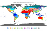
climatic conditions. Tokyo's easternmost territory, the island of Minamitorishima in Ogasawara village, is in the tropical savanna climate zone (Köppen...
213 KB (17,881 words) - 18:28, 1 November 2024
the Volcano Islands and three remote islands of Nishinoshima, Minamitorishima, and Okinotorishima. These islands are parts of Japan's Nanpō Islands...
62 KB (6,557 words) - 16:29, 25 October 2024
Jima Minami Iwo Jima (South Iwo Jima) Nishinoshima Okinotorishima Minamitorishima The Geospatial Information Authority of Japan, a government agency...
3 KB (384 words) - 12:01, 27 April 2024
eastern Asian country, because east of Japan is the vast Pacific Ocean. Minamitorishima is Japan's easternmost island. Thus Japan is the land where the sun...
75 KB (7,798 words) - 18:56, 5 November 2024
Protected Area for the Prince Edward Islands". Retrieved 2023-07-13. "Minamitorishima _ AcademiaLab". academia-lab.com. Archived from the original on 2023-07-13...
20 KB (1,262 words) - 00:05, 18 September 2024
Air Station Squadron Atsugi Air Station Iwoto Auxiliary Air Facility Minamitorishima Fleet Air Wing 5 (Naha Air Base) Air Patrol Squadron 5 (P-3C Orion)...
16 KB (1,134 words) - 05:56, 28 October 2024
Islands (since 1891) Ogasawara Islands Iwo Islands Okinotorishima Minamitorishima Minor outlying islands around them These territories were called gaichi...
7 KB (688 words) - 15:38, 21 October 2024
observed in whole country of Japan, even in its easternmost territory, Minamitorishima (153°59′E) and its westernmost territory, Yonaguni (122°56′E)....
7 KB (575 words) - 21:03, 5 November 2024
Izu island chains, and the uninhabited islands of Okinotorishima and Minamitorishima) are not considered part of Western Tokyo. Under the Ritsuryō system...
10 KB (389 words) - 08:38, 24 February 2024
Csb) Managua, Nicaragua (Aw) Maputo, Mozambique (Aw, bordering BSh) Minamitorishima, Japan (Aw) Mombasa, Kenya (As) Mumbai, India (Aw, bordering Am) Naples...
13 KB (1,117 words) - 10:58, 31 October 2024
Islands (comprising the Volcano Islands and three remote islands: Minamitorishima, Nishinoshima, and Okinotorishima) and the Izu Islands are sometimes...
85 KB (8,460 words) - 01:40, 5 November 2024
$88 million (2006 USD) Areas affected Johnston Atoll, Wake Island, Minamitorishima, Kamchatka Peninsula, Alaska IBTrACS Part of the 2006 Pacific hurricane...
36 KB (3,527 words) - 12:51, 7 September 2024
reaching hurricane status. Another tropical depression had formed near Minamitorishima in Japan. On August 8, it received the name Lan. On August 13, Seven-E...
167 KB (15,459 words) - 23:03, 5 November 2024
35861 (Makurazaki Airfield) Minami Torishima Airport Ogasawara Tokyo Minamitorishima RJAM MUS Other 24°17′23″N 153°58′45″E / 24.28972°N 153.97917°E /...
44 KB (578 words) - 09:08, 4 August 2024
Islands, the Volcano Islands, and the isolated islets Okinotorishima, Minamitorishima, and Nishinoshima. Together with the Ōshima, Miyake, and Hachijō Subprefectures...
10 KB (919 words) - 12:19, 14 September 2024
153°58′52.2″E / 24.2857750°N 153.981167°E / 24.2857750; 153.981167 (Minamitorishima - 8930-X) used a 411.48 metre tall tower until 1985 demolished Nantucket...
82 KB (8,918 words) - 14:13, 1 November 2024
echoed between Osaka and Kyoto. 91 I-67 Shipwreck 29 Aug 1940 Off Minamitorishima The submarine sank in a diving accident. No survivors. 88 Submarine...
26 KB (383 words) - 18:03, 26 August 2024
3 W 00:11 28 Feb 0.08 0.3 Guam Guam 13.4 N 144.7 E 03:07 0.16 0.5 Minamitorishima Japan 24.1N 153.5E 03:43 0.1 0.3 DART Saipan 19.1 N 155.8 E 03:55...
140 KB (11,576 words) - 19:29, 29 October 2024
Nishinoshima (Rosario Island), Okinotorishima (Parece Vela), and Minamitorishima (Marcus Island), are today part of Ogasawara municipality. It is a...
19 KB (1,795 words) - 18:54, 30 September 2024
Foreign Affairs in the first Okuma Cabinet and worked hard to make Minamitorishima a Japanese territory, but in the fall he resigned due to the resignation...
12 KB (1,667 words) - 06:05, 16 March 2024
submarine that sank in a diving accident off the southern coast of Minamitorishima. I-70 10 December 1941 A Kaidai 6-type submarine sunk by United States...
206 KB (513 words) - 14:51, 5 November 2024
typhoon season. The system developed into a tropical storm south of Minamitorishima on October 8 and strengthened into a typhoon on October 10. Songda...
20 KB (1,944 words) - 00:39, 15 August 2024
of legs and can reach about 26 mm in length. The species occurs on Minamitorishima, also known as Marcus Island, a small and isolated Japanese atoll in...
2 KB (140 words) - 23:22, 18 January 2024
Range, Omura, Nagasaki Makiminato Service Area Annex, Urasoe, Okinawa Minamitorishima Communication Site, Ogasawara, Tokyo Nagahama Rifle Range, Kure, Hiroshima...
92 KB (6,397 words) - 17:20, 7 October 2024
17 July 1944 by HMS Telemachus. I-67 – Sank in diving accident off Minamitorishima on 29 August 1940. The Kaidai VIa type (海大VIa型, Navy large type VIa)...
81 KB (9,813 words) - 15:46, 3 November 2024


