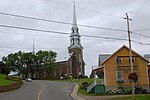
Mont-Apica is an unorganized territory in the Canadian province of Quebec, located in the regional county municipality of Lac-Saint-Jean-Est. It had a...
6 KB (281 words) - 05:30, 28 January 2023
Station Mont Apica Canadian Forces Station Mont Apica (CFS Mont Apica) was a radar station of the Pinetree Line, located in Mont-Apica, Quebec, Canada...
2 KB (163 words) - 22:47, 16 October 2024
APICA or Apica may refer to: Apica River, stream in Charlevoix Regional County Municipality, Capitale-Nationale, Quebec, Canada Mont-Apica, Quebec, unorganized...
573 bytes (102 words) - 00:04, 29 February 2024
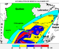
area of Quebec City. March 1971, however, saw the "Century's Snowstorm" with more than 40 cm (16 in) in Montreal to 80 cm (31 in) in Mont Apica of snow...
241 KB (23,467 words) - 00:55, 18 December 2024
Alma and its terminus in Hebertville. Lac-Pikauba Lac-Jacques-Cartier Mont-Apica Lac-Achouakan Belle-Rivière Hébertville Métabetchouan–Lac-à-la-Croix Desbiens...
3 KB (111 words) - 18:03, 14 December 2024
administrative region of Saguenay–Lac-Saint-Jean, in the province of Quebec, in Canada. The Apica River flows through a narrow, steep valley. Visitors can admire...
10 KB (1,205 words) - 21:17, 26 June 2024
south-east of the center of the village of Mont-Apica; 11.3 km (7.0 mi) south-east of the confluence of the Apica River and the Pikauba River; 49.8 km (30...
5 KB (530 words) - 01:42, 14 December 2021
(16 in) in Montreal to 80 cm (31 in) in Mont Apica of snow within 24 hours in many regions of southern Quebec. Also, the winter of 2010 was the warmest...
43 KB (5,007 words) - 20:33, 19 December 2024
Eastern Canadian blizzard of March 1971 (category Natural disasters in Quebec)
March 5, 1971. The storm was also nicknamed the "Storm of the Century" in Quebec. The event included the worst 24-hour snowfall on record in the city of...
12 KB (1,114 words) - 18:45, 21 February 2024
Jocelyne Alloucherie (category Sculptors from Quebec)
through installations. Born in Mont-Apica, Quebec, she spent many of her early years in Chicoutimi and moved to Quebec City before 1961. She studied for...
7 KB (659 words) - 19:16, 14 April 2024
to Fighter Controller duties in 1958, serving at Radar Stations in Mont Apica, Quebec and Edgar Ontario. In 1961, he was selected to join the RCAF's Golden...
7 KB (699 words) - 13:42, 25 September 2024
Jacques-Cartier Massif (category Mountains of Quebec)
220 ft)); Mont du Dôme (975 metres (3,199 ft)); Mont du Lac à Moïse (960 metres (3,150 ft)); Mount Apica (884 metres (2,900 ft)); Mountain in Liguori (790...
5 KB (459 words) - 19:51, 28 September 2024
CFB Bagotville (redirect from Aéroport Bagotville, Quebec)
fighter/interceptor aircraft; it replaced a radar station at RCAF Station Mont Apica which was closed. 433 Squadron disbanded in 2006 with its aircraft and...
24 KB (2,195 words) - 20:44, 14 November 2024
Lowther CFS Moosonee CFS Ramore CFS Sioux Lookout Quebec: CFS Chibougamau CFS Moisie CFS Mont Apica CFS Lac St. Denis CFS Senneterre RCAF Station Parent...
11 KB (857 words) - 15:58, 22 October 2024
274) is a town in Saguenay–Lac-Saint-Jean, in the Canadian province of Quebec. The present town of Alma was formed in 1962 from the merging of four villages:...
14 KB (679 words) - 07:40, 16 December 2024
This is a list of rivers of Quebec. Quebec has about: One million lakes, of which 62279 have a toponymic designation (a name), plus 218 artificial lakes;...
104 KB (9,399 words) - 19:26, 22 October 2024
Lac-Saint-Jean-Est Regional County Municipality (redirect from Lac-Saint-Jean-Est County Regional Municipality, Quebec)
territories in Quebec "Banque de noms de lieux du Québec: Reference number 141098". toponymie.gouv.qc.ca (in French). Commission de toponymie du Québec. "Ministère...
9 KB (247 words) - 15:36, 29 November 2024
CFB Valcartier (redirect from Valcartier, Quebec)
Saint-Gabriel-de-Valcartier, 8 nautical miles (15 km; 9.2 mi) north northwest of Quebec City, Quebec, Canada. The 2nd Canadian Division is stationed at the base, comprising...
17 KB (1,499 words) - 04:40, 27 August 2024
Hébertville (redirect from Hebertville, Quebec)
Hébertville (French pronunciation: [ebɛʁvil]) is a municipality in Quebec, Canada. Hébertville was founded in 1849 and is named for the priest Nicolas-Tolentin...
6 KB (160 words) - 07:35, 16 December 2024
Saint-Bruno in Quebec, see Saint Bruno (disambiguation). Saint-Bruno (French pronunciation: [sɛ̃ bʁyno]) is a municipality in Quebec, located within...
5 KB (129 words) - 07:29, 9 December 2024
(territoires non organisés) in Quebec. There are no unorganized territories in the following administrative regions: Centre-du-Québec, Chaudière-Appalaches, Estrie...
16 KB (54 words) - 22:19, 19 November 2024
route 169; 14.3 km (8.9 mi) south-east of the center of the ex-hamlet of Mont-Apica; 50.4 km (31.3 mi) south-east of the confluence of the Pikauba River and...
7 KB (836 words) - 21:05, 5 October 2024
of route 169; 24.6 kilometres (15.3 mi) south-west of the ex-hamlet of Mont-Apica; 47.6 kilometres (29.6 mi) south of the confluence of the Pikauba River...
6 KB (578 words) - 10:24, 2 May 2023
municipalities in Quebec "Banque de noms de lieux du Québec: Reference number 28326". toponymie.gouv.qc.ca (in French). Commission de toponymie du Québec. Ministère...
6 KB (178 words) - 07:35, 16 December 2024
RCAF Station Chibougamau RCAF Station Moisie RCAF Station Mont Apica RCAF Station Lac St. Denis RCAF Station Parent RCAF Station Senneterre RCAF Station...
24 KB (375 words) - 18:24, 12 February 2024
Apica (altitude: 886 metres (2,907 ft)); 3.7 kilometres (2.3 mi) south of lac Suzor-Côté; 4.7 kilometres (2.9 mi) north-west of the hamlet Mont-Apica;...
9 KB (918 words) - 07:35, 17 November 2023
Lac-Moncouche is an unorganized territory in the Canadian province of Quebec, located in the regional county municipality of Lac-Saint-Jean-Est. It had...
5 KB (108 words) - 05:20, 28 January 2023
Saint-Gédéon-de-Grandmont[citation needed] ([sɛ̃ ʒedeɔ̃ də ɡʁɑ̃mɔ̃]) is a municipality in Quebec, Canada, in the regional county municipality of Lac-Saint-Jean-Est and the...
10 KB (562 words) - 15:44, 29 November 2024
Saint-Ludger-de-Milot (redirect from Saint-Ludger-de-Milot, Quebec)
Saint-Ludger-de-Milot is a municipality in Quebec, Canada. Saint-Ludger-de-Milot was founded on January 1st, 1948. Population trend: Population in 2021:...
6 KB (212 words) - 01:06, 18 November 2024
Sainte-Monique, Saguenay–Lac-Saint-Jean (redirect from Sainte-Monique, Saguenay-Lac-Saint-Jean, Quebec)
Sainte-Monique (French pronunciation: [sɛ̃t mɔnik]) is a municipality in Quebec, Canada. It is sometimes known as Sainte-Monique-de-Honfleur (for example...
6 KB (219 words) - 15:49, 29 November 2024


