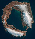
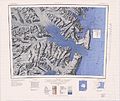
Narębski Point is a headland on the south-east coast of the Barton Peninsula, at the south-western end of King George Island, in the South Shetland Islands...
2 KB (199 words) - 22:39, 5 February 2023
Harmony Point Kroner Lake Lions Rump Mount Pond Narębski Point Pendulum Cove Port Foster Potter Peninsula Ronald Hill San Telmo Island South East Point Stonethrow...
5 KB (482 words) - 12:35, 3 October 2024
Fildes Peninsula (redirect from Halfthree Point)
which is permanently covered by ice. Its southeastern end is a point called Halfthree Point. It was charted and named by Discovery Investigations personnel...
4 KB (477 words) - 15:57, 20 January 2024
Hut Point Peninsula (77°47′S 166°51′E / 77.783°S 166.850°E / -77.783; 166.850) is a long, narrow peninsula from 2 to 3 nautical miles (3.7 to 5.6 km;...
16 KB (2,687 words) - 05:54, 8 July 2024
Harmony Point Kroner Lake Lions Rump Mount Pond Narębski Point Pendulum Cove Port Foster Potter Peninsula Ronald Hill San Telmo Island South East Point Stonethrow...
4 KB (441 words) - 22:12, 24 January 2024
Adelaide Island (redirect from Mothes Point)
1976–77. The point was named by UK-APC in 1978 for BAS builder Donald C. Mackay. The Mackay Point is a tiny peninsula (450 m at its widest point) protruding...
11 KB (1,362 words) - 19:46, 3 October 2024
the constellation of Taurus. Cape Rymill Rhino Rock Scott Uplands Flagon Point Foster Peninsula Giannini Peak Graham Spur Hall Ridge Heirtzler Ice Piedmont...
3 KB (359 words) - 12:34, 3 October 2024
Foster Group's principal outcrops are located at South Point, Cathedral Crags near Entrance Point and north of Punta de la Descubierta forming spectacular...
39 KB (4,027 words) - 13:23, 3 October 2024
Peak in the central mountains to the coast between Conception Point in the west to Foul Point in the east. Most of the land in the site is covered by glacial...
5 KB (532 words) - 01:53, 5 October 2024
Harmony Point Kroner Lake Lions Rump Mount Pond Narębski Point Pendulum Cove Port Foster Potter Peninsula Ronald Hill San Telmo Island South East Point Stonethrow...
82 KB (191 words) - 06:23, 4 October 2024
Cape Royds (redirect from Newport Point)
a hut at Cape Royds, a small promontory twenty-three miles north of Hut Point where Scott had stayed during the Discovery Expedition. The whole shore...
12 KB (1,875 words) - 13:08, 29 March 2024
Cape Evans (redirect from Tryggve Point)
around Cape Evans include North Bay, South Bay, Cape Evans Hut, Tryggve Point, Turks Head Bay, Turks Head, Inaccessible Island, Tent Island, Dellbridge...
7 KB (1,027 words) - 15:39, 14 February 2024
Biscoe Point is a rocky point forming the south-eastern side of Biscoe Bay, immediately north of Access Point on the south side of Anvers Island, in the...
2 KB (230 words) - 03:11, 29 April 2022
Harmony Point Kroner Lake Lions Rump Mount Pond Narębski Point Pendulum Cove Port Foster Potter Peninsula Ronald Hill San Telmo Island South East Point Stonethrow...
9 KB (1,027 words) - 12:53, 4 April 2024
Harmony Point Kroner Lake Lions Rump Mount Pond Narębski Point Pendulum Cove Port Foster Potter Peninsula Ronald Hill San Telmo Island South East Point Stonethrow...
6 KB (481 words) - 17:04, 29 February 2024
Cape Crozier (redirect from Wood Point (Antarctica))
169°24′E / 77.517°S 169.400°E / -77.517; 169.400) is the most easterly point of Ross Island in Antarctica. It was discovered in 1841 during James Clark...
13 KB (1,571 words) - 04:48, 29 May 2024
Bay is an irregular bay, 8 km (5 mi) wide at its entrance between Demay Point and Martins Head, indenting the southern coast of King George Island for...
5 KB (430 words) - 22:16, 20 January 2024
Harmony Point Kroner Lake Lions Rump Mount Pond Narębski Point Pendulum Cove Port Foster Potter Peninsula Ronald Hill San Telmo Island South East Point Stonethrow...
5 KB (408 words) - 09:36, 7 February 2023
Collins Point is a small but prominent headland 1.4 km (0.87 mi) west-south-west of Fildes Point, on the south side of Port Foster, Deception Island, in...
2 KB (247 words) - 20:36, 12 January 2023
Suffield Point is the south-west entrance point of Norma Cove, Fildes Peninsula, on King George Island in the South Shetland Islands of Antarctica. It...
2 KB (182 words) - 18:24, 12 April 2023
(0.62 mi) crater or caldera sits at the top of the volcano. The highest point of the volcano lies east-northeast of the caldera and reaches 2,733 metres...
84 KB (9,332 words) - 06:42, 20 April 2024
port have remained for other features in the same archipelago — Williams Point and Yankee Harbor. The centre of Deception Island is a caldera, formed by...
3 KB (334 words) - 08:00, 19 August 2024
Harmony Point Kroner Lake Lions Rump Mount Pond Narębski Point Pendulum Cove Port Foster Potter Peninsula Ronald Hill San Telmo Island South East Point Stonethrow...
12 KB (1,284 words) - 03:14, 29 October 2024
Edmonson Point is a rounded, largely ice-free point lying below Mount Melbourne along the west side of Wood Bay, Victoria Land, Antarctica. It was mapped...
3 KB (266 words) - 15:53, 7 November 2021
Ablation Point, also known as Punta Ablación, is the eastern extremity of a hook-shaped rock ridge marking the north side of the entrance to Ablation...
5 KB (680 words) - 11:23, 29 September 2024
Cape Geology is a low, gravel-covered point marking the western limit of Botany Bay, in the southern part of Granite Harbour, Victoria Land, Antarctica...
3 KB (374 words) - 18:37, 9 April 2023
Harmony Point Kroner Lake Lions Rump Mount Pond Narębski Point Pendulum Cove Port Foster Potter Peninsula Ronald Hill San Telmo Island South East Point Stonethrow...
7 KB (718 words) - 19:03, 25 October 2024
Harmony Point Kroner Lake Lions Rump Mount Pond Narębski Point Pendulum Cove Port Foster Potter Peninsula Ronald Hill San Telmo Island South East Point Stonethrow...
5 KB (640 words) - 15:15, 19 July 2024
Harmony Point is a point which lies close west of Harmony Cove and forms both the south side of the entrance to Malak Sechko Cove and the western extremity...
3 KB (282 words) - 01:29, 19 January 2024
Lewis Bay (redirect from Wyandot Point)
168°04′00″E / 77.3833333°S 168.0666667°E / -77.3833333; 168.0666667. A rock point 3 nautical miles (5.6 km; 3.5 mi) west-southwest of Cape Tennyson on the...
5 KB (563 words) - 23:38, 12 July 2024


