Route 530 is a 22-kilometre (14 mi) long north-east looping secondary highway in the southeast portion of New Brunswick, Canada. The route's northern terminus...
2 KB (152 words) - 08:55, 4 February 2024
Route 530, or Highway 530, may refer to: Alberta Highway 530 Manitoba Provincial Road 530 New Brunswick Route 530 A530 road I-530 US 530 (former) AR 530...
1 KB (97 words) - 23:11, 4 April 2024

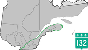
of Route 535 and Route 134. Beausoleil is also located around the mouth of the Shediac River in Shediac Bay at the crossroads of Route 530 and Route 134...
6 KB (187 words) - 21:47, 10 December 2024

Route 11 is a provincial highway in northeastern New Brunswick, Canada. The 440-kilometre (270 mi) road runs from Moncton to the Quebec border, near Campbellton...
25 KB (1,036 words) - 10:15, 27 September 2023
Cove, and to the south by Bourgeois, Caissie Cape comprises New Brunswick Route 530, Chemin De La Cote (Shore Road in English) and the roads that run...
4 KB (454 words) - 22:09, 3 November 2024
of 530. With a land area of 62.08 km2 (23.97 sq mi), it had a population density of 8.9/km2 (23.0/sq mi) in 2021. Miscou Island is accessed by Route 113...
2 KB (196 words) - 03:00, 6 January 2025
Grand-Digue is located around the intersection of Grand Digue Rd and Route 530. Following the expulsion of the Acadians in 1755, many Acadians found...
5 KB (316 words) - 08:19, 5 January 2025

1. CR 527 follows Route 18 into New Brunswick and exits the concurrency with Route 18 and forms one for the entire length of Route 172 through Rutgers...
27 KB (1,697 words) - 06:11, 14 January 2025
Route 535 is a 30-kilometre (19 mi) long north-east looping secondary highway in the south east portion of New Brunswick, Canada. The route's northern...
2 KB (180 words) - 08:54, 4 February 2024

Brunswick is located south of New Brunswick. It was named for its earlier-established neighbor, South Brunswick. Brunswick comes from New Brunswick,...
76 KB (7,867 words) - 21:16, 9 January 2025

List of former New Brunswick provincial highways. Marked by green signs, these highways are the primary routes in the system, and Routes 1, 2, 7, 8, 11...
49 KB (501 words) - 12:30, 15 January 2025

Shediac (redirect from Shédiac, New Brunswick)
colloquial French) is a heavily Acadian town in Westmorland County, New Brunswick. The town is home to the famous Parlee Beach and is known as the "Lobster...
15 KB (1,035 words) - 17:43, 7 January 2025

from New Brunswick to the Delaware River at Lambertville. Also included in this turnpike is what is now Route 27 to New Brunswick. A spur route, County...
11 KB (848 words) - 06:11, 14 January 2025
Cocagne (redirect from Cocagne, New Brunswick)
Cocagne Bay at the crossroads of Route 535 and Route 134. Cocagne is also located on the northern terminus of Route 530 In the 2021 Census of Population...
8 KB (558 words) - 21:35, 29 July 2024

KML/County Route 516 (New Jersey) KML is from Wikidata Wikimedia Commons has media related to County Route 516 (New Jersey). NJ State Highways: CR 515-530...
12 KB (988 words) - 06:11, 14 January 2025
Route 134 is a 261 km (162 mi)-long north–south secondary highway in eastern New Brunswick, Canada. The highway is divided into a northern and southern...
17 KB (762 words) - 21:01, 28 July 2024
Route 525 is a 10-kilometre (6.2 mi) long east–west secondary highway in the northwest portion of New Brunswick, Canada. The route's northern terminus...
2 KB (123 words) - 08:55, 4 February 2024

northwest alignment. CR 525 begins at Route 28 in Bound Brook, located 8 miles (13 km) northwest of New Brunswick in Somerset County. CR 525 begins as...
7 KB (525 words) - 06:11, 14 January 2025

intersection of Route 38 and South Pemberton Road (CR 530). A short distance after the intersection of Route 38 and South Pemberton Road (CR 530), the route becomes...
71 KB (6,064 words) - 01:11, 1 February 2025

KML/County Route 529 (New Jersey) KML is from Wikidata Wikimedia Commons has media related to County Route 529 (New Jersey). NJ State Highways: CR 515-530 CR...
8 KB (627 words) - 06:11, 14 January 2025

Garden State Parkway (redirect from Route 444 (New Jersey))
solar farm before reaching an interchange with Route 18 and Route 36, which head north towards New Brunswick and east towards Long Branch, respectively....
211 KB (18,820 words) - 07:39, 29 January 2025

County Route 522 (CR 522) is a county highway in the U.S. state of New Jersey. The highway extends 21 miles (34 km) from Route 27 in South Brunswick Township...
11 KB (865 words) - 06:11, 14 January 2025

media related to Kent County, New Brunswick. Kent County (2016 population 30,475) is located in east-central New Brunswick, Canada. The county features...
23 KB (437 words) - 14:42, 4 October 2024

KML/County Route 523 (New Jersey) KML is from Wikidata Wikimedia Commons has media related to County Route 523 (New Jersey). NJ State Highways: CR 515-530...
12 KB (839 words) - 06:11, 14 January 2025

Hope Street bus Public Transport Victoria 22 May 2015 New bus route 509 introduced to Brunswick West Archived 2016-04-10 at the Wayback Machine Public...
108 KB (714 words) - 07:07, 27 January 2025

Route 9 (US 9) is a United States Numbered Highway in the Mid-Atlantic region of the United States, running from Laurel, Delaware, to Champlain, New York...
109 KB (8,891 words) - 02:19, 26 January 2025
Autoroute 85 to Edmundston, New Brunswick. This eastern section of the highway, from Rivière-du-Loup towards Gaspé, was the former Route 6, until the early 1970s...
36 KB (575 words) - 08:01, 1 December 2024
Area codes 506 and 428 (redirect from New Brunswick area codes)
the North American Numbering Plan (NANP) for the Canadian province of New Brunswick. Area code 506 was created in 1955 in a split of numbering plan area...
11 KB (1,245 words) - 19:42, 2 January 2025

pre-1927 routes that had been taken over or built, but were not assigned new numbers, kept their old numbers. These four routes - Route 4N, Route 5N, Route 8N...
20 KB (589 words) - 23:22, 15 January 2025

Route 520 (New Jersey). KML file (edit • help) Template:Attached KML/County Route 520 (New Jersey) KML is from Wikidata NJ State Highways: CR 515-530...
11 KB (962 words) - 17:59, 26 January 2025