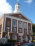
New Hampshire Route 85 (abbreviated NH Route 85 or NH 85) is a 4.854-mile-long (7.812 km) north–south state highway in Rockingham County in southeastern...
5 KB (309 words) - 02:48, 25 March 2023
New Hampshire Route 101 (NH 101) is a state-maintained highway in southern New Hampshire extending from Keene to Hampton Beach. It is the major east–west...
37 KB (3,355 words) - 06:55, 18 November 2024
located along New Hampshire Route 85 and the Squamscott River. It is a quaint village of handsome old houses. Newfields is one of New Hampshire's wealthiest...
14 KB (1,114 words) - 15:16, 26 August 2024
Route 85 (former) New Hampshire Route 85 New Jersey Route 85 (former) County Route 85 (Bergen County, New Jersey) County Route 85 (Ocean County, New Jersey)...
7 KB (522 words) - 19:24, 31 August 2024
New Hampshire Route 28 is an 85.413-mile-long (137.459 km) north–south state highway in eastern New Hampshire. It connects the town of Ossipee in east-central...
19 KB (1,359 words) - 12:22, 8 July 2024
Newfields at its junction with New Hampshire Route 85. The western terminus is in Epping at its junction with New Hampshire Route 125. NH 87 begins in the west...
4 KB (210 words) - 02:49, 25 March 2023
town by area in New England. U.S. Route 3 is the only major highway in the town, although the northern terminus of New Hampshire Route 145 also lies within...
20 KB (1,510 words) - 12:26, 17 September 2024
New Hampshire Route 10 is a 122.25-mile-long (196.74 km) north–south state highway in western New Hampshire, United States. Its southern terminus is in...
18 KB (1,257 words) - 02:38, 25 March 2023
New Hampshire Route 108 is a 42.430-mile-long (68.284 km) north–south state highway in Rockingham and Strafford counties in southeastern New Hampshire...
15 KB (873 words) - 13:02, 14 October 2024
along New Hampshire Route 27 just west of New Hampshire Route 125. Epping was originally part of Exeter, one of the four original New Hampshire townships...
23 KB (1,744 words) - 18:13, 4 November 2024
New Hampshire Route 11 is a 108.223-mile-long (174.168 km) east–west state highway in New Hampshire, running completely across the central part of the...
24 KB (1,613 words) - 16:42, 20 February 2024
and lies along the Contoocook River at the junction of U.S. Route 202 and New Hampshire Route 101. Peterborough is 38 miles (61 km) west of Manchester and...
28 KB (2,487 words) - 03:19, 12 October 2024
U.S. Route 4 in New Hampshire runs for 106.834 miles (171.933 km) across the central and southern part of the state, stretching from Lebanon on the Connecticut...
21 KB (1,150 words) - 01:42, 25 June 2024
census-designated place (CDP), and is located along New Hampshire Route 125 and the Salmon Falls River, just north of Route 75. Originally a part of Rochester variously...
16 KB (1,383 words) - 06:57, 5 October 2024
census-designated place (CDP), and is located at the junction of U.S. Route 3 with New Hampshire Route 26. The town also includes the villages of Kidderville, Upper...
27 KB (2,479 words) - 00:56, 5 November 2024
S. Route 3 New Hampshire Route 3A New Hampshire Route 28 New Hampshire Route 28A NH 28 Bypass, known as Londonderry Turnpike. New Hampshire Route 101...
87 KB (6,752 words) - 17:09, 7 November 2024
diagonal routes). The Massachusetts Highway Commission convinced the rest of southern New England and New York to use this system in 1915 (New Hampshire and...
158 KB (6,445 words) - 17:10, 1 February 2024
New Hampshire (/ˈhæmpʃər/ HAMP-shər) is a state in the New England region of the Northeastern United States. It borders Massachusetts to the south, Vermont...
128 KB (11,707 words) - 17:53, 15 November 2024
from 2,105 at the 2010 census. It is located at the junctions of New Hampshire routes 31, 45, and 123. Once a part of Mason called "Mason Village", Greenville...
18 KB (1,156 words) - 03:15, 12 October 2024
Dorchester is a town in Grafton County, New Hampshire, United States. The population was 339 at the 2020 census. Originally granted by Governor Benning...
10 KB (718 words) - 14:24, 3 May 2024
Goffstown village and southeast 3.5 miles (5.6 km) to New Hampshire Route 101 in Bedford. New Hampshire Route 114A follows Mast Road through the center of Pinardville...
10 KB (778 words) - 18:19, 5 March 2024
traveling through the states of Pennsylvania, New Jersey, New York, Connecticut, Massachusetts, and New Hampshire. The highway has borne the number 202 since...
57 KB (3,188 words) - 05:14, 16 August 2024
portion of Route 101 in eastern Bedford from New Hampshire Route 114 to the Manchester border is a freeway, while the remainder of the route through the...
34 KB (2,297 words) - 02:59, 12 October 2024
Lancaster is a town located along the Connecticut River in Coös County, New Hampshire, United States. The town is named after the city of Lancaster in England...
21 KB (1,632 words) - 13:43, 20 August 2024
Interstate 89 (redirect from New Hampshire Route 89)
capital of New Hampshire; Montpelier, the state capital of Vermont; and Burlington, Vermont. I-89 is one of three main Interstate highways whose route is located...
40 KB (3,141 words) - 07:52, 14 November 2024
Route 286 is a 3.7-mile-long (6.0 km) east–west state highway in Salisbury, Massachusetts and Seabrook, New Hampshire. The route was previously known as...
8 KB (542 words) - 01:05, 15 March 2023
New Hampshire Route 84 is a 4.184-mile-long (6.733 km) secondary east–west state highway in Rockingham County in southeastern New Hampshire. The western...
4 KB (219 words) - 02:48, 25 March 2023
Albany is a town in Carroll County, New Hampshire, United States. The population was 759 at the 2020 census. Most of Albany is within the southeastern...
11 KB (938 words) - 13:50, 19 August 2024
census-designated place (CDP) and is located at the junctions of New Hampshire routes 102, 111 and 3A, directly across the Merrimack River from the city...
28 KB (2,583 words) - 23:55, 11 November 2024
Everett Turnpike (redirect from Central Turnpike (New Hampshire))
routes: U.S. Route 3 from the Massachusetts border to New Hampshire Route 101A in Nashua, unnumbered from there until New Hampshire Route 101 in Bedford...
19 KB (1,680 words) - 06:58, 18 November 2024


