
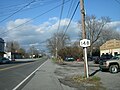
New York State Route 429 (NY 429) is a north–south state highway located entirely within Niagara County, New York, in the United States. It extends for...
17 KB (1,413 words) - 08:47, 22 August 2024
numbered 429: Japan National Route 429 Florida State Road 429 Nevada State Route 429 New York State Route 429 Oregon Route 429 Puerto Rico Highway 429 Tennessee...
890 bytes (79 words) - 23:15, 4 April 2024

New York State Route 5 (NY 5) is a state highway that extends for 370.80 miles (596.74 km) across the state of New York in the United States. It begins...
91 KB (7,590 words) - 14:12, 18 September 2024

numbered state highways in the U.S. state of New York. Signed state highways in New York, referred to as "touring routes" by the New York State Department...
167 KB (908 words) - 11:59, 30 April 2024

Niagara County, New York, United States, on the southern side of the intersection of New York State Route 429 and New York State Route 31. Originally called...
2 KB (153 words) - 21:24, 17 September 2024

New York State Route 104 (NY 104) is a 182.41-mile-long (293.56 km) east–west state highway in Upstate New York in the United States. It spans six counties...
60 KB (5,306 words) - 09:10, 21 August 2024

(917.05 km) within the U.S. state of New York. It is operated by the New York State Thruway Authority (NYSTA), a New York State public-benefit corporation...
115 KB (8,807 words) - 12:14, 15 October 2024

New York State Route 31 (NY 31) is a state highway that extends for 208.74 miles (335.93 km) across western and central New York in the United States....
69 KB (6,626 words) - 15:38, 7 October 2024

New York State Route 3 (NY 3) is a major east–west state highway in New York, in the United States, that connects central New York to the North Country...
45 KB (4,032 words) - 05:55, 21 August 2024

town line past the New York Power Authority Generating Plant to its northern terminus at Lewiston Rd. (NY 104). New York State Route 429 (Townline Road,...
23 KB (2,173 words) - 03:18, 18 July 2024

Town of Cambria is in the center of Niagara County. New York State Route 93 and New York State Route 104 pass through the town. Some of the early settlers...
12 KB (1,107 words) - 03:44, 19 May 2024

cities of the state, bypassing Syracuse and Utica by great distances to the south while the New York State Thruway and New York State Route 5 (NY 5), which...
95 KB (8,617 words) - 03:57, 10 June 2024

New York, often called New York City or NYC, is the most populous city in the United States, located at the southern tip of New York State on one of the...
367 KB (35,783 words) - 02:59, 15 October 2024

New York State Route 430 (NY 430) is a state highway located entirely within Chautauqua County, New York, in the United States. Its western terminus is...
19 KB (1,747 words) - 22:37, 14 April 2024

Route 62 (Niagara Falls Blvd.), North-South highway that crosses the town from Amherst town line to Niagara Falls city line. New York State Route 265...
18 KB (1,806 words) - 03:58, 19 May 2024

New York State Route 265 (NY 265) is a 19.75-mile (31.78 km) long state highway located in the western part of New York in the United States. NY 265 is...
16 KB (1,404 words) - 01:51, 15 June 2024

New York, United States. The population was 429 at the 2020 census. The village is in the northwestern part of the town of Hunter on New York State Route...
10 KB (886 words) - 09:53, 14 October 2024
and census-designated place (CDP) in Greene County, New York, United States. The population was 429 at the 2020 census. Leeds is located in the town of...
8 KB (630 words) - 01:09, 18 December 2023

New York State Route 384 (NY 384) is a state highway in Western New York in the United States. It is a north–south route extending from the city of Buffalo...
24 KB (2,451 words) - 19:50, 14 June 2024

second-longest highway in the state after New York State Route 17 (NY 17). Although most of the route is part of the tolled New York State Thruway, two non-tolled...
44 KB (2,803 words) - 12:14, 15 October 2024

New York State Route 428 (NY 428) was a north–south state highway located within Chautauqua County, New York, in the United States. The southern terminus...
8 KB (694 words) - 01:18, 5 August 2024

Designations in New York State (PDF). Archived from the original (PDF) on July 29, 2013. Retrieved August 5, 2015. "Route Changes in State Listed". New York Post...
98 KB (469 words) - 00:49, 4 June 2024

New York State Route 425 (NY 425) is a north–south state highway in the western portion of New York in the United States. It extends for 23.85 miles (38...
18 KB (1,949 words) - 14:36, 27 March 2024
designation. County routes in New York Highways in Niagara County, New York "County Roads Listing - Niagara County" (PDF). New York State Department of Transportation...
23 KB (299 words) - 16:30, 9 February 2024

Route 62 (US 62) is a part of the U.S. Highway System that travels from the United States–Mexico border at El Paso, Texas, to Niagara Falls, New York...
37 KB (3,444 words) - 16:55, 14 July 2024

Route 2 runs the entire length of the northern tier of Massachusetts, beginning at the New York border, where it connects with New York State Route 2...
34 KB (2,020 words) - 16:25, 24 August 2024

villages. 31 state-maintained highways enter the county, which account for a combined 267.0 miles (429.7 km) of the state highway mileage in New York. 21 of...
55 KB (5,037 words) - 13:16, 20 March 2022

at the new alignment in Tennessee. For most of its alignment, it closely parallels Virginia's southern border with North Carolina. State Route 383 (SR...
47 KB (1,992 words) - 01:35, 21 April 2024
Niagara County Community College (category Community colleges in New York (state))
Niagara Falls, New York. The current campus opened on February 5, 1973 at the corner of New York State Route 31 and New York State Route 429 in the suburban...
16 KB (1,047 words) - 15:28, 4 October 2024

Brooklyn (redirect from Brooklyn, New York, New York)
Brooklyn is a borough of New York City located at the westernmost end of Long Island in the State of New York. Formerly an independent city, the borough...
174 KB (16,267 words) - 23:23, 9 October 2024