
The Nipmuck Trail is a Blue-Blazed hiking trail system which meanders through 34.5 miles (55.5 km) of forests in northeast Connecticut. It is maintained...
10 KB (1,102 words) - 15:33, 10 June 2024

state forests. In addition to the Nipmuck Trail there are several smaller hiking trails which connect to the Natchaug Trail as well as several park and forest...
18 KB (1,738 words) - 22:30, 5 May 2024

Webster/Dudley Band of Chaubunagungamaug Nipmuck Indians, also known as the Chaubunagungamaug, Chaubunagungamaug Nipmuck, Pegan or Dudley/Webster Indians, is...
19 KB (2,230 words) - 19:49, 9 October 2024

Farmington Canal Heritage Trail, also known as the New Haven and Northampton Canal Greenway, is an 82-mile (132 km) multi-use rail trail located in Connecticut...
9 KB (990 words) - 21:16, 10 July 2024

million restoration and includes a visitors' center and museum, hiking trails, and picnic area. William Gillette's "castle", called Seventh Sister and...
15 KB (1,305 words) - 00:41, 6 October 2024

production. The forest is traversed by the hiking path known as the Nipmuck Trail; this route is the only public access allowed except for permitted hunting...
2 KB (181 words) - 17:38, 18 June 2024

Westwoods Trails is an extensive hiking trail system in Guilford, Connecticut. The trail system has approximately 39 miles (63 km) of trails with features...
5 KB (663 words) - 17:00, 28 April 2024

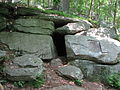
as 'No Trespassing'. There is one marked trail that goes through the Boston Hollow. This is the Nipmuck Trail. It enters the hollow from the southeast...
7 KB (1,102 words) - 07:02, 31 January 2023

Chatfield Hollow State Park (category Hiking trails in Connecticut)
mountain biking trails in the state. Among them are the Lookout Trail and the Pond Trail, which is a side trail that loops off the Deep Woods Trail. Rock climbing...
9 KB (782 words) - 05:35, 6 August 2024

The Ives Trail and Greenway is a 20-mile (32 km) hiking trail in the Housatonic Valley Region (also known as Greater Danbury). Its route connects Ridgefield...
4 KB (614 words) - 20:18, 20 May 2023
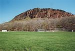
Regicides Trail is a Blue-Blazed hiking trail, about 7 miles (11 km) long, roughly following the edge of a diabase, or traprock, cliff northwest of New...
8 KB (1,016 words) - 11:20, 31 December 2023
the wolf was codified. Today, the Wolf Den is accessible from a hiking trail off of Wolf Den drive in Mashamoquet Brook State Park, a +1,000-acre (400 ha)...
5 KB (502 words) - 16:46, 26 September 2023

accessed by a trail starting at the Mansfield Historical Society and is part of the Nipmuck Trail. It meets up with several other trails at a cleared space...
4 KB (275 words) - 21:28, 15 September 2024

Sleeping Giant (Connecticut) (redirect from Sleeping Giant State Park Trails)
over 30 miles (48 km) of hiking trails traverse it including 5 miles (8 km) of the 23-mile (37 km) Quinnipiac Trail. Quinnipiac University is located...
21 KB (2,144 words) - 05:18, 2 September 2024

Breakneck Pond (category Nipmuck State Forest)
trails from Bigelow Hollow State Park and camping is permitted at three locations around the lake. It is also the northern terminus for the Nipmuck Trail...
4 KB (177 words) - 10:34, 18 April 2024

Trail Nipmuck Old Furnace Pachaug Paugussett Peoples Pequot Pine Knob Pomperaug Quinebaug Quinnipiac Ragged Mountain Regicides Risley Pond Loop Trail...
15 KB (1,996 words) - 13:39, 11 October 2024

encounters three sets of rapids. Hiking trails in neighboring Nepaug State Forest, including the Tunxis Trail, are accessible from Satan's Kingdom Road...
5 KB (285 words) - 01:48, 1 August 2024
368 acre open space in Ridgefield, Connecticut. The space has many trails, trail heads and also one of Ridgefield's highest points, at 1,021 feet (311 m)...
3 KB (375 words) - 21:13, 18 June 2024

1970s, trail reconstruction was done by the Youth Conservation Corps of America. In 2006, observation platforms were constructed along a trail next to...
5 KB (394 words) - 23:36, 18 August 2024

State Park Trail is a rail trail and linear state park located in Connecticut. The trail is divided into sections designated South (a 25-mile trail from East...
35 KB (2,902 words) - 21:54, 8 September 2024

center. The park's hiking trails grant access to the adjacent Pootatuck State Forest. Trails From the west side, the main trail starts from the north end...
9 KB (845 words) - 10:35, 3 September 2024

Case Mountain (redirect from Case Mountain Trails)
watershed land stretching from the Glastonbury border north to Case Pond. Some trails lead south across the Glastonbury border to a larger area of land owned...
8 KB (1,014 words) - 01:59, 3 June 2024

Pequot Trail is a 7.6-mile (12.2 km) Blue-Blazed Trail, a hiking trail maintained by the Connecticut Forest and Park Association. The Pequot Trail extends...
8 KB (1,270 words) - 05:21, 7 November 2022
stone formation. The Vista Point cliff, located at the end of the Orange Trail, stands 150 to 175 feet (53 m) above the Eightmile River. Other attractions...
6 KB (582 words) - 21:24, 15 September 2024
beverages are prohibited. A number of hiking trails traverse the ridge, most notably the Giant Steps Trail which ascends to the summit at a near-vertical...
6 KB (661 words) - 21:09, 18 June 2024
park includes a five-acre tidal estuary with ramp for car-top boating. A trail leads to the top of a 183-foot (56 m) hill that was used by Native Americans...
4 KB (253 words) - 02:37, 2 August 2024

Cockaponset State Forest (redirect from Cockaponset Trail)
by hemlock. Hiking trails The Connecticut Department of Energy and Environmental Protection (CT DEEP) manages a 20-mile (32 km) trail system based around...
9 KB (779 words) - 07:36, 18 December 2023
Nipmuck State Forest is a Connecticut state forest. Its 9,000 acres (3,600 ha) surround Bigelow Hollow State Park in the town of Union and include parcels...
5 KB (309 words) - 23:18, 19 September 2024
Gay City State Park (redirect from Gay City Trails)
campground. The park's trail system, which is used for hiking and cycling, includes a five-mile trail that tours the entire park. Trails also connect Gay City...
8 KB (531 words) - 01:13, 8 October 2024

Wintergreen; and the 7-mile (11 km) Regicides Trail, part of the Connecticut Forest and Park Association's Blue Trail system. The park is part of a larger area...
8 KB (795 words) - 20:05, 5 September 2024