Normalnull ("standard zero") or Normal-Null (short N. N. or NN) is an outdated official vertical datum used in Germany. Elevations using this reference...
2 KB (162 words) - 00:08, 23 July 2024

mountain in the range together with its height above sea level (taken as Normalnull (NN)) and the state in which its highest elevation is located. If the...
24 KB (142 words) - 11:46, 24 June 2024
interconnected nerve cells or a machine-learning model inspired by one Normalnull, a German height reference system preceding Normalhöhennull (NHN) nn,...
2 KB (311 words) - 15:16, 29 July 2024
the Netherlands, its height was used by Prussia in 1879 for defining Normalnull, and in 1955 by other European countries. In the 1990s, it was used as...
4 KB (552 words) - 09:12, 16 June 2024
Medizinische(r) Technische(r) Assistent(in) Medical Technician NN das Normalnull sea level NOK Nationales Olympisches Komitee National Olympic Committee...
39 KB (888 words) - 17:10, 23 August 2024

vertical reference EGM96 deviates a couple of meters from the German Normalnull and the Belgian TAW, thereby suggesting an altitude of 701 m for the Weißer...
3 KB (242 words) - 17:24, 16 April 2024

quasigeoid or mean sea level Normalhöhennull – Vertical datum used in Germany Normalnull – Outdated official vertical datum used in Germany North West Shelf Operational...
23 KB (4,104 words) - 03:03, 16 July 2024

level in the municipal area ranges from a high of 300 meters (980 ft) Normalnull (NN) to a low of 247 meters (810 ft) NN. A portion of the Federally protected...
4 KB (445 words) - 08:20, 12 June 2024

above NHN or m (NHN). The NHN was introduced because for heights above Normalnull the actual gravitational field of the Earth was not taken into account...
6 KB (572 words) - 00:08, 23 July 2024

sea level ranges from 466 meters (1,529 ft) to 836 meters (2,743 ft) Normalnull. The Greuthau [de], Hohenäcker-Imenberg [de], and Wonhalde-Spielberg [de]...
4 KB (334 words) - 07:29, 21 June 2023

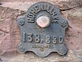
Neuendorf-Sachsenbande which has officially been measured at 3.5 metres below Normalnull. The Church of Freepsum was built in the 13th century. Organ in the Church...
2 KB (195 words) - 20:56, 17 October 2023

the tables of the German height reference system, based on height above Normalnull (~sea level) in Amsterdam, and data from the Bavarian Survey Office (Bayerischen...
37 KB (1,154 words) - 16:25, 17 July 2024

level in the municipal area ranges from a high of 566 meters (1,857 ft) Normalnull (NN) to a low of 307 meters (1,007 ft) NN. Portions of the Federally protected...
3 KB (330 words) - 13:58, 7 October 2022

level in the municipal area ranges from a low of 241 meters (791 ft) Normalnull (NN) to a high of 352 meters (1,155 ft) NN. Asperg has one borough, Asperg...
4 KB (340 words) - 15:24, 20 August 2024

France: General levelling of France Germany: Normalhöhennull, preceded by Normalnull Great Britain: Ordnance Datum Newlyn Netherlands: Amsterdam Ordnance Datum...
10 KB (1,459 words) - 03:47, 10 July 2024

Neckar with river kilometers and aimed stowage height in meters above Normalnull (NN) and difference in level (de) in meters. In contrast to other waterways...
82 KB (9,581 words) - 07:37, 20 August 2024

level in the municipal area ranges from a low of 775 meters (2,543 ft) Normalnull (NN) to a high of 928 meters (3,045 ft) NN. Bitz's municipal coat of arms...
4 KB (387 words) - 11:17, 12 June 2024
Plateau. Elevation above sea level ranges from 529 meters (1,736 ft) Normalnull (NN) on the Danube as it flows into Riedlingen to 652 meters (2,139 ft)...
4 KB (396 words) - 14:19, 20 August 2024
elevation above sea level in the municipal area, 190 meters (620 ft) Normalnull (NN), is found where the Neckar flows out of Marbach and into Benningen...
10 KB (1,169 words) - 18:35, 3 July 2023

level in the municipal area ranges from a high of 462 meters (1,516 ft) Normalnull (NN) to a low of 414 meters (1,358 ft) NN. The Federally-protected Sommerrain...
6 KB (509 words) - 11:49, 10 July 2024

level in the municipal area ranges from a high of 386 meters (1,266 ft) Normalnull (NN) to a low of 259 meters (850 ft) NN. Hemmingen has one borough (Ortsteil)...
3 KB (275 words) - 09:39, 10 October 2022
elevation in Reichenbach is the Windkapf with a height of 928 metres above Normalnull. The mountain range here consists mainly of granite. In the parish there...
2 KB (186 words) - 05:00, 30 May 2024

hills in the Solling include the following (heights given in m above Normalnull): Große Blöße (527.8 m) Großer Ahrensberg (524.9 m) Moosberg (513.0 m)...
4 KB (387 words) - 18:35, 9 April 2023

border, marks its lowest elevation above sea level at 165 meters (541 ft) Normalnull (NN). The highest elevation, 543 meters (1,781 ft) NN, is found in the...
8 KB (585 words) - 01:49, 13 May 2024
Eisfeld-Süd. The highest hills in the range are (heights in metres (m) above Normalnull (NN)): Buchberg (527.2 m), Bavaria Mirsdorfer Kuppe (525.3 m), Bavaria...
2 KB (186 words) - 21:01, 19 January 2023
level varies in the municipal area from a low of 469 meters (1,539 ft) Normalnull (NN) to a high of 700 meters (2,300 ft) NN. The Federally-protected Häselteiche [de]...
3 KB (295 words) - 20:39, 7 August 2020
alphabetically with their height given in metres (m) above sea level (Normalnull). The following table lists the highest mountains and hills in each Thuringian...
22 KB (1,702 words) - 10:34, 27 November 2023

level in the municipal area ranges from a high of 747 meters (2,451 ft) Normalnull (NN) to a low of 337 meters (1,106 ft) NN. A portion of the Federally...
4 KB (363 words) - 11:22, 13 June 2024

Reservoir lies in the valley of the Alb at about 737 metres above sea level (Normalnull). The nearest settlement is the town of St. Blasien (760 m ü. NN), whose...
3 KB (308 words) - 06:29, 13 November 2020

of the Helleberg are the following, sorted by height in metres above Normalnull (NN) Numerous forest tracks and paths run over the Helleberg, including...
4 KB (327 words) - 00:21, 18 January 2021