
Oregon Route 38 is an Oregon state highway that runs between the city of Reedsport, on the Oregon Coast, and an interchange with Interstate 5 near the...
4 KB (320 words) - 17:49, 22 June 2023

The highway is signed east–west. Oregon Route 138 begins (at its western terminus) at a junction with Oregon Route 38 in Elkton. It heads due south from...
6 KB (413 words) - 07:43, 23 June 2023

Douglas County, Oregon, United States. It is located on the lower Umpqua River, at the junction of Oregon Route 38 and Oregon Route 138, about 20 miles...
11 KB (635 words) - 14:47, 16 July 2023

needs of this growing activity. Reedsport is at the junction of Oregon Route 38 and U.S. Route 101, 3 miles (5 km) north of Winchester Bay and 54 miles (87 km)...
20 KB (1,875 words) - 20:17, 28 July 2024

a parallel of its parent route when it was extended south through Oregon in 1935. In Oregon, it replaced most of Oregon Route 11. The Washington section...
31 KB (3,198 words) - 06:12, 25 August 2024

Oregon Route 18 is a state highway that runs between the Oregon Coast, near Lincoln City, and Newberg. OR 18 traverses the Salmon River Highway No. 39...
15 KB (1,251 words) - 03:43, 15 June 2024

U.S. Route 20 (US 20) is a major west–east cross-state highway in the northern part of the U.S. state of Oregon, especially east of the Cascade Mountains...
19 KB (951 words) - 22:11, 20 August 2024

Oregon Route 99 is a state highway that runs between the southern border of Oregon, and the city of Junction City. Oregon Route 99 was formed from parts...
16 KB (532 words) - 07:42, 23 June 2023
Cove Highway No. 342 (see Oregon highways and routes) and part of the La Grande-Baker Highway No. 66. It is a combined 38.93 miles (62.65 km) long and...
3 KB (245 words) - 09:25, 23 June 2023

U.S. Route 101 (US 101), is a major north–south U.S. Highway in Oregon that runs through the state along the western Oregon coastline near the Pacific...
23 KB (1,899 words) - 19:15, 15 May 2024
Highway 38 Oregon Route 38 Pennsylvania Route 38 South Carolina Highway 38 South Dakota Highway 38 Tennessee State Route 38 Texas State Highway 38 (former)...
6 KB (461 words) - 23:18, 4 April 2024
unincorporated community in Douglas County, Oregon, United States. It is along the Umpqua River and Oregon Route 38, and is about 20 miles (32 km) from the...
4 KB (179 words) - 10:45, 24 August 2023

U.S. Route 30 (US 30) in the U.S. state of Oregon is a major east–west United States Numbered Highway that runs from its western terminus in Astoria to...
36 KB (2,200 words) - 20:14, 16 July 2024

Oregon Route 200 is an Oregon state highway running from OR 99W at Monroe to the Lane-Douglas County line near Anlauf. OR 200 is composed of most of the...
4 KB (325 words) - 01:41, 30 December 2023

The Oregon Trail was a 2,170-mile (3,490 km) east–west, large-wheeled wagon route and emigrant trail in the United States that connected the Missouri...
144 KB (19,253 words) - 07:09, 1 August 2024
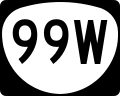
Oregon Route 99W is a state-numbered route in Oregon, United States, that runs from OR 99 and OR 99E in Junction City north to I-5 in southwestern Portland...
14 KB (1,249 words) - 22:58, 16 May 2024

Oregon Route 46, also known as Caves Highway, is an Oregon state highway that runs between the city of Cave Junction and the Oregon Caves National Monument...
3 KB (191 words) - 17:49, 22 June 2023

245 is known as the Dooley Mountain Highway No. 415 (see Oregon highways and routes). It is 38.62 miles (62.15 km) long and runs north–south, entirely...
3 KB (322 words) - 09:26, 23 June 2023
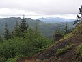
southwest portion of Oregon between the middle fork of the Coquille River in the south and the Umpqua River on the north. Oregon Route 38 is the general divide...
16 KB (1,771 words) - 12:02, 22 December 2023
Green Acres, Oregon or Greenacres, Oregon may refer to: Green Acres, Coos County, Oregon Green Acres, Douglas County, Oregon, on Oregon Route 38 This disambiguation...
183 bytes (57 words) - 07:56, 10 May 2024

Historic Columbia River Highway (redirect from Oregon Route 100)
through the Oregon Department of Transportation as the Historic Columbia River Highway No. 100 (still partially marked as U.S. Route 30; see Oregon highways...
40 KB (3,950 words) - 18:30, 10 August 2024

Oregon Route 227 was an American state highway which originally ran from the city of Canyonville, Oregon to the community of Trail. In 1985, the highway...
3 KB (207 words) - 00:59, 28 June 2024

Oregon Route 211 is a state highway which runs through part of the northeastern portion of Oregon's Willamette Valley. Its northeastern terminus is its...
4 KB (192 words) - 09:21, 23 June 2023

state of Oregon, there are two systems for categorizing roads in the state highway system: named state highways and numbered state routes. Named highways...
42 KB (235 words) - 04:49, 2 January 2024

U.S. Route 97 (US 97) in the U.S. state of Oregon is a major north–south United States highway which runs from the California border, south of Klamath...
27 KB (2,121 words) - 15:47, 1 June 2024

month. The freeway remains parallel or concurrent to Oregon Route 99 (OR 99) and its spur routes, running along former segments of US 99 that were bypassed...
87 KB (5,983 words) - 22:02, 10 August 2024
special routes of U.S. Route 30 exist. In order from west to east they are as follows. U.S. Route 30 Business (US 30 Bus.) in St. Helens, Oregon uniquely...
43 KB (4,044 words) - 22:24, 4 August 2024

Oregon Route 6 is a state highway in the U.S. state of Oregon that runs between the city of Tillamook on the Oregon Coast, to the Willamette Valley, near...
7 KB (643 words) - 03:43, 15 June 2024

(1.58 km2), all of it land. Drain is at the crossroads of Oregon Route 99 and Oregon Route 38, at a pass in the Coast Range, on the way west to the Pacific...
16 KB (1,362 words) - 07:23, 10 December 2023
(March 10, 1962). "Stadium Freeway Route Hit". The Oregon Journal. p. 10. "Town Topics: Freeway Hearing Row Seen". The Oregon Journal. March 16, 1962. p. 4...
48 KB (5,067 words) - 14:07, 20 August 2024