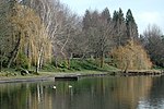
Oxbow Inlet is a tributary of Oxbow Creek in Wyoming County, Pennsylvania, in the United States. It is approximately 1.5 miles (2.4 km) long and flows...
6 KB (632 words) - 00:02, 2 April 2023
border Oxbow Inlet, a tributary of Oxbow Creek in Wyoming County, Pennsylvania Oxbow Lake (New York), in Hamilton County, New York Oxbow Lake (Virginia)...
3 KB (433 words) - 16:21, 19 October 2023
Coldwater Fishery and a Migratory Fishery. Oxbow Creek begins in Oxbow Lake, which the tributary Oxbow Inlet flows into, in Lemon Township. The creek flows...
10 KB (1,029 words) - 07:08, 12 February 2023
Resaca (channel) (category Oxbow lakes)
Resaca is the name given to a type of oxbow lake in the southern half of Cameron County, Texas. The resacas constitute former channels of the Rio Grande...
3 KB (357 words) - 14:01, 14 March 2024
islands. NY Route 8 is located along the southeast shoreline, Oxbow Road crosses the lake inlet on the northeastern end, and Old Piseco Road (County Rt. 24)...
4 KB (275 words) - 16:06, 6 April 2024
1008 over Horton Creek in Lemon Township, Wyoming County. Oxbow Inlet, next tributary of Oxbow Creek going upstream List of rivers of Pennsylvania United...
7 KB (657 words) - 07:03, 12 February 2023
Ackerly Creek Kennedy Creek (Pennsylvania)Kennedy Creek Oxbow Creek Horton Creek Oxbow Inlet Monroe Creek Field Brook East Branch Field Brook Horton Creek...
73 KB (4,253 words) - 01:40, 15 May 2024
word used for various coastal inlets and straits Fjard – Glacially formed, broad, shallow inlet Fjord – Long, narrow inlet with steep sides or cliffs, created...
28 KB (8,345 words) - 00:26, 7 May 2024
(330 ft) of mainly low passage leads to an oxbow with a larger passage arriving from Rift Entrance. A long awkward inlet passage called Masochist Passage can...
12 KB (1,667 words) - 12:46, 13 May 2024
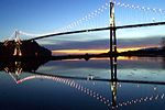
Bridge, is a suspension bridge that crosses the first narrows of Burrard Inlet and connects the City of Vancouver, British Columbia, to the North Shore...
24 KB (2,311 words) - 23:26, 11 July 2024
especially an inlet "creek". Dictionary.com. Dictionary.com, LLC. Retrieved 18 May 2019. Chiefly Atlantic States and British...a recess or inlet in the shore...
30 KB (977 words) - 01:03, 23 June 2024
Richard; Jesch, Judith; Parsons, David N (2016). Vikings and the Danelaw. Oxbow Books. ISBN 978-1-78570-455-0. Archived from the original on 14 April 2023...
76 KB (10,011 words) - 00:55, 20 July 2024
the proper name and postal address of which was Granville, B.I. ("Burrard Inlet"). The official boundary does not include most of Hastings Street except...
14 KB (1,319 words) - 20:22, 29 June 2024
America, "slough" may refer to a side-channel from or feeding a river, or an inlet or natural channel only sporadically filled with water. An example of this...
12 KB (1,337 words) - 09:19, 30 April 2024
feet (60–400 m) deep. Rift lakes Landslide and ice dam lakes Salt lakes Oxbow lakes Crater lakes Glacial lakes Subglacial lakes Ancient lake formation...
11 KB (974 words) - 17:20, 27 May 2024
Ontario Center Ontario Oriskany Oriskany Falls Orwell Oswegatchie Oswego Oxbow Palmyra Parish Parishville Penn Yan Pennellville Peterboro Phelps Philadelphia...
18 KB (1,049 words) - 21:30, 15 January 2024
Cuckmere Haven (category Oxbow lakes)
Seaford. The river is an example of a meandering river, and contains several oxbow lakes. It is a popular tourist destination with an estimated 350,000 visitors...
10 KB (1,158 words) - 20:56, 12 January 2024
Lake (section Oxbow lakes)
The most common type of fluvial lake is a crescent-shaped lake called an oxbow lake due to the distinctive curved shape. They can form in river valleys...
81 KB (9,642 words) - 05:13, 18 July 2024
Sydney Inlet Provincial Park is a provincial park in the Clayoquot Sound region of the west coast of Vancouver Island, British Columbia, Canada, located...
2 KB (193 words) - 04:17, 28 May 2024
River, since 1877 when a flood redirected the Missouri River and formed an oxbow lake and a section of Iowa trapped on the other side of the river. In particular...
20 KB (2,670 words) - 12:39, 23 June 2024
production. In 1904, they established their home near his quarry on Tod Inlet at the base of the Saanich Peninsula on Vancouver Island. In 1907 Isaburo...
10 KB (1,151 words) - 15:47, 11 February 2024
the United Kingdom, India, and parts of Maryland, New England, a tidal inlet, typically in a salt marsh or mangrove swamp, or between enclosed and drained...
36 KB (3,863 words) - 22:33, 18 July 2024
Lowe Inlet Marine Provincial Park is a provincial park in British Columbia, Canada located on the Inside Passage of the North Coast, 118 km south of Prince...
2 KB (105 words) - 06:46, 4 November 2022
of vegetation decay. The meander of the river has produced distinctive oxbow lakes. North of the park is the NE-SW regional trending Augusta Fault and...
17 KB (1,476 words) - 20:09, 20 December 2023
many lakes and oxbows, remnant mountains up to 180 m high rise in places (Pigeon's Rock Mountain, etc.) rise in places by lakes and oxbows. In the inner...
13 KB (1,771 words) - 20:18, 11 July 2024
that must be removed before the mineral can be extracted in strip mining. oxbow 1. A wide U-shaped meander in a river or stream. 2. The lake formed when...
196 KB (18,440 words) - 15:25, 10 June 2024
(25 ha) lake, which lies in a small artificial drainage basin, has no natural inlet or outlet. Water normally enters the lake only from rain, surface runoff...
11 KB (1,274 words) - 14:20, 1 January 2021
Reach National Monument: desert and river. Islands, riffles, gravel bars, oxbow ponds and backwater sloughs provide support to forty-three species of fish...
8 KB (869 words) - 05:44, 8 February 2024
Delta Niskonlith Lake North Thompson Islands North Thompson Oxbows East North Thompson Oxbows Jensen Island North Thompson River Oregon Jack Painted Bluffs...
2 KB (114 words) - 02:45, 28 September 2023
Regional Trail through residential areas and along the north side of Portage Inlet. The highway becomes a full freeway with four-to-six lanes as it enters...
71 KB (3,900 words) - 21:16, 19 July 2024


