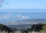
The Oxnard Plain is a large coastal plain in southwest Ventura County, California, United States surrounded by the mountains of the Transverse Ranges...
67 KB (6,213 words) - 14:27, 12 September 2024
in 1903, Oxnard lies approximately 60 miles (97 km) northwest of downtown Los Angeles. It is at the western edge of the fertile Oxnard Plain, adjacent...
105 KB (9,861 words) - 11:16, 21 November 2024
was 843,843. The largest city is Oxnard, and the county seat is the city of Ventura. Ventura County comprises the Oxnard–Thousand Oaks–Ventura, CA Metropolitan...
139 KB (10,514 words) - 01:05, 14 November 2024
The Oxnard strike of 1903 was a labor rights dispute in the southern California coastal city of Oxnard between local landowners and the majority Japanese...
15 KB (1,969 words) - 21:51, 1 June 2024
Mississippi Alluvial Plain (Mississippi) Oxnard Plain (Ventura County, California) Snake River Plain (Idaho) Chianan Plain (Taiwan) Depsang Plains (China and India)...
17 KB (1,639 words) - 03:20, 20 November 2024
The district serves students in grades 9–12 on the Oxnard Plain, including the cities of Oxnard, Port Hueneme, and Camarillo, California as well as adjacent...
17 KB (1,467 words) - 23:56, 25 October 2024
Alluvial Plain, Oxnard Plain, and Laguna de Santa Rosa in the United States Santa Clara Valley in San Jose, California Tempisque River plain in Costa...
6 KB (558 words) - 04:48, 4 November 2024
Indians for thousands of years. Present day Camarillo and the larger Oxnard Plain were portions of a paramount Chumash capital at the village of Muwu (today's...
57 KB (4,882 words) - 19:34, 8 November 2024
Community College District, it serves the Oxnard Plain cities of Oxnard, Camarillo, and Port Hueneme. Oxnard College offers both degrees and certificates...
8 KB (666 words) - 05:04, 29 March 2024
Valley (South) Kern County Tehachapi Mountains South Coast Ventura County Oxnard Plain Conejo Valley Thousand Oaks East County- Moorpark, Simi Valley Channel...
6 KB (377 words) - 04:44, 5 May 2024
Port of Hueneme (redirect from Oxnard Harbor District)
(NBVC). The original wharf was built to serve the new farmers on the Oxnard Plain and became the largest grain shipping port south of San Francisco. The...
50 KB (5,453 words) - 23:19, 13 August 2024
Channel Islands Beach, California (category Geography of Oxnard, California)
populated narrow 1.3-mile-long strip (2.1 km) along the coastal edge of the Oxnard Plain was subdivided using the glamor of Hollywood to sell lots in the mid-1920s...
20 KB (1,699 words) - 02:37, 13 August 2024
Angeles County and the northern Santa Clarita Valley on the east to the Oxnard Plain on the west marked by South Mountain on the south bank of the river....
7 KB (596 words) - 11:49, 6 October 2024
Valley to the north and the Santa Clarita Valley to the northeast. The Oxnard Plain is to the west of the Santa Susana Mountains. The Newhall Pass separates...
15 KB (1,542 words) - 20:46, 17 November 2024
was once common along the 16.5-mile-long (26.6 km) coastline of the Oxnard Plain.: 62-63 The 92-acre (37 ha) site was established as a California state...
5 KB (415 words) - 05:18, 29 June 2022
northeast of Oxnard, the school is surrounded by strawberry fields and other crops growing on the Oxnard Plain. The school is part of the Oxnard Union High...
14 KB (1,359 words) - 22:12, 21 October 2024
It is generally south of the city of Santa Barbara, and west of the Oxnard Plain in Ventura County. It trends east–west, is approximately 130 kilometres...
7 KB (799 words) - 20:24, 10 November 2024
located on the Central Coast of California, at the intersection of the Oxnard Plain and northernmost edge of the Santa Monica Mountains range. The Channel...
33 KB (3,367 words) - 18:19, 13 October 2024
Santa Clara River (California) (category Geography of Oxnard, California)
System north and northwest of Los Angeles, then flows west onto the Oxnard Plain and into the Santa Barbara Channel of the Pacific Ocean. The watershed...
42 KB (4,487 words) - 07:01, 25 October 2024
35-acre (14 ha) site on Fifth Street west of downtown, served all of the Oxnard Plain and the Conejo Valley until 1956 when Adolfo Camarillo High School opened...
13 KB (1,041 words) - 03:35, 28 September 2024
Los Angeles Basin (redirect from Los Angeles Plain)
of Los Angeles Greater Los Angeles area Los Angeles metropolitan area Oxnard Plain San Joaquin Valley Jahns, Richard (1973). "A Profile of Southern California...
29 KB (3,480 words) - 00:04, 9 November 2024
agriculture and farming. In places such as the Sacramento Valley and Oxnard Plain in California, draining marshes and estuaries combined with supplemental...
39 KB (3,854 words) - 01:08, 13 November 2024
The Oxnard Historic Farm Park includes several historical buildings in Oxnard, California, United States. Listed on the National Register of Historic...
8 KB (518 words) - 15:40, 28 March 2024
The Oxnard Transit Center (formerly Oxnard Transportation Center) is an intermodal transit center in downtown Oxnard, California. It is served by Amtrak...
7 KB (566 words) - 22:14, 2 November 2024
Coast North County (SD) Northern California Orange Coast Owens Valley Oxnard Plain Peninsular Ranges Pomona Valley Sacramento–San Joaquin River Delta Sacramento...
13 KB (209 words) - 03:46, 1 October 2024
'olołkoy Beach Park (redirect from Oxnard State Beach)
recreational area operated by the city of Oxnard, California at the edge of the Oxnard Plain. Formerly called Oxnard Beach Park, the park was renamed after...
6 KB (470 words) - 17:36, 4 October 2024
Obispo County) Ojai Valley (Ventura County) Orange Coast (Orange County) Oxnard Plain (Ventura County) Palomar Mountain (San Diego County) Palo Verde Valley...
81 KB (6,614 words) - 22:54, 9 November 2024
Point Mugu (category Geography of Oxnard, California)
in 1923–24 to complete Pacific Coast Highway between Malibu and the Oxnard Plain. This replaced a narrow path around the rock and much of that roadway...
8 KB (754 words) - 05:59, 14 August 2024
Valley to the northwest, Conejo Mountain (also known as Conejo Hills) and Oxnard Plain to the west, and the Santa Monica Mountains to the south. The valley...
17 KB (1,714 words) - 05:15, 18 July 2024
Camarillo Airport (redirect from Oxnard Flight Strip)
The plane had just undergone four weeks of flight testing over the Oxnard Plain. FAA Airport Form 5010 for CMA PDF, retrieved 2022-05-22 Southern California...
14 KB (1,392 words) - 01:26, 9 November 2024


