Pātūtahi is a small settlement 15 kilometres from Gisborne, in the northeast of New Zealand's North Island. It is located in the valley of the Waipaoa...
7 KB (685 words) - 03:37, 29 May 2023
The Patutahi River is a river of the Northland Region of New Zealand's North Island. A tributary of the Kaikou River, it flows northwest before turning...
1 KB (79 words) - 02:37, 13 April 2024

PTA 0294 47 Patetongs PTE 0819 28 Patoka PTO 070 298 Patumahoe PHO 085 Patutahi PHI 079 27 Peebles PBL 0297 27 Peria PER Connect via operator Picton PN...
35 KB (1,816 words) - 20:53, 6 July 2024

marae in Makaraka Te Whānau a Kai, with Ngātapa marae, Pākōwhai marae in Pātūtahi, Rongopai marae in Waituhi, and Tākitimu marae in Waituhi Te Whānau a Taupara...
5 KB (480 words) - 23:23, 15 April 2024

in Wellington in 1963. Fintan Patrick Walsh was born Patrick Tuohy at Pātūtahi, Poverty Bay, on 13 August 1894, one of eleven children of farming parents...
4 KB (247 words) - 03:16, 18 July 2023

towns and settlements in the Gisborne district include: Hicks Bay Manutuke Patutahi Ruatoria Te Araroa Te Karaka Tokomaru Bay Tolaga Bay The subnational gross...
19 KB (1,698 words) - 08:52, 14 June 2024

54444°E / -38.77222; 177.54444 Lake Repongaere Gisborne District North of Patutahi 38°35′45″S 177°52′30″E / 38.59583°S 177.87500°E / -38.59583; 177.87500...
165 KB (1,033 words) - 09:26, 13 May 2024
Disused railways Pātūtahi (Ngātapa Branch) Line and station closed 7.9 km (4.9 mi) Moutohora Branch Park Racecourse Line mothballed, station closed...
5 KB (323 words) - 03:20, 29 June 2023

2016, Gisborne hosted the premiere of Mahana, a New Zealand film set in Patutahi and Manutuke, and based on Witi Ihimaera's semi-autobiographical novel...
41 KB (3,752 words) - 09:51, 5 June 2024

(190) Te Araroa (170) Ruatoria (860) Te Karaka (580) Tokomaru Bay (530) Pātūtahi (370) Manutūkē (440) Tolaga Bay (930) Tuai (240) Frasertown (270) Nūhaka...
63 KB (2,910 words) - 03:30, 24 June 2024
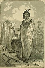
direction of Te Kooti's approach. Te Kooti in the meantime had reached Patutahi, a village in the western hills overlooking Poverty Bay. Tūranga, on the...
67 KB (9,958 words) - 21:29, 11 June 2024
Amalgamated with Taieri County Papatoetoe 28 March 1919 1946 Elevated to borough Patutahi fl. 1952 fl. 1972 Dependent Town District within Cook County Pleasant Point...
84 KB (2,488 words) - 19:44, 25 June 2024
from the bridge piers of the Waipaoa River crossing between Makaraka and Patutahi, the most significant remains are those past the original terminus at Ngatapa...
22 KB (2,002 words) - 22:49, 20 December 2023
extended SH 1 north to Puhoi. Now known as the Dairy Flat Highway. 36 SH 2 at Patutahi SH 38 at Frasertown Tiniroto 83.4 Was revoked in 1990–91, but re-gazetted...
34 KB (320 words) - 02:39, 17 May 2024
Pakowhai Marae Te Poho o Hiraina Te Aitanga-a-Māhaki (Te Whānau a Kai) Patutahi Parihimanihi Te Poho o Māhaki Te Aitanga-a-Māhaki (Ngāi Tūketenui, Ngāti...
13 KB (161 words) - 09:04, 19 December 2022
the touring Australian side in 1958. A schoolteacher, Cossey taught at Patutahi School, near Gisborne, in the mid-1950s, where one of his students was...
4 KB (145 words) - 00:23, 6 June 2024
rugby, public toilets Patutahi Soccer Ground 38°37′31″S 177°53′19″E / 38.625401°S 177.888512°E / -38.625401; 177.888512 Patutahi Gisborne Sports ground...
9 KB (60 words) - 02:22, 14 April 2024

settlements along the banks of the river include Te Karaka, Ormond, and Patutahi. The river has formed the fertile and highly productive Poverty Bay flats...
5 KB (362 words) - 02:48, 13 April 2024
River Pariwhakaoho River Park River Pataua River Pātea River Paturau River Patutahi River Pearse River Pearson River Penk River Percival River Peria River...
31 KB (2,843 words) - 05:08, 4 May 2024
(6.4%) were unemployed. Te Arai statistical area, which also includes Pātūtahi, covers 54.68 km2 (21.11 sq mi) and had an estimated population of 1,260...
11 KB (1,169 words) - 01:48, 29 December 2023

In 1995, Foon stood as councillor for the Gisborne District Council's Patutahi Taruheru ward at the encouragement of two detectives. At the time, the...
27 KB (2,345 words) - 07:38, 20 February 2024
2621 Ormond School 1–6 Coed Ormond State 6 84 [18] 2631 2631 Patutahi School 1–8 Coed Pātūtahi State 1 62 – 2643 2643 Potaka School 1–8 Coed Potaka State...
16 KB (124 words) - 03:04, 17 September 2023
0.12 Te Kauwhata (Waikato 5 0.12 Brunner 23 0.08 Kohukohu (Hokianga) 4 0.08 Ohaupo (Waipa) 5 0.08 Patutahi (Cook) 5 0.08 Ross 15 0.04 Fiord 7,861 0.00...
13 KB (665 words) - 09:05, 9 May 2024
defection of a number of men. On 24 December, Colonel Whitmore set out from Patutahi with a stronger and better prepared force of men, including the Armed Constabulary...
8 KB (1,049 words) - 13:50, 2 November 2023
Gisborne Ward, and one each from the four wards of Matakaoa-Waiapu, Taruheru-Patutahi, Tawhiti-Uawa and Waipaoa. Under the elected members, there is an appointed...
9 KB (747 words) - 07:58, 13 April 2024
his playing days he moved back to the Hawke's Bay Region and resided in Patutahi. Waddell was originally a rugby player. He represented the Napier sub union...
18 KB (1,690 words) - 07:16, 12 December 2023
with their own fortified village. An outpost village was based at modern Patutahi. Rākei-hikuroa had five sons, but greatly favoured Tūpurupuru. His excellence...
17 KB (2,161 words) - 14:10, 22 February 2024
highway. Former Provincial State Highway 36 used to run between SH 2 at Patutahi west of Gisborne and SH 38 at Frasertown just north of Wairoa, a distance...
4 KB (344 words) - 06:27, 19 September 2023
Ormond, Waikohu and Turanganui districts all had road boards in 1877. Patutahi followed in 1879, and then: Whataupoko (1882), Waimata (1885), Kaiti (1887)...
9 KB (1,246 words) - 07:58, 13 April 2024