and Paraguay River. The Mato Grosso Plateau is directly to the east of Parecis. Encyclopædia Britannica: Parecis Mountains. Retrieved 20 February 2013...
1 KB (96 words) - 03:06, 27 January 2022
Parecis or Parecís may refer to: Parecis, Rondônia, a municipality in Brazil Parecis Plateau, a plateau in Brazil Parecis River, a river in Mato Grosso...
355 bytes (72 words) - 18:32, 26 December 2019
Paraguay, while flowing in different directions, both originate in the Parecis plateau of Brazil. Among the fish species shared between these rivers are the...
6 KB (416 words) - 15:59, 22 October 2024
The Parecis titi monkey (Plecturocebus parecis) is a species of titi monkey, a type of New World monkey, endemic to Brazil. It is popularly referred to...
6 KB (654 words) - 07:51, 9 September 2024
Brazil, in the state of Mato Grosso. The Juruena originates in the Parecis plateau. Within Mato Grosso the river defines the eastern boundary of the 227...
9 KB (395 words) - 04:21, 22 May 2024
Tapajós River basin in Brazil. Its specific epithet refers to the Parecis Plateau, where the type specimen was collected. The species reaches 6 cm (2...
1 KB (107 words) - 12:30, 24 February 2024
also rivals the Mamore in length and volume, having its source in the Parecis plateau, Mato Grosso, Brazil, a few miles from streams flowing north-ward to...
13 KB (431 words) - 21:48, 9 July 2024
through dense forests and then later through the plains on top of the Parecis plateau. They reached the River of Doubt on February 27, 1914. At this point...
13 KB (1,448 words) - 14:39, 16 July 2024
648013000 • elevation 800 m (2,600 ft) 3rd source Juruena • location Parecis Plateau, Mato Grosso • coordinates 14°43′6.0168″S 59°9′45.7848″W / 14.718338000°S...
22 KB (1,207 words) - 01:08, 9 August 2024
Paraguay Brazil Argentina Bolivia Physical characteristics Source Parecis Plateau • location Alto Paraguai, Brazil • coordinates 14°37′37″S 56°30′07″W...
19 KB (1,891 words) - 13:59, 7 July 2024
mountainous Parecis plateau (Chapada dos Parecis). The land rises to 1,126 metres (3,694 ft) at the tallest peak of the Parecis plateau. The terrain...
12 KB (1,357 words) - 15:06, 28 August 2023
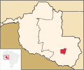
Parecis is a municipality located in the Brazilian state of Rondônia. Its population was 6,198 (2020) and its area is 2,549 km2. Parecis Plateau IBGE 2020...
3 KB (31 words) - 08:14, 30 March 2024
Source • location Confluence of Pimenta Bueno and Comemoração, Parecis plateau, Rondônia, Brazil • elevation 173 m (568 ft) Mouth Madeira River • location...
6 KB (279 words) - 11:46, 12 March 2024
Macro-Jê languages, which were likely spoken in an area between the Parecis Plateau and upper Araguaia River.: 425 The Cariban languages are closely related...
74 KB (1,733 words) - 15:36, 9 July 2024
found in the Serra do Cachimbo on the Pará–Mato Grosso boundary, the Parecis plateau in Rondônia, the Atlantic coast near the mouth of the Amazon, and in...
12 KB (1,194 words) - 16:35, 2 October 2024
Guimarães plateau, bounded to the north by the Paranatinga depression, to the east by the Araguaia depression and to the northeast by the Parecis plateau. Altitudes...
6 KB (691 words) - 01:20, 21 June 2023
the northern part of the reserve. Both these rivers originate on the Parecis plateau. The MT-418 highway, which runs west to become the RO-205 highway in...
8 KB (876 words) - 00:15, 23 October 2024
Bolivia. The park is in the central-west Brazilian pediplain and the Parecis plateau. Altitudes are from 100 to 400 metres (330 to 1,310 ft). The park has...
6 KB (626 words) - 19:17, 22 September 2024
Moenkhausia pankilopteryx Bertaco & P. H. F. Lucinda, 2006 Moenkhausia parecis Ohara & Marinho, 2016 Moenkhausia petymbuaba F. C. T. Lima & Birindelli...
19 KB (1,377 words) - 19:59, 30 December 2023
Department, Bolivia Pacajá (Pacaja) Panará, Mato Grosso and Pará, Brazil Parecís (Paressi) Rikbaktsa (Erikbaksa), Mato Grosso, Brazil Rio Pardo people,...
110 KB (9,031 words) - 10:54, 21 October 2024
the Cravari River on its left. Brasnorte municipality contains the Pareci Plateau to the south and the Southern Amazon Interplanaltic Depression to the...
9 KB (909 words) - 15:35, 28 June 2024
Mariano da Silva Rondon built telegraph posts in the fields of the Plateau Parecis, linking several cities between Cuiabá and Porto Velho. Towns often...
8 KB (875 words) - 14:28, 15 August 2024
the Upper Xingu Relief and altitude: Residual Northern Plateau and Mato Grosso Plateau Parecis. Altitude of 384 meters above the sea level. Hydrography:...
11 KB (1,393 words) - 14:12, 8 July 2024
Municipality of Passo Fundo Flag Seal Nickname(s): Capital of the mid-Plateau, Land of the Good Folks Motto(s): Work, Brotherhood, Progress! Location...
19 KB (1,473 words) - 18:06, 26 July 2024
northern part of the state lies on the southern slopes of the elevated plateau extending southward from São Paulo across the states of Paraná and Santa...
111 KB (11,966 words) - 20:20, 20 October 2024
feet (560 m) above sea-level, and sits at the foot of the Mato Grosso plateau. Its history dates from 1730 as a gold mining settlement. In 1746, diamonds...
6 KB (155 words) - 18:56, 21 May 2024
639-1 639-2B Scope/Type Family Native eng fra spa zho rus deu pab I/L Parecís pac I/L Pacoh pad I/L Paumarí pae I/L Pagibete paf I/E Paranawát paranawát...
34 KB (169 words) - 01:53, 18 July 2024
meters (23 ft) above sea level. The interior of the municipality is on a plateau called Serras de Sudeste (Southeastern Mountain Ranges). Consequently,...
36 KB (3,263 words) - 17:44, 19 October 2024
situated in a transitional area between the central depression and the plateau. List of municipalities in Rio Grande do Sul IBGE 2022 "FAMURS 12/04/2018...
5 KB (475 words) - 18:34, 19 October 2024
2 km2) and the population in 2020 was 12,195. The relief, located in a plateau known as Serras de Sudeste, is a rather irregular, specially the Passarinho's...
6 KB (407 words) - 09:07, 9 August 2024


