
Puerto Rico Highway 110 (PR-110) is a road that goes from Añasco, Puerto Rico to Aguadilla through Moca. It extends from Puerto Rico Highway 2 north of...
12 KB (378 words) - 18:24, 1 August 2023

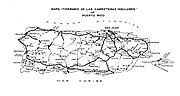
The highway system in Puerto Rico is composed of approximately 14,400 kilometers (8,900 mi) of roads in Puerto Rico, maintained by the Puerto Rico Department...
171 KB (3,630 words) - 04:50, 24 June 2024

Puerto Rico Highway 2 (PR-2) is a road in Puerto Rico that connects the cities of San Juan and Ponce. At 156 miles (230 km) long, it is Puerto Rico's...
53 KB (3,460 words) - 22:10, 19 April 2024

Puerto Rico Highway 462 (PR-462) is an east–west road between the municipalities of Aguadilla and Moca in Puerto Rico. With a length of 2.41 kilometers...
3 KB (141 words) - 02:26, 1 August 2023

Puerto Rico Highway 111 (PR-111) is a highway connecting Aguadilla, Puerto Rico at Puerto Rico Highway 2 and Puerto Rico Highway 115 to Utuado, Puerto...
22 KB (786 words) - 01:56, 6 February 2024
110 (1967) (former) Wisconsin Highway 110 Wyoming Highway 110 Territories Puerto Rico Highway 110 Puerto Rico Highway 110R (former) A110 B110 D110 road...
7 KB (455 words) - 15:27, 9 April 2024

Puerto Rico is an unincorporated territory of the United States located in the northeast Caribbean, approximately 1,000 miles (1,600 km) southeast of...
93 KB (8,676 words) - 07:48, 5 June 2024

Puerto Rico Highway 10 (PR-10) is a major highway in Puerto Rico. The primary state road connects the city of Ponce in the south coast to Arecibo in the...
38 KB (3,442 words) - 09:29, 19 February 2024

Puerto Rico Highway 123 (PR-123) is a secondary highway that connects the city Arecibo to the city of Ponce. It runs through the towns of Utuado and Adjuntas...
25 KB (1,629 words) - 14:38, 5 September 2023

Puerto Rico Highway 181 (PR-181), also known as Expreso Trujillo Alto, is a road that connects the towns of San Juan, Puerto Rico (very close to Carolina)...
12 KB (428 words) - 02:32, 6 February 2024

The economy of Puerto Rico is classified as a high income economy by the World Bank and as the most competitive economy in Latin America by the World...
184 KB (17,132 words) - 19:43, 27 June 2024
of Puerto Rico. The highways serve the more than 3 million residents, and 3-4 million tourists who visit each year. Puerto Rico's territorial highway system...
31 KB (3,452 words) - 12:17, 27 January 2024

primary highways in the contiguous United States, there are signed Interstates in Hawaii and unsigned Interstates in Alaska and Puerto Rico. There are...
54 KB (645 words) - 17:23, 3 July 2024

Puerto Rico (Spanish for 'rich port'; abbreviated PR), officially the Commonwealth of Puerto Rico, is a Caribbean island, Commonwealth, and unincorporated...
264 KB (26,421 words) - 09:12, 7 July 2024

locally [ˈkawaʔ]) is a city and municipality of Puerto Rico located in the Central Mountain Range of Puerto Rico, south of San Juan and Trujillo Alto, west...
56 KB (4,816 words) - 23:02, 28 April 2024
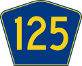
Puerto Rico Highway 125 (PR-125) is a road that travels from Aguadilla, Puerto Rico to San Sebastián, passing through Moca. This highway begins at PR-111...
8 KB (226 words) - 02:44, 1 August 2023

[kaˈtaɲo]) is a town and municipality located on the northeastern coast of Puerto Rico, bordering the San Juan Bay and the Atlantic Ocean, and adjacent to the...
32 KB (2,694 words) - 04:42, 4 June 2024

Autónomo de Guayama), is a city and municipality on the Caribbean coast of Puerto Rico. As of the 2020 U.S. Census, the city had a population of 36,614. It...
53 KB (4,974 words) - 06:42, 27 June 2024

pronunciation: [ˈponse] ) is a city and a municipality on the southern coast of Puerto Rico. The most populated city outside the San Juan metropolitan area, was...
220 KB (21,912 words) - 15:29, 30 June 2024
1953, the Puerto Rico Department of Transportation and Public Works implemented a major renumbering of its insular highways. Before 1953, highway routes...
41 KB (1,131 words) - 14:58, 5 March 2024

September 19–21, 2017, Hurricane Maria devastated the entire island of Puerto Rico and caused a major humanitarian crisis. Originally as a powerful Category...
116 KB (10,558 words) - 08:55, 3 July 2024

The history of Puerto Rico began with the settlement of the Ortoiroid people before 430 BC. At the time of Christopher Columbus's arrival in the New World...
123 KB (14,887 words) - 02:54, 11 July 2024

mountain town and municipality located in the Cordillera Central region of Puerto Rico, south of Corozal and Naranjito; north of Coamo and Aibonito; west of...
37 KB (2,469 words) - 05:33, 23 April 2024

Las Nereidas Palomas Abajo Parts of Puerto Rico Highway 167 Residencial Ariel Residencial Manuel Martorell Sector 110 Sector Cipey Sector El 26 Sector Higüero...
8 KB (697 words) - 11:47, 9 August 2023

Puerto Rico Highway 466 in Ceiba Baja Puerto Rico portal List of communities in Puerto Rico List of barrios and sectors of Aguadilla, Puerto Rico "US...
10 KB (724 words) - 18:50, 6 April 2024
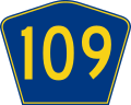
Puerto Rico Highway 109 (PR-109) is a rural road that travels from Añasco, Puerto Rico to San Sebastián. This road extends from its junction with PR-2...
5 KB (137 words) - 21:02, 7 April 2024
locally [keβɾaˈðiʎaʔ]) is a town and municipality of the island of Puerto Rico located in the northern shore bordering the Atlantic Ocean, north of...
42 KB (2,671 words) - 08:05, 29 April 2024

Comerío barrio-pueblo (redirect from Comerío, Comerío, Puerto Rico)
Nereidas, Palomas Abajo, Parts of Puerto Rico Highway 167, Residencial Ariel, Residencial Manuel Martorell, Sector 110, Sector Cipey, Sector El 26, Sector...
13 KB (1,051 words) - 04:12, 28 December 2023
state highway in the U.S. state of Maryland Secondary Highway 489, a road near the Yellowstone River, Montana Puerto Rico Highway 489, a highway in Hatillo...
954 bytes (120 words) - 23:13, 4 April 2024
Birth of the New World (category Arecibo, Puerto Rico)
Columbus' Statue) is a 360 foot (110 m) bronze sculpture located on the Atlantic coastline of Arecibo, Puerto Rico. When completed in 2016, it became...
30 KB (3,334 words) - 08:54, 26 May 2024