
Puerto Rico Highway 15 (PR-15), formerly Road No. 4 (Carretera #4), is a main highway connecting the municipalities of Guayama and Cayey in Puerto Rico...
10 KB (564 words) - 01:55, 6 February 2024

The highway system in Puerto Rico is composed of approximately 14,400 kilometers (8,900 mi) of roads in Puerto Rico, maintained by the Puerto Rico Department...
171 KB (3,630 words) - 01:06, 5 August 2024

Puerto Rico Highway 22 (PR-22), also part of unsigned Interstate PR2, is an 84.3 km (52.4 mi) long toll road on the north coast of Puerto Rico that connects...
21 KB (1,055 words) - 01:31, 5 August 2024
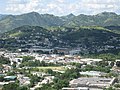
officially Cayey de Muesas, is a mountain town and municipality in central Puerto Rico located on the Sierra de Cayey within the Central Mountain range, north...
49 KB (4,710 words) - 23:20, 12 August 2024

Puerto Rico Highway 111 (PR-111) is a highway connecting Aguadilla, Puerto Rico at Puerto Rico Highway 2 and Puerto Rico Highway 115 to Utuado, Puerto...
22 KB (786 words) - 01:56, 6 February 2024
Puerto Rico Highway 52 (PR-52), a major toll road in Puerto Rico, is also known as Autopista Luis A. Ferré. It was formerly called Expreso Las Américas...
21 KB (1,126 words) - 17:28, 10 May 2024

Puerto Rico Highway 2 (PR-2) is a road in Puerto Rico that connects the cities of San Juan and Ponce. At 156 miles (230 km) long, it is Puerto Rico's...
53 KB (3,469 words) - 22:22, 4 August 2024

Puerto Rico Highway 167 (PR-167) is one of the main highways in the San Juan–Caguas–Guaynabo metropolitan area of Puerto Rico. Highway 167 starts at Puerto...
9 KB (404 words) - 01:59, 6 February 2024
Puerto Rico Highway 53 (PR-53) or unsigned Interstate PR3 is a main tollway that is parallel to Puerto Rico Highway 3, which goes from Fajardo to Salinas...
17 KB (911 words) - 04:03, 26 February 2024
The Puerto Rico Police (Spanish: Policía de Puerto Rico), officially the Puerto Rico Police Bureau, is a law enforcement agency with jurisdiction over...
71 KB (8,422 words) - 06:06, 21 July 2024

Puerto Rico Highway 3 (PR-3) at nearly 100 miles long, is the second-longest highway on Puerto Rico (after PR-2). It connects the San Juan neighborhood...
21 KB (773 words) - 22:22, 4 August 2024
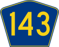
Puerto Rico Highway 143 (PR-143) is a secondary highway that connects the town of Adjuntas to the town of Barranquitas. Heading east from Adjuntas, PR-143...
11 KB (310 words) - 18:25, 1 August 2024
Puerto Rico Highway 1 (PR-1) is a highway in Puerto Rico that connects the city of Ponce to San Juan. Leaving Ponce, the road heads east and follows a...
23 KB (755 words) - 06:38, 2 May 2024

Puerto Rico Highway 116 (PR-116) is a main highway in the southwest part of Puerto Rico, beginning in Guánica, Puerto Rico at Puerto Rico Highway 2 to...
13 KB (548 words) - 02:39, 6 February 2024

colonists in 1521, who called it Ciudad de Puerto Rico ("City of Puerto Rico", Spanish for rich port city). Puerto Rico's capital is the second oldest European-established...
162 KB (15,542 words) - 12:15, 17 August 2024

Puerto Rico Highway 165 (PR-165) is the road that goes from Naranjito to Guaynabo. The highway passes by Toa Alta, Toa Baja, Dorado, Levittown, Cataño...
15 KB (561 words) - 02:23, 6 February 2024

Humacao (Spanish pronunciation: [umaˈkao]) is a city and municipality in Puerto Rico located in the eastern coast of the island, north of Yabucoa; south of...
45 KB (3,795 words) - 12:33, 18 August 2024

locally [ˈkawaʔ]) is a city and municipality of Puerto Rico located in the Central Mountain Range of Puerto Rico, south of San Juan and Trujillo Alto, west...
56 KB (4,816 words) - 12:47, 13 August 2024

pronunciation: [baʝaˈmon], locally [baʝaˈmoŋ]) is a city, municipality of Puerto Rico and suburb of San Juan located in the northern coastal valley, north...
46 KB (3,866 words) - 23:21, 12 August 2024
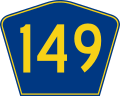
Puerto Rico Highway 149 (PR-149) is a secondary highway in Puerto Rico that connects the towns of Manatí in the north coast of Puerto Rico, from PR-22...
14 KB (447 words) - 02:37, 6 February 2024
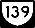
Puerto Rico Highway 139 (PR-139) is a two-way secondary highway in the municipality of Ponce in Puerto Rico. With a length of 25.2 km (15.7 mi), it extends...
12 KB (867 words) - 01:54, 6 February 2024

Puerto Rico is an unincorporated territory of the United States located in the northeast Caribbean, approximately 1,000 miles (1,600 km) southeast of...
93 KB (8,676 words) - 18:06, 24 August 2024
Puerto Rico Highway 115 (PR-115) is a highway which follows the west coastline of Puerto Rico from south Añasco at PR-2 to near downtown Aguadilla, where...
9 KB (385 words) - 01:54, 30 August 2023

of Puerto Rico, bordered by the Atlantic Ocean to the north and west, north of Aguada, and Moca and west of Isabela. Aguadilla is spread over 15 barrios...
66 KB (5,727 words) - 23:20, 12 August 2024

Puerto Rico Highway 10 (PR-10) is a major highway in Puerto Rico. The primary state road connects the city of Ponce in the south coast to Arecibo in the...
38 KB (3,442 words) - 01:31, 5 August 2024

Puerto Rico Highway 189 (PR-189) is a 15 kilometres (9 mi) long main highway which parallels very closely the first half of Puerto Rico Highway 30 from...
8 KB (294 words) - 03:04, 1 August 2023

ˈβaxa]) is a town and municipality located on the coast of north central Puerto Rico. It is north of Morovis, east of Manatí, and west of Vega Alta. Vega...
35 KB (2,996 words) - 00:59, 13 August 2024

Puerto Rico Highway 185 (PR-185) is a main highway that connects Canóvanas, Puerto Rico to Juncos, Puerto Rico and is about 25 kilometers long. It begins...
8 KB (453 words) - 01:53, 6 February 2024

Puerto Rico Highway 14 (PR-14) is a main highway connecting Ponce to Cayey, Puerto Rico. The road runs the same course as the historic Carretera Central...
23 KB (655 words) - 11:30, 4 January 2024
Puerto Rico Highway 125 (PR-125) is a road that travels from Aguadilla, Puerto Rico to San Sebastián, passing through Moca. This highway begins at PR-111...
8 KB (226 words) - 02:44, 1 August 2023