The Rough River Lake is a Y-shaped reservoir located in Breckinridge, Hardin, and Grayson counties in Kentucky, United States, about 70 miles southwest...
8 KB (965 words) - 16:46, 4 November 2023
Rough River Dam State Resort Park is a Kentucky state park encompassing 637 acres (258 ha) on Rough River Lake in Grayson county. Rough River Dam of 1959...
3 KB (170 words) - 01:33, 3 August 2023
has also been known historically as "Rough Creek". In the 1950s it was dammed, creating Rough River Lake. Rough River has an immense amount of terrestrial...
6 KB (727 words) - 00:56, 19 November 2022
Kincaid Lake Laurel River Lake Lake Linville Lake Malone Martins Fork Lake Nolin River Lake Paintsville Lake Pan Bowl Lake Rough River Lake Shanty Hollow...
2 KB (162 words) - 02:04, 30 April 2023
June 17, 2003. His body was found on June 25, 2003, in a suitcase in Rough River Lake. On June 17, 2003, Phillips was seen having lunch at a restaurant in...
14 KB (1,540 words) - 23:40, 24 September 2024
Rough Lake is an alpine lake in Custer County, Idaho, United States, located in the White Cloud Mountains in the Sawtooth National Recreation Area. The...
2 KB (93 words) - 04:43, 6 May 2024
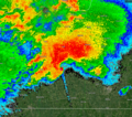
County at 11:48 p.m. CST (5:48 UTC) as it entered Rough River Dam State Resort Park near Rough River Lake, approximately four miles (6.4 km) west of McDaniels...
93 KB (8,988 words) - 22:36, 19 December 2024
Hardinsburg. McDaniels is situated on Rough River Lake, which collects the 29.5-mile-long (47.5 km) North Fork Rough River, which flows for its entire length...
4 KB (464 words) - 05:07, 27 July 2023
the middle of town. Leitchfield is situated between Rough River Lake to the north and Nolin River Lake to the south. According to the United States Census...
13 KB (1,307 words) - 19:28, 16 May 2024
flows through Lake Schwielochsee before entering Berlin, as Müggelspree [de] (pronounced [ˈmʏɡl̩ˌʃpʁeː] ). The Spree is the main river of Berlin, Brandenburg...
8 KB (853 words) - 04:02, 21 October 2024
Louis River (abbreviated St. Louis River) is a river in the U.S. states of Minnesota and Wisconsin that flows into Lake Superior. The largest U.S. river to...
16 KB (1,532 words) - 04:12, 7 September 2024
Rough Creek Fault System, considered a potential hydrocarbon resource. Grayson County is home to two U.S. Army Corps of Engineers lakes, Rough River Lake...
16 KB (1,426 words) - 21:44, 6 November 2024
11:48 p.m. CST (5:48 UTC) as it began to enter Rough River Dam State Resort Park near Rough River Lake, approximately four miles (6.4 km) west of McDaniels...
172 KB (16,885 words) - 19:38, 16 December 2024
Kentucky Rough River Lake Dam, Rough River Lake, USACE Smithland Locks and Dam, Ohio River, USACE (between Illinois and Kentucky) Taylorsville Lake Dam, Taylorsville...
3 KB (348 words) - 20:30, 22 October 2023
route southeast of McDaniels via Lilac and Fisher. The route crosses Rough River Lake at the Grayson—Breckinridge county line. KML file (edit • help) Template:Attached...
2 KB (125 words) - 17:57, 16 February 2024
flow through rough hill country, much of it covered by the Berwick Forest. An artificial lake, Lake Mahinerangi is formed on the river behind a small...
3 KB (204 words) - 11:15, 22 August 2024
541 miles (2.480 km) from Laurel Branch Camping Area on the shore of Rough River Lake along Laurel Branch Road east to KY 259 near McDaniels. The western...
107 KB (11,131 words) - 03:42, 17 August 2024
chapalaense of the rough-footed mud turtle is largely restricted to Lake Chapala, while the more widespread subspecies murrayi inhabits the Lerma River basin (and...
16 KB (1,665 words) - 12:11, 28 October 2024
six watercourses come together, Dry Devils River, Granger Draw, House Draw, Jackson, Flat Rock Draw, and Rough Canyon. It flows southwest for 94 miles (151 km)...
6 KB (909 words) - 15:37, 29 January 2024
Cumberland River at Pineville, Barbourville, and Williamsburg in early February 2020. Kentucky portal Quadrula tuberosa — Cumberland River endemic 'Rough rockshell'...
14 KB (1,150 words) - 22:14, 8 December 2024
Tributaries of the Green River include the Barren River, the Nolin River, the Pond River and the Rough River. The river was named after Nathanael Greene, a general...
13 KB (1,406 words) - 00:59, 18 December 2024
of Rough Lake, in the White Cloud Mountains Custer County, Idaho Rough Creek, an historical name of the Rough River in west-central Kentucky Rough Creek...
391 bytes (89 words) - 12:16, 2 July 2021
destruction of up to 250 miles (400 km) from near Bay, Arkansas, to Rough River Lake in Kentucky. However, a path break in Obion County, Tennessee, confirmed...
249 KB (23,405 words) - 02:53, 18 December 2024
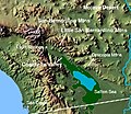
lake reached even higher elevations, up to 31–52 m (102–171 ft) above sea level. During the Holocene most of the water came from the Colorado River with...
78 KB (9,584 words) - 04:14, 18 November 2024
Sula River [ru] (21 km) → Sula lake (7 km) → Lieksanjoki (132 km) → Pielinen Lake (44 km) → Pielisjoki (67 km) → Saimaa. The watershed area is a rough guess...
262 KB (9,219 words) - 18:21, 27 November 2024
Lake Tanganyika and Lake Mweru, which feed the Lualaba River, which then becomes the Congo below Boyoma Falls. The Chambeshi River in Zambia is generally...
111 KB (4,992 words) - 16:01, 11 December 2024
the greater Baltistan Region, and in the Indus River basin. Foroq Tso (Lake) or Upper Kachura Lake is of clear water and has a depth of 70 metres (230 ft)...
4 KB (297 words) - 17:55, 17 November 2024
Gitathuru River Kiu River Mathari River Mbagathi River Nairobi River Ngong River RuiRuaka River The Motoine River flows to Nairobi Dam, an artificial lake meant...
7 KB (585 words) - 04:43, 28 September 2023
List of drainage basins by area (redirect from List of River Basins)
"watersheds"), sorted by area, which drain to oceans, mediterranean seas, rivers, lakes and other water bodies. All basins larger than 400,000 km2 (150,000 sq mi)...
76 KB (1,453 words) - 02:12, 9 December 2024
to the lake is via helicopter, a rough deer trail from Slaughter Burn or Harry's Track, a marked route from the outlet of Lake Hauroko. Lakes of New Zealand...
3 KB (234 words) - 22:52, 16 May 2024


