
Route 114A is an alternate state route to Rhode Island Route 114, located along the Massachusetts – Rhode Island border in East Providence, RI and Seekonk...
5 KB (284 words) - 22:38, 27 January 2024

I-195 then leaves Rhode Island, having gone 3.82 miles (6.15 km). I-195 enters Seekonk, Massachusetts, and interchanges with Route 114A at exit 1. There...
36 KB (2,547 words) - 17:15, 25 July 2024
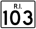
Route 103 is a numbered state highway running 11.8 miles (19.0 km) in Rhode Island, United States. It runs from Interstate 195 (I-195) in East Providence...
8 KB (566 words) - 22:35, 27 January 2024
city and town in Rhode Island, except for New Shoreham (Block Island), has at least one numbered route. State highways in Rhode Island are signed with...
34 KB (179 words) - 17:27, 14 August 2024

California, and east to Provincetown, Massachusetts. In western Rhode Island, it forms part of one of several routes between Hartford, Connecticut, and Providence...
28 KB (1,945 words) - 21:54, 20 March 2024

Seekonk is a town in Bristol County, Massachusetts, United States, on the Massachusetts border with Rhode Island. It was incorporated in 1812 from the...
23 KB (2,798 words) - 14:35, 26 July 2024

across the states of Connecticut, Rhode Island, and Massachusetts. Route 199 was also incorporated into the new route, connecting with the New York state...
56 KB (4,047 words) - 21:19, 30 July 2024

Route 103A Route 104 Route 107 Route 108 Route 114 Route 114A Route 115 Route 116 Route 117 Route 120 Route 121 Route 122 Route 123 Route 126 Route 128...
23 KB (1,797 words) - 15:10, 26 April 2024

England. One is in Massachusetts with Massachusetts Route 114A, a loop of Rhode Island Route 114 (Rhode Island Route 114A is the designation for the small...
9 KB (639 words) - 18:11, 16 June 2024

114A in Seekonk, which is actually related to Rhode Island Route 114 and is located about 50 miles (80 km) away from Massachusetts Route 114. Route 114...
8 KB (586 words) - 23:07, 1 December 2023

Massachusetts, the highway division of the Massachusetts Department of Transportation (MassDOT) assigns and marks a system of state-numbered routes....
70 KB (169 words) - 06:35, 12 March 2024

with Route 1A. In Rhode Island, US 1A exists in two segments in Providence County connected by a mostly-unsigned concurrency with I-195, while Route 1A...
32 KB (2,763 words) - 03:07, 10 August 2024
List of highways numbered 114 (redirect from Route 114A)
Highway 114 Ohio State Route 114 Oklahoma State Highway 114 (former) Pennsylvania Route 114 Rhode Island Route 114 Rhode Island Route 114A South Carolina Highway...
5 KB (331 words) - 23:34, 4 April 2024

New England road marking system (redirect from Route 8 (Massachusetts 1920s))
of Westerly, Rhode Island. Route 17 was replaced by Massachusetts Route 23, U.S. Route 7, U.S. Route 44, and Connecticut Route 2. Route 18, designated...
158 KB (6,445 words) - 17:10, 1 February 2024
U.S. Route 6 (US 6) in Massachusetts is a 117.952-mile-long (189.825 km) portion of the cross-country route connecting Providence, Rhode Island, to Fall...
31 KB (2,583 words) - 15:49, 30 July 2024

72b, 73b, 74b, 75b, 82b, 84a, 86a–b, 88a, 89a, 90b, 91b, 105b, 109b, 110b, 114a, 115a; Bava Metzia 30a; Bava Batra 3b, 23b, 31b, 56b, 91b 91b, 100b, 123b...
188 KB (24,914 words) - 23:02, 21 June 2024