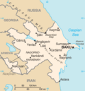
Sadarak District (Azerbaijani: Sədərək rayonu) is one of the 7 districts of the Nakhchivan Autonomous Republic of Azerbaijan. The district borders the...
12 KB (1,095 words) - 18:15, 5 December 2024
ISO 3166-2:AZ (section Municipalities and rayons)
Autonomous Republic) 11 municipalities and 66 rayons The eleven municipalities have special status equal to the rayons. Şuşa, the disputed municipality, has been...
10 KB (259 words) - 09:32, 26 September 2024
- Julfa ( Road 21) - Nakhchivan M 7: Nakhchivan - Sədərək State road D.080 (Turkey) R 63: Sədərək Armenia Մ2: Yeraskh ( E117) UN Economic Commission...
2 KB (91 words) - 22:09, 6 July 2024
Sharur District (redirect from Şərur Rayon)
Republic of Azerbaijan. The district borders the districts of Kangarli, Sadarak, as well as the Vayots Dzor and Ararat provinces of Armenia and the West...
8 KB (786 words) - 22:54, 6 November 2024
Administrative divisions of Azerbaijan (redirect from Rayons of Azerbaijan)
Azerbaijan is administratively divided into 67 districts (rayon) and 11 cities (şəhər) that are subordinate to the Republic. Out of these districts and...
27 KB (500 words) - 18:36, 14 December 2024
46°9′E / 38.850°N 46.150°E / 38.850; 46.150 (Ordubad (South))) West: Sadarak Rayon (39°42′N 44°46′E / 39.700°N 44.767°E / 39.700; 44.767) East: Ordubad...
2 KB (312 words) - 23:20, 28 November 2024
municipality in the Sadarak Rayon of Nakhchivan Autonomous Republic, Azerbaijan Heydərabad, a town and municipality in the Saatly Rayon of Azerbaijan Haidarabad...
6 KB (698 words) - 21:54, 25 November 2024
Absheron - Afag Masud - Afrasiyab Badalbeyli - Ag-Gol National Park - Agdam (rayon) - Agdash - Aghasi Mammadov - Aghstev - Agjabadi - Agstafa - Agsu - Ajami...
25 KB (2,496 words) - 23:11, 2 October 2024
Karki village on 16 January 1990, Armenian forces started moving towards Sadarak District. When the Department of Internal Affairs of Sharur region received...
4 KB (346 words) - 14:47, 6 November 2024
Babek (Babək) Julfa (Culfa) Kangarli (Kəngərli) Ordubad (Ordubad) Sadarak (Sədərək) Shahbuz (Şahbuz) Sharur (Şərur) Nakhchivan (Naxçıvan) Shaki-Zagatala...
251 KB (22,395 words) - 01:20, 3 December 2024
Daran (trees) داران "Place with Pomegranate trees". Ordubad Sadarak Shaki and Shaki (rayon) According to the Azerbaijan Development Gateway, the name of...
35 KB (3,802 words) - 01:42, 21 December 2024
District of Nakhchivan, Azerbaijan. It is located near of the Nakhchivan-Sadarak highway, 3 km in the north-west from the district center, on the plain...
4 KB (314 words) - 17:30, 23 February 2024
Azerbaijan Oğuz Rayon 40°46′19″N 47°34′45″E / 40.77194°N 47.57917°E / 40.77194; 47.57917 Surrounded by Şəki Rayon, Ağdaş Rayon and Qəbələ Rayon. Voeren (Fourons)...
381 KB (35,066 words) - 03:50, 20 December 2024
Bagratashen – Vanadzor – 481 km (299 mi): Alyat – Saatly Rayon – Megri – Ordubad – Julfa – Nakhchivan – Sadarak – 1,120 km (700 mi): Uchkuduk – Daşoguz – Ashgabat...
89 KB (5,736 words) - 05:14, 18 December 2024
were destroyed in the 20th and 21st century. I Kultapa, Ovchular Tepesi, Sadarak, Khalac, Ərəbyеngicə and other monuments have been found during this period...
10 KB (329 words) - 11:12, 11 August 2024


