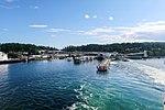
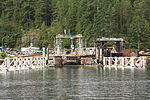
Saltery Bay is an unincorporated community on the Sunshine Coast of southern British Columbia, Canada. It is located about 30 kilometres (19 mi) southeast...
5 KB (115 words) - 21:49, 9 February 2024
Saltery Bay Provincial Park is a provincial park in British Columbia, Canada. The park is located southeast of the city of Powell River, and on the north...
2 KB (78 words) - 19:22, 19 October 2024
lasts 9.5 nautical miles (17.6 km) between Earls Cove to the south and Saltery Bay to the north. The 59-kilometre-long (37 mi) northern land section of...
12 KB (1,004 words) - 20:08, 14 June 2024
surrounding regions. Notable lines include Horseshoe Bay-Langdale, Little River-Westview, and Earls Cove-Saltery Bay. Minor ferry operators and water taxis provide...
8 KB (703 words) - 03:57, 6 November 2024
USS Saidor (redirect from USS Saltery Bay)
Commencement Bay class were ordered on 23 January 1943, allocated to Fiscal Year 1944. The keel for the ship, originally named Saltery Bay, was laid down...
9 KB (1,016 words) - 23:03, 29 October 2024
Sunshine Coast Regional District (redirect from Garden Bay, British Columbia)
run from Horseshoe Bay to Gibsons across Howe Sound. At the northern end of the peninsula, ferries run from Earl's Cove to Saltery Bay. Sechelt - Pop 10...
15 KB (623 words) - 03:27, 4 October 2024
The Commencement Bay-class escort aircraft carriers were the last class of escort carriers built for the US Navy in World War II. The ships were based...
11 KB (373 words) - 12:47, 30 August 2024
the Salish Eagle, and to Texada Island on the Island Discovery. The Saltery Bay Ferry Terminal is located 23 km south on Highway 101 and provides access...
36 KB (2,733 words) - 14:12, 19 July 2024
– Jervis Inlet (Highway 101): Earls Cove to Saltery Bay Route 8 – Queen Charlotte Channel: Horseshoe Bay to Bowen Island (via Snug Cove) Route 9 – Active...
56 KB (2,905 words) - 15:49, 21 October 2024
Qathet Regional District (redirect from Brew Bay, British Columbia)
includes the area southeast of Powell River to the ferry terminal at Saltery Bay and from Wildwood, northwest of Powell River to Desolation Sound and...
16 KB (669 words) - 03:45, 28 July 2024
(1943) – damaged at Kure by U.S. air raid March 1945, grounded in Beppu Bay and dismantled in place in 1946 Hiyō class Jun'yō (1939) – damaged during...
147 KB (4,547 words) - 20:12, 5 November 2024
one seriously. On September 20, 1978, Queen of the Islands rammed the Saltery Bay dock causing $495,000 worth of damage. On November 2, 2013, Queen of...
45 KB (5,619 words) - 21:04, 11 October 2024
terminal at Saltery Bay on Jervis Inlet in the south. The trail goes within close proximity of the communities of Powell River, Lang Bay, Lund, and Teeshohsum...
6 KB (369 words) - 20:46, 29 March 2024
were briefly used for revenue service between Horseshoe Bay in West Vancouver and Departure Bay in Nanaimo from 1999 to March 2000. The third catamaran...
14 KB (1,604 words) - 09:30, 12 January 2024
then named Queen of Chilliwack. She later changed to the Earls Cove - Saltery Bay route. In 1996 Queen of Chilliwack was taken out of service for another...
6 KB (276 words) - 02:09, 9 August 2024
metres length 3,397 gross tons 15.5 kts 7094 HP Route: Earl's Cove ↔ Saltery Bay All three ferries were built at Vancouver Shipyards of the Washington...
2 KB (147 words) - 22:21, 26 July 2024
mostly dabbling and diving ducks, visiting SHMBS at Roberts Bay. Above Roberts Bay, All Bay has a very high density of marina and boats and there is a...
18 KB (1,770 words) - 23:16, 9 October 2024
The Butchart Gardens is a group of floral display gardens in Brentwood Bay, British Columbia, Canada, located near Victoria on Vancouver Island. The gardens...
9 KB (1,061 words) - 22:15, 29 July 2024
TransLink's 620 bus route. Duke Point ferry terminal Departure Bay ferry terminal Horseshoe Bay ferry terminal Earls Cove ferry terminal Roberts Bank Roberts...
9 KB (714 words) - 04:42, 13 August 2024
northwest bank of Jervis Inlet near Hotham Sound, and just northeast of the Saltery Bay ferry terminal on the upper Sunshine Coast, and opposite the mouth of...
1 KB (108 words) - 15:58, 11 April 2024
Swartz Bay is a 22.7 ha (56.1-acre) ferry terminal and a major transportation facility at Swartz Bay in North Saanich, British Columbia. It is located...
11 KB (997 words) - 07:07, 3 September 2024
Columbia. It is a terminal for the BC Ferries route across the inlet to Saltery Bay, linking the Lower Sunshine Coast with the Upper Sunshine Coast. Earls...
7 KB (529 words) - 21:46, 9 February 2024
Anderson Bay Copeland Islands Marine Desolation Sound Marine Inland Lake Malaspina Okeover Arm Jedediah Island Marine Sabine Channel Marine Saltery Bay South...
14 KB (1,319 words) - 20:22, 29 June 2024
Anderson Bay Copeland Islands Marine Desolation Sound Marine Inland Lake Malaspina Okeover Arm Jedediah Island Marine Sabine Channel Marine Saltery Bay South...
21 KB (1,953 words) - 04:44, 2 September 2024
Vancouver's Downtown peninsula, surrounded by waters of Burrard Inlet and English Bay. The park borders the neighbourhoods of West End and Coal Harbour to its...
69 KB (7,328 words) - 02:09, 29 October 2024
the Coast Mountains. It is located on the SE side of Lois Lake above Saltery Bay, an unincorporated coastal community on the Jervis Inlet near the city...
4 KB (349 words) - 23:11, 6 November 2024
confirmed that there was what has been described as a tunnel that ran from James Bay into the basement of the Empress. At high tide one was able to visit the...
18 KB (1,837 words) - 02:59, 21 October 2024
Anderson Bay Copeland Islands Marine Desolation Sound Marine Inland Lake Malaspina Okeover Arm Jedediah Island Marine Sabine Channel Marine Saltery Bay South...
7 KB (595 words) - 01:13, 6 November 2024
scene in the 2011 film Final Destination 5, known fictionally as the "North Bay Bridge". The bridge is featured in the background of the "Vancouver Velocity"...
24 KB (2,311 words) - 16:48, 26 August 2024
19th century. Karta Bay is the site of the first salmon saltery in Alaska. Karta Bay is situated at the northwestern end of Kasaan Bay, of which it forms...
3 KB (351 words) - 12:27, 22 February 2020


