The Shire of Oxley was a local government area in Victoria, Australia, immediately to the south of the city of Wangaratta, which housed the shire's council...
4 KB (246 words) - 11:36, 12 May 2023
of Myrtleford, and parts of the United Shire of Beechworth, Shire of Oxley, Shire of Yackandandah and Shire of Omeo. The Shire is governed and administered...
10 KB (568 words) - 11:45, 4 November 2024
amalgamation of the City of Wangaratta, Shire of Wangaratta, Shire of Oxley, and parts of the United Shire of Beechworth, Shire of Benalla and Shire of Yarrawonga...
11 KB (555 words) - 19:00, 21 August 2024
coordinates) Oxley is a south-western suburb in the City of Brisbane, Queensland, Australia. In the 2021 census, Oxley had a population of 9,100 people. Oxley is...
40 KB (3,967 words) - 00:44, 16 November 2024
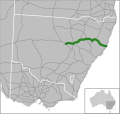
the coast of the Tasman Sea. It was named to commemorate John Oxley, the first European to explore much of inland New South Wales in 1818. Oxley Highway...
16 KB (1,281 words) - 06:02, 13 August 2024
Nevertire (category Warren Shire)
junction of the Mitchell Highway and the Oxley Highway, in Warren Shire. Nevertire is about 496 kilometres northwest of Sydney, 78 km north-west of Narromine...
5 KB (377 words) - 02:28, 30 November 2023
as the administrative centre of the Shire of Oxley until 1936. "2016 Census QuickStats Oxley (Vic.)". Australian Bureau of Statistics. Retrieved 8 December...
2 KB (143 words) - 10:07, 7 May 2023
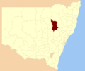
state election redrew Oxley to contain the entirety of Bellingen Shire, Nambucca Shire, Kempsey Shire and a large inland component of Port Macquarie-Hastings...
12 KB (615 words) - 03:22, 25 March 2024
The Warrumbungle Shire is a local government area in the central western region of New South Wales, Australia. The Shire is traversed by the Newell Highway...
9 KB (508 words) - 01:49, 13 November 2024
populated districts of Queensland. The future Sherwood Shire contained an area of 22 square miles. The most northerly landmark, Oxley Point (Chelmer), was...
94 KB (11,362 words) - 08:37, 14 October 2024
Whorouly (category Rural City of Wangaratta)
Kennett Government (and the creation of the Rural City of Wangaratta), the township was in the disbanded Shire of Oxley. The town can easily be missed, being...
5 KB (410 words) - 15:29, 21 April 2024
Gunnedah (category Gunnedah Shire)
Australia and is the seat of the Gunnedah Shire local government area. In the 2021 census the town recorded a population of 8,338. Gunnedah is situated...
22 KB (1,725 words) - 07:06, 20 November 2024
Mid North Coast (category Regions of New South Wales)
government areas: the City of Coffs Harbour, the Bellingen Shire, the Kempsey Shire, the Mid-Coast Council, the Nambucca Shire and the Port Macquarie-Hastings...
9 KB (627 words) - 17:30, 17 August 2024
includes the towns of Balranald and Euston. Other localities in the Shire include Kyalite, Hatfield, Penarie, Clare and Oxley. As of 29 January 2020, the...
8 KB (292 words) - 20:56, 14 September 2024
the Grand Final. In 1955 Hughes was appointed to the Shire of Oxley as Assistant Borough Engineer of Wangaratta and he played football with the Wangaratta...
3 KB (246 words) - 04:55, 7 May 2023
1916. On 18 November 1994, the Shire of Wangaratta was abolished, and along with the City of Wangaratta, the Shire of Oxley and various surrounding districts...
4 KB (271 words) - 11:38, 12 May 2023
The Oxley Wild Rivers National Park is a protected national park that is located in the Northern Tablelands region of New South Wales, Australia in the...
35 KB (4,454 words) - 22:17, 11 January 2024
October 1979, from the Shire of Wangaratta. On 18 November 1994, the City of Wangaratta was abolished, and along with the Shires of Oxley, Wangaratta and various...
4 KB (276 words) - 11:38, 12 May 2023
Robert Cook (Australian politician) (category National Party of Australia members of the Parliament of Australia)
they moved to Oxley and established a dairy farm. Cook was a member of Chiltern Shire Council 1902–04, and was elected to the Shire of Oxley Council in 1908...
4 KB (360 words) - 17:41, 19 January 2022
Coonabarabran (category Warrumbungle Shire)
surveyor-general for the Colony of New South Wales, John Oxley, made an expedition through the north-west areas of the colony. Oxley surveyed the area around...
25 KB (2,313 words) - 11:43, 13 September 2024
Parish (Oxley County), New South Wales is a rural locality of Bogan Shire and a civil parish of Oxley County, New South Wales. a Cadastral divisions of New...
2 KB (223 words) - 20:40, 19 January 2023
Chirnside Park, Victoria (category Yarra Ranges Shire)
the Shire of Yarra Ranges local government area. Chirnside Park recorded a population of 11,779 at the 2021 census. From 1838, the area formed part of the...
7 KB (765 words) - 18:58, 28 April 2024
Macleay River (category Geographic Names Register of NSW not in Wikidata)
Dyke rivers and passing through a number of spectacular gorges and waterfalls in Cunnawarra National Park and Oxley Wild Rivers National Park, through heritage-listed...
12 KB (1,009 words) - 02:49, 4 November 2024
is a rural locality of Warren Shire. Lawson Parish is also a civil parish of Oxley County, New South Wales, a Cadastral divisions of New South Wales. The...
3 KB (258 words) - 21:01, 21 November 2020
were established in the colony of Victoria, Australia, pursuant to legislation passed in 1853 and were an early form of local government in Victoria. The...
10 KB (169 words) - 23:23, 5 November 2023
Buddabadah, New South Wales (category Geographic Names Register of NSW not in Wikidata)
Parish (Oxley County), New South Wales is a rural locality of Bogan Shire and a civil parish of Oxley County, New South Wales, a Cadastral divisions of New...
2 KB (216 words) - 03:29, 20 December 2022
mayor of Tweed Shire Council is Cr. Chris Cherry. The European history of the Tweed Shire began in 1823 when the Tweed River was explored by John Oxley. After...
18 KB (1,372 words) - 08:25, 23 September 2024
Carinda (category Walgett Shire)
from an Aboriginal word meaning 'you carry'. In 1818 John Oxley and George Evans arrived north of Warren and attempted to travel downstream along the Macquarie...
4 KB (489 words) - 07:29, 18 November 2024
and Oxley Highways. The use of the area is mainly for wool and cotton growing. The shire was formed on 1 January 1957 through the amalgamation of Marthaguy...
7 KB (267 words) - 02:39, 13 September 2024
Parish (Oxley County), New South Wales is a rural locality of Warren Shire and a civil parish of Oxley County, New South Wales, a Cadastral divisions of New...
2 KB (213 words) - 20:48, 19 January 2023


