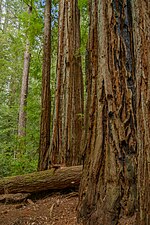
The Skyline-to-the-Sea Trail is a 29.5-mile (47.5 km) hiking trail that descends from the ridge of the Santa Cruz Mountains in California to the Pacific...
14 KB (1,293 words) - 15:52, 19 November 2024
Midpeninsula Regional Open Space District (category Parks in the San Francisco Bay Area)
Area Ridge Trail, and Skyline-to-the-Sea Trail, which are regional trail systems in the Bay Area that include district lands. The Midpeninsula Regional...
20 KB (886 words) - 00:44, 19 November 2024
Routes & Byways California's Pacific Coast. Morris Book Publishing. "Skyline-to-the-Sea". sacbee.com. Retrieved 13 December 2014. Green, Stewart (2014). Scenic...
9 KB (965 words) - 22:03, 19 September 2024
Big Basin Redwoods State Park (category Parks in the San Francisco Bay Area)
trails. Some of these trails link Big Basin to Castle Rock State Park and the eastern reaches of the Santa Cruz range. The Skyline-to-the-Sea Trail threads...
22 KB (2,400 words) - 18:58, 17 November 2024
Route 35, or Skyline Boulevard at Saratoga Gap. The Skyline-to-the-Sea Trail passes through the camp about 5 miles (8.0 km) from its Skyline terminus, in...
18 KB (2,302 words) - 23:40, 16 November 2024
Castle Rock State Park (California) (category Bay Area Ridge Trail)
State Park, and the Pacific Coast. Due to its overnight parking lot, Castle Rock is a popular starting point for the Skyline-to-the-Sea Trail, a 30-mile (48 km)...
8 KB (672 words) - 16:52, 13 June 2024
Mount Umunhum (category Pages using interlanguage link with the wikidata parameter)
lot at the summit. It is a spur of the Bay Area Ridge Trail. In 2017, the Midpeninsula Regional Open Space District granted an easement to the Amah Mutsun [Wikidata]...
13 KB (1,224 words) - 14:39, 21 December 2024
Rancho Del Oso Nature and History Center (category Protected areas established in the 1970s)
where the Waddell Creek watershed drains from the Santa Cruz Mountains into the sea. The site is also near the end of the hiking enthusiast's Skyline-to-the-Sea...
2 KB (189 words) - 12:01, 31 March 2018
Santa Cruz Mountains (category Subregions of the San Francisco Bay Area)
long-distance trails in the range: the Skyline-to-the-Sea Trail, which winds 38 miles (61 km) from Castle Rock State Park through Big Basin to the Pacific Ocean...
26 KB (2,694 words) - 09:04, 23 November 2024
Sequoia sempervirens (category Trees of the West Coast of the United States)
measuring the National Geographic Tree ("Nugget") immediately adjacent to the Tall Trees Trail". 27 September 2014. National Park Service (1997). "The General...
77 KB (8,272 words) - 20:32, 9 November 2024
The Nissan Skyline GT-R (Japanese: 日産・スカイラインGT-R, Hepburn: Nissan Sukairain GT-R) is a Japanese sports car based on the Nissan Skyline range. The first...
81 KB (9,638 words) - 23:54, 11 December 2024
Boulder Creek (California) (category Tributaries of the San Lorenzo River)
is at 436 feet (133 m) above sea level. Boulder Creek's headwaters are just north of SR 236. The Skyline-to-the-Sea Trail passes through this area. It...
7 KB (805 words) - 21:18, 22 February 2023
Montara Mountain (category Mountains of the San Francisco Bay Area)
Mountain. The earliest historical trail remnant of Montara Mountain is the precolonial Indian Trail which traverses the ridgeline between Willow Brook Estates...
8 KB (882 words) - 14:49, 21 December 2024
San Lorenzo River (category Drainage basins of the Pacific Ocean)
Lorenzo River drops 2,000 feet (610 m) in the first 3 miles. Starting just south of the Saratoga Toll Road Trail, the river is roughly paralleled by State...
33 KB (3,565 words) - 08:22, 29 November 2024
Sanborn County Park (redirect from Sanborn-Skyline County Park)
Mountains to become the Skyline-to-the-Sea Trail, which continues to the Pacific Ocean. This Bay Area Ridge Trail ultimately circumnavigates the entire Bay...
11 KB (1,350 words) - 00:41, 15 September 2024
Mount Bielawski (category Mountains of the San Francisco Bay Area)
located in the Santa Cruz Mountains of California, near the San Francisco Bay Area. The mountain reaches an elevation of 3,234 feet (986 m) just to the southwest...
3 KB (245 words) - 05:22, 15 October 2024
Falls Skyline Ridge Trail (24 km (15 mi)) - Sky Pilot In the morning of February 4, 2014, prior to the gondola's public opening, a gondola came off the line...
13 KB (1,321 words) - 16:08, 29 June 2024
is from the Skyline Drive trail head at about milepost 39 of the Skyline Drive and gains almost 800 feet. The peak sits just southeast of the Appalachian...
3 KB (283 words) - 23:28, 30 July 2024
for the Lake Apopka Loop Trail, and an observation tower 132 feet (40 m) above sea level that provides views of Lake Apopka and the Orlando skyline. At...
3 KB (208 words) - 15:19, 29 July 2024
Recreation Area, which is owned and operated by the City of Santa Cruz Water Department. It has hiking trails, picnic areas, and boating access. List of lakes...
4 KB (292 words) - 05:24, 16 July 2023
One of the six Boy Scouts of America councils that serves the San Francisco Bay area, the Pacific Skyline Council was founded in 1940 as the Stanford...
5 KB (516 words) - 23:40, 16 November 2024
Waddell Creek (California) (category Pages using the Kartographer extension)
although total distance from headwater source tributaries to the sea is 14 miles (23 km). The Waddell Creek watershed drains 26 square miles (67 km2) and...
9 KB (955 words) - 21:26, 13 July 2023
Long Ridge is a hill located in the Santa Cruz Mountains in the San Francisco Bay Area, California. The hill rises to an elevation of about 2,600 feet...
3 KB (173 words) - 17:55, 6 December 2022
the Mamores VK, the Ring of Steall Skyrace, the Ben Nevis Ultra and the Glen Coe Skyline. The inaugural Glen Coe Skyline took place in 2015 and the Mamores...
19 KB (1,897 words) - 23:58, 16 December 2024
Cape Breton Highlands National Park (category Pages using the Kartographer extension)
26 marked hiking trails, including the Skyline Trail. At the western entrance of the park is the Acadian village of Chéticamp on the Gulf of Saint Lawrence...
16 KB (1,676 words) - 21:20, 30 October 2024
Flats Trails do not reach the peak. The Sagebrush Trail is a spur off of the Skyline Trail, connecting it to Trailhead Park. The Langdon Trail wraps around...
8 KB (894 words) - 19:08, 28 May 2024
The Trans Canada Trail is a cross-Canada system of greenways, waterways, and roadways that stretches from the Atlantic to the Pacific to the Arctic oceans...
41 KB (4,174 words) - 01:22, 26 November 2024
Tahoe–Yosemite Trail (both in California), the Skyline Trail (in Oregon) and the Cascade Crest Trail (in Washington). The Pacific Crest Trail System Conference...
49 KB (4,803 words) - 03:43, 25 November 2024
passing through 14 states. The Appalachian Trail Conservancy claims the Appalachian Trail to be the world's longest hiking-only trail. More than three million...
122 KB (12,246 words) - 17:23, 21 December 2024
long-distance trails in the United States, with a minimum length of 30 miles (48 km). National Trails System National Millennium Trail project – 16 long-distance...
42 KB (537 words) - 03:51, 23 September 2024


