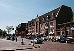
Stampersgat is a village situated in the municipality of Halderberge, in the north-west of the North Brabant province in the Netherlands. The village...
4 KB (219 words) - 07:02, 23 May 2023
(population: 13,110) Hoeven (6,560) Oud Gastel (6,360) Bosschenhoofd (2,180) Stampersgat (1,330) Dutch Topographic map of the municipality of Halderberge, June...
7 KB (305 words) - 20:47, 11 November 2024
North Brabant. The canal connects west from the river Mark (Dintel) to Stampersgat starting at the point Dintel, transitioning from the Steenbergse Vliet...
2 KB (154 words) - 14:59, 13 July 2023
covered the villages of Oud Gastel, located 7 km north of Roosendaal, and Stampersgat. The municipality existed until 1997, when it became part of the new...
749 bytes (78 words) - 01:52, 11 March 2022
Dorset Rotterdam, South Holland and Hull, East Riding of Yorkshire Stampersgat, North Brabant and Cheltenham, Gloucestershire Zutphen, Gelderland and...
24 KB (2,543 words) - 15:43, 7 August 2024
the Turnhout-Antwerp Canal, and the Netherlands, where it fought at Stampersgat. The battalion reached Nijmegen in late November, where it spent over...
103 KB (13,202 words) - 16:31, 29 July 2024
4°26′15″E Stad van Gerwen Nuenen, Gerwen en Nederwetten 51°30′30″N 5°32′25″E Stampersgat Halderberge 51°36′45″N 4°26′40″E Standdaarbuiten Moerdijk 51°36′50″N...
352 KB (49 words) - 13:56, 22 September 2024
A59 overlap Steenbergen 215 134 24 N 268 / Noordlangeweg – Dinteloord, Stampersgat 223 139 25 N 257 / Zeelandweg-Oost – Steenbergen, Nieuw-Vossermeer Bergen...
35 KB (3,376 words) - 20:13, 16 September 2024
Station - Roosendaal, Spoorstraat - Oud Gastel - Oud Gastel, Busstation - Stampersgat - Dinteloord - Steenbergen - Lepelstraat - Halsteren - Bergen op Zoom...
9 KB (474 words) - 20:19, 13 September 2024
Philipsland - St Willebrord - Stad aan 't Haringvliet - Stadskanaal - Stampersgat - Standdaarbuiten - Staphorst - Starnmeer - Startenhuizen - Stavenisse -...
70 KB (3,940 words) - 07:59, 26 January 2024


