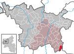
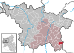
Strotzbüsch is an Ortsgemeinde – a municipality belonging to a Verbandsgemeinde, a kind of collective municipality – in the Vulkaneifel district in Rhineland-Palatinate...
5 KB (482 words) - 17:26, 1 June 2023
Saxler Schalkenmehren Schönbach Schutz Steineberg Steiningen Strohn Strotzbüsch Udler Üdersdorf Utzerath Wallenborn Weidenbach Winkel 2. Gerolstein Basberg...
7 KB (517 words) - 09:45, 17 November 2024
12194°N 6.95861°E / 50.12194; 6.95861 (Immerather Maar)) Immerath, Strotzbüsch 6.0 2.9 Shallowest of all Eifel maar lakes Meerfelder Maar (50°6′2″N...
27 KB (2,868 words) - 20:53, 30 December 2024
Saxler Schalkenmehren Schönbach Schutz Steineberg Steiningen Strohn Strotzbüsch Udler Üdersdorf Utzerath Wallenborn Weidenbach Winkel Wahl der Bürgermeister...
2 KB (93 words) - 19:32, 5 June 2023
wayside chapel, Bildstock, 18th century On Landesstraße 52 going towards Strotzbüsch – sandstone wayside cross, marked 1819 Rudolf-Schneiders-Straße – Mater...
8 KB (746 words) - 08:40, 30 November 2024
Mückeln mit Schutzalf, Niederwinkel, Oberwinkel, Sprink, Trautzberg and Strotzbüsch. On the road from Strohn to Mückeln lies the Herrenbüsch where graves...
12 KB (1,332 words) - 17:26, 1 June 2023
the east is the Üßbach valley. Immerath's neighbours are Gillenfeld, Strotzbüsch and Lutzerath. Digs and finds in the 1930s on the eastern slope of the...
8 KB (921 words) - 17:21, 1 June 2023


