
Sweet Grass (also Sweetgrass) is a census-designated place and unincorporated community in Toole County, Montana, United States, on the Canada–US border...
6 KB (243 words) - 21:24, 26 August 2023

Sweet Grass County is a county located in the U.S. state of Montana. As of the 2020 census, the population was 3,678. Its county seat is Big Timber. The...
13 KB (1,023 words) - 00:32, 26 April 2024
Sweet Grass Creek is a tributary of the Yellowstone River, approximately 50 mi (80 km) long, in south central Montana in the United States. It rises in...
2 KB (103 words) - 00:33, 24 April 2022
grass belongs to the genus Coleanthus in the sweet grass family Sweet Grass, Montana, United States Sweet Grass County, Montana, United States Sweet Grass...
1 KB (153 words) - 15:19, 25 April 2023
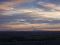
807 ft [1,770 m]). The Sweet Grass Hills are an example of the island ranges that dot the central third portion of the state of Montana. These island ranges...
12 KB (719 words) - 14:28, 20 May 2024

The Sweetgrass–Coutts Border Crossing connects the town of Sweet Grass, Montana, with the village of Coutts, Alberta, on the Canada–United States border...
9 KB (797 words) - 19:40, 14 March 2024
McLeod is an unincorporated community in Sweet Grass County, Montana, United States. McLeod is located on Montana Secondary Highway 298 southwest of Big...
4 KB (192 words) - 02:04, 2 December 2023

Big Timber is a city in, and the county seat of, Sweet Grass County, Montana, United States. The population was 1,650 at the 2020 census. Big Timber takes...
21 KB (1,767 words) - 10:36, 8 July 2024

Interstate 15 (redirect from Interstate 15 (California–Montana))
in Sweet Grass, Montana, at the Canada–US border, where it becomes Alberta Highway 4. It is 1,433 miles (2,306 km) long from San Diego to Sweet Grass. North...
28 KB (2,690 words) - 01:50, 5 August 2024
railroad official. In 2004, a joint border facility opened in Coutts–Sweet Grass, Montana, housing both Canadian and American federal authorities. In February...
11 KB (561 words) - 18:42, 6 August 2024

(96 km) long, in south central Montana in the United States. It is one of two rivers named the Boulder River in Montana. It rises in the Gallatin National...
8 KB (340 words) - 22:13, 23 November 2023

Greycliff is a census-designated place (CDP) in Sweet Grass County, Montana, United States. The population was 56 at the 2000 census. Greycliff Prairie...
8 KB (601 words) - 02:10, 11 July 2023

Crazy Mountains (category Landforms of Sweet Grass County, Montana)
Musselshell River Sweet Grass Creek Crazy Peak Meagher County, Montana - north Sweet Grass County, Montana - east Park County, Montana - west, south Due...
8 KB (784 words) - 11:51, 27 June 2024
(southwestern Montana), a tributary of the Jefferson River in Jefferson County, southwestern Montana in the United States The Boulder River (Sweet Grass County...
686 bytes (132 words) - 09:38, 15 December 2014
Customhouse (New Bedford, Massachusetts) U.S. Customs Building (Sweet Grass, Montana), NRHP-listed in Toole County Alexander Hamilton U.S. Custom House...
2 KB (290 words) - 11:38, 16 March 2021

Railway, a narrow gauge railway (3-foot (0.91 m)) which ran from Sweet Grass, Montana (at the Canada–US border) to a terminus adjacent to the Robert Vaughn...
10 KB (954 words) - 23:35, 24 November 2023
a set of hills southeast of Melville, Montana in Sweet Grass County, Montana. List of mountain ranges in Montana "Franklin Hills". Geographic Names Information...
1 KB (44 words) - 01:53, 29 July 2017
National Forest in the U.S. state of Montana. Mount Douglas is the tallest peak in Sweet Grass County, Montana and is within the Absaroka-Beartooth Wilderness...
2 KB (118 words) - 13:27, 2 December 2020

Melville is an unincorporated community in northern Sweet Grass County, Montana, United States. It lies along local roads just west of U.S. Route 191...
9 KB (340 words) - 22:30, 25 May 2024
coordinates) There are at least 50 named lakes and reservoirs in Sweet Grass County, Montana. Armour Pond, 45°21′29″N 110°13′04″W / 45.35806°N 110.21778°W...
9 KB (2,244 words) - 04:20, 8 April 2022
Coutts/Ross International Airport (category Airports in Montana)
west of Sweet Grass, Montana, United States. Ross International Airport is owned by the U.S. state of Montana and is operated by the Montana Aeronautics...
5 KB (374 words) - 13:48, 27 February 2024
Lake Pinchot (category Bodies of water of Sweet Grass County, Montana)
Lake Pinchot is a lake in Sweet Grass County, Montana, in the United States. Lake Pinchot was named in honor of Gifford Pinchot, a park service official...
3 KB (72 words) - 09:55, 7 November 2023
Montana Castle Butte (Sweet Grass County), a butte in Sweet Grass, Montana Castle Butte (Valley County), a butte in Valley County, Montana Castle Butte (Yellowstone...
1 KB (152 words) - 00:40, 18 March 2017
Western United States, connecting the gold rush territory of southern Montana to the Oregon Trail in eastern Wyoming. Its most important period was from...
21 KB (2,667 words) - 08:17, 17 May 2024

985-metre) mountain summit located in Toole County, Montana, United States. Gold Butte is part of the Sweet Grass Hills and ranks as the fourth-highest peak in...
5 KB (482 words) - 19:45, 28 June 2024
Cayuse Hills (category Landforms of Sweet Grass County, Montana)
mountain range northeast of Big Timber, Montana in Sweet Grass County, Montana. List of mountain ranges in Montana "Cayuse Hills". Geographic Names Information...
1 KB (45 words) - 07:40, 14 May 2022

770-metre) mountain summit in Liberty County, Montana, United States. Mount Lebanon is part of the Sweet Grass Hills and ranks as the fifth-highest peak in...
4 KB (312 words) - 19:45, 28 June 2024

mountain summit located in Toole County, Montana, United States. West Butte is the highest peak in the Sweet Grass Hills and the highest in the county. It...
8 KB (559 words) - 19:45, 28 June 2024
(secondary coordinates) There are at least 53 named mountains in Sweet Grass County, Montana. Antelope Butte, 45°43′35″N 110°05′08″W / 45.72639°N 110.08556°W...
10 KB (2,341 words) - 17:35, 8 March 2024
Quebec is an unincorporated community in Sweet Grass County, Montana, United States. Quebec is located along Interstate 90, southeast of Big Timber. Quebec...
3 KB (104 words) - 04:19, 28 July 2023