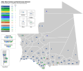
department is made up of following communes: Bousteila Hassimhadi Koumbi Saleh Timbédra Touil "Mauritania: Administrative divisions". www.citypopulation.de. Retrieved...
5 KB (62 words) - 22:47, 9 July 2024
Djigueni Department Néma Department Oualata Department Timbedra Department Ayoun el Atrous Department Kobenni Department Tamchekket Department Tintane...
5 KB (154 words) - 21:06, 23 October 2024
182,700 km2. Its capital is Néma, but the largest town, in Bassiknou Department, is Fassala (or Vassale) at the extreme southeast of Mauritania, with...
14 KB (1,238 words) - 01:23, 27 October 2024
the north, east and west are the departments of Timbedra, Néma and Bassikounou. The Amourj department is made up of following communes: Adel Bagrou Amourj...
6 KB (92 words) - 20:51, 16 February 2024
بوصطيلة) is a commune and town in Mauritania. It is located in the Timbedra department within the south-eastern region of Hodh Ech Chargui. Mauritania's...
4 KB (70 words) - 04:38, 24 October 2024
October 29, 2018. Yahya Ould Hademine was born on December 31, 1953, in Timbédra. He received his primary education in Djigueni. Yahya attended the College...
8 KB (727 words) - 09:05, 31 October 2024
elected from single- or multi-member electoral districts based on the departments (or moughataas) that the country is subdivided in (with the exception...
252 KB (494 words) - 19:06, 30 June 2024
Nouakchott–Oumtounsy International Sélibaby Tamchakett Tichitt Tidjikja Timbedra Tazadit. See Airports in Mauritania 17 in total (2002) 2 are of length...
9 KB (814 words) - 19:17, 30 September 2024
255 48.20% 2,423 51.80% 4,678 Tidjikja 13,646 59.30% 9,365 40.70% 23,011 Timbédra 20,632 52.01% 19,037 47.99% 39,669 Tintane 21,010 50.53% 20,573 49.47%...
60 KB (2,197 words) - 23:47, 3 November 2024
067°W / 21.300; -13.067 Country Mauritania Region Adrar Region Department Atar Department Elevation 328.0 m (1,076.1 ft) Population (2000) • Total 2,735...
5 KB (401 words) - 19:33, 23 October 2024
43% 985 4.65% 1,099 5.19% 144 0.68% 266 1.21% 596 2.70% Tichitt Tidjikja Timbédra Tintane 17,772 80.62% 655 2.97% 2,925 13.27% 260 1.18% 347 1.57% 84 0.38%...
26 KB (576 words) - 22:00, 12 July 2024
43% 985 4.65% 1,099 5.19% 144 0.68% 266 1.21% 596 2.70% Tichitt Tidjikja Timbédra Tintane 17,772 80.62% 655 2.97% 2,925 13.27% 260 1.18% 347 1.57% 84 0.38%...
20 KB (2,110 words) - 14:35, 28 September 2024
/ 17.450; -11.350 Country Mauritania Region Assaba Region Department Boumdeid Department Area • Total 57.5 sq mi (149.0 km2) Population (2013 census)...
4 KB (66 words) - 21:46, 23 October 2024
Aoukar. It is the capital of Hodh Ech Chargui Region and of the Néma Department. While the urban population of Nema is approximately 20,000, the surrounding...
7 KB (551 words) - 02:52, 24 October 2024
Sélibaby (Arabic: سليبابي) is a capital town and department of the Guidimaka Region, in Mauritania. It is located at around 15°9′33″N 12°11′00″W / 15...
4 KB (173 words) - 02:19, 24 October 2024
in Northwest Africa, as is the administrative headquarters of Kobenni Department. Population is the 2013 census was 11,833. The town is 257 km² and mostly...
2 KB (72 words) - 20:36, 6 March 2024
Railway stations in Mauritania "Mauritania: Administrative Division (Departments and Communes) - Population Statistics, Charts and Map". www.citypopulation...
5 KB (158 words) - 18:01, 16 February 2024
85000; -5.93583 Country Mauritania Region Hodh Ech Chargui Department Bassikounou (department) Government • Mayor Mohamed Sidi Hanena Population (2013)...
6 KB (265 words) - 18:57, 14 August 2024
Region Department Commune Population Area Adrar Aoujeft Aoujeft 5,362 El Medah 3,402 Maaden 3,477 Ntrguent 1,636 Atar Atar 35,170 Ain Ehel Taya 4,750 Choum...
6 KB (33 words) - 15:42, 4 November 2024
16°12′33″N 11°30′07″W / 16.20921°N 11.50203°W / 16.20921; -11.50203 Country Mauritania Region Assaba Region Department Kiffa Time zone UTC±00:00 (GMT)...
8 KB (461 words) - 19:12, 23 October 2024
a town and commune in Southern Mauritania, located in the Ould Yengé department of the Guidimaka Region. The commune of Dafort is located in the region...
5 KB (227 words) - 00:00, 8 May 2024
15.333°N 12.867°W / 15.333; -12.867 Country Mauritania Region Gorgol Department Maghama Government • Mayor Oumar Gorbal Sy Population (2013) • Total...
5 KB (169 words) - 19:28, 16 April 2024
town and commune in southern Mauritania. It is located in the Sélibaby department in the Guidimaka Region. In 2013, it had a population of 15,099. "Tachott...
4 KB (49 words) - 21:48, 23 March 2024
0118367. PMC 4340953. PMID 25714751. "Mauritania: Administrative Division (Departments and Communes) - Population Statistics, Charts and Map". www.citypopulation...
5 KB (331 words) - 18:58, 12 October 2024
central-western Mauritania, located in the Adrar Region. It is part of the Aoujeft Department. The village has a date palm grove. The population in the 2013 census...
3 KB (48 words) - 14:15, 4 March 2024
جَدْرُ المحقن Jedr El Moubghuen Commune and town Country Mauritania Region Trarza Department Rosso Population (2000) • Total 6,632 Time zone UTC+0 (GMT)...
4 KB (95 words) - 20:58, 21 June 2024
Lehreijat is a village and rural commune in the Tintane department of Mauritania. In the 2013 census, it had a population of 13, 915. "Lehreijat (Rural...
4 KB (44 words) - 13:46, 11 March 2023
2015. Retrieved 14 June 2015. "Mauritania: Administrative Division (Departments and Communes) - Population Statistics, Charts and Map". www.citypopulation...
5 KB (120 words) - 18:48, 23 October 2024
Cheggar Commune and town Country Mauritania Region Brakna Department Aleg Government • Mayor Mohamed Ould Sidi Boubacar (PRDS) Population (2013) • Total...
4 KB (75 words) - 20:43, 2 March 2024
100°W / 18.600; -16.100 Country Mauritania Region Trarza Department Ouad Naga Department Area • Total 145.8 sq mi (377.5 km2) Population (2013 census)...
4 KB (100 words) - 10:06, 3 March 2024


