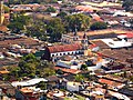
Tlalnelhuayocan is a municipality in the Mexican state of Veracruz, located 2 kilometres from the state capital Xalapa. It stands on the Mexico City–Veracruz...
1 KB (147 words) - 16:47, 28 August 2023

and Emiliano Zapata, to the south with Coatepec and the west with Tlalnelhuayocan. Situated east, about 50 km (31 mi) away along Mexican Federal Highway...
48 KB (4,585 words) - 15:21, 12 July 2024

borders the municipalitys of Las Vigas de Ramírez, Acajete, Xico and Tlalnelhuayocan, and the state of Puebla. It is on Federal Highway 140. Its climate...
7 KB (201 words) - 08:17, 14 September 2023
Mágico" in 2006. Coatepec borders the municipalities of Xalapa and Tlalnelhuayocan (north); Teocelo and Jalcomulco (south); Emiliano Zapata (east); and...
10 KB (498 words) - 14:58, 7 August 2024
Vigas de Ramírez, Perote, Rafael Lucio, Tatatila, Teocelo, Tlacolulan, Tlalnelhuayocan, Villa Aldama and Xico. The district's head town (cabecera distrital)...
18 KB (1,030 words) - 23:03, 28 July 2024

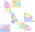
+2.0% 917.9 354.4 41.2/km2 (106.6/sq mi) June 17, 1825 182 Tlalnelhuayocan Tlalnelhuayocan 19,664 16,311 +20.6% 36.7 14.2 535.8/km2 (1,387.7/sq mi) December...
82 KB (1,134 words) - 15:41, 16 July 2024

Las Vigas de Ramírez to the east by Rafael Lucio, to the south by Tlalnelhuayocan and to the west by Perote. It is watered by affluent creeks of the...
10 KB (302 words) - 03:52, 15 July 2024
Zapata, Jalcomulco, Paso de Ovejas, Puente Nacional, Rafael Lucio, Tlalnelhuayocan, Úrsulo Galván and Xico. Because of demographic change, Veracruz currently...
18 KB (1,045 words) - 23:38, 28 July 2024

Tlacolulan and Jilotepec, to the southeast by Banderilla, to the south by Tlalnelhuayocan and to the west by Tres Valles. It is watered by small tributaries...
7 KB (291 words) - 04:47, 1 March 2024

took place in the state; one such landslide collapsed two houses in Tlalnelhuayocan, killing one inhabitant and injuring 10 others. Mudslides and rockfall...
38 KB (3,836 words) - 21:26, 8 July 2024