
Umtanum Ridge is a long anticline mountain ridge in Yakima County and Kittitas County in the U.S. state of Washington. It runs for approximately 55 miles...
2 KB (227 words) - 14:13, 18 November 2023

Umtanum Ridge Water Gap is a geologic feature in Washington state in the United States. It includes the Yakima Canyon (or "Yakima River Canyon"), and...
7 KB (641 words) - 05:42, 11 April 2024

and dominated by three east-west parallel ridges, the Saddle Mountains, Manastash Ridge, and Umtanum Ridge anticlines, which are part of the Yakima Fold...
12 KB (1,372 words) - 11:20, 22 June 2024
north by Umtanum Ridge and on the south by the Rattlesnake Hills. Moxee Valley and Black Rock Valley lie south of Yakima Ridge. Yakima Ridge is part of...
3 KB (231 words) - 14:41, 24 January 2021

firing and small unit tests. The first range was constructed in 1942 on Umtanum Ridge, 13 miles (21 km) northeast of the present cantonment area. In 1947...
30 KB (3,651 words) - 14:45, 15 February 2024

who preferred wagon trails along nearby ridges and creeks.: 42 One of the main routes across the Umtanum Ridge was a toll road constructed in the 1880s...
26 KB (2,539 words) - 04:33, 15 June 2024
Nisqually Delta Sims Corner Eskers and Kames Steptoe and Kamiak Buttes Umtanum Ridge Water Gap Wallula Gap Withrow Moraine and Jameson Lake Drumlin Field...
8 KB (135 words) - 19:08, 24 May 2024

Basin) and mountains on the southern side (the Olympics, Manastash and Umtanum ridges, Rattlesnake Mountain, the Horseheaven Hills, the Wallowa Mountains)...
118 KB (14,439 words) - 12:22, 29 July 2024

of wild buckwheat known by the common names basalt desert buckwheat and Umtanum Desert wild buckwheat. It is endemic to Washington in the United States...
4 KB (453 words) - 03:04, 13 March 2024

Structure, geochemistry and implications of a mid-Cretaceous paleospreading ridge in the South Pacific". Earth and Planetary Science Letters. 245 (3–4). Elsevier...
61 KB (3,692 words) - 12:50, 14 June 2024

where US 12 splits. The freeway then travels northeast over the Umtanum and Manastash ridges to reach the Kittitas Valley. I-82 ends in Ellensburg at a junction...
32 KB (3,301 words) - 21:20, 3 October 2023
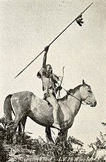
the Yakima River. Síla-ħlama (along the Yakima River between Wenas and Umtanum creeks, the northernmost Lower Yakama Band) Wínas-ħlama (along Wenas Creek...
24 KB (2,950 words) - 03:52, 1 July 2024
national historic preserve. Other sites with petrified wood include the Umtanum Petrified Forest and the Saddle Mountain Petrified Forest. 1975 Waterfall...
33 KB (1,188 words) - 18:11, 22 August 2024

focus was the conservation of indigenous fauna and flora, such as the Umtanum desert buckwheat, which only grows in the area and was prized by Native...
137 KB (15,445 words) - 03:36, 15 August 2024

026 cu mi) of basalt in layers of 10 to 60 m (33 to 197 ft) in thickness. The Umtanum flow has been estimated at 2,750 km3 (660 cu mi) in layers 50 m (160 ft)...
35 KB (4,212 words) - 00:28, 18 August 2024
the United States when it was built. The freeway ascends the Umtanum and Manastash ridges as it passes near the Yakima Firing Center and through undeveloped...
67 KB (5,805 words) - 01:46, 5 August 2024